Method and device for realizing three-dimensional navigation

A 3D and 3D scene technology, applied in the field of 3D navigation, can solve the problems of high hardware data processing performance requirements, large amount of 3D electronic map data, and expensive 3D navigator

Active Publication Date: 2011-06-29
BYD CO LTD
View PDF0 Cites 25 Cited by
  • Summary
  • Abstract
  • Description
  • Claims
  • Application Information

AI Technical Summary

Problems solved by technology

However, the data volume of the 3D electronic map used in 3D navigation is extremely large, which requires high hardware data processing performance, which makes the 3D navigator expensive and limits its popularization and application.

Method used


Image

  • Method and device for realizing three-dimensional navigation
  • Method and device for realizing three-dimensional navigation
  • Method and device for realizing three-dimensional navigation

Examples


Embodiment approach

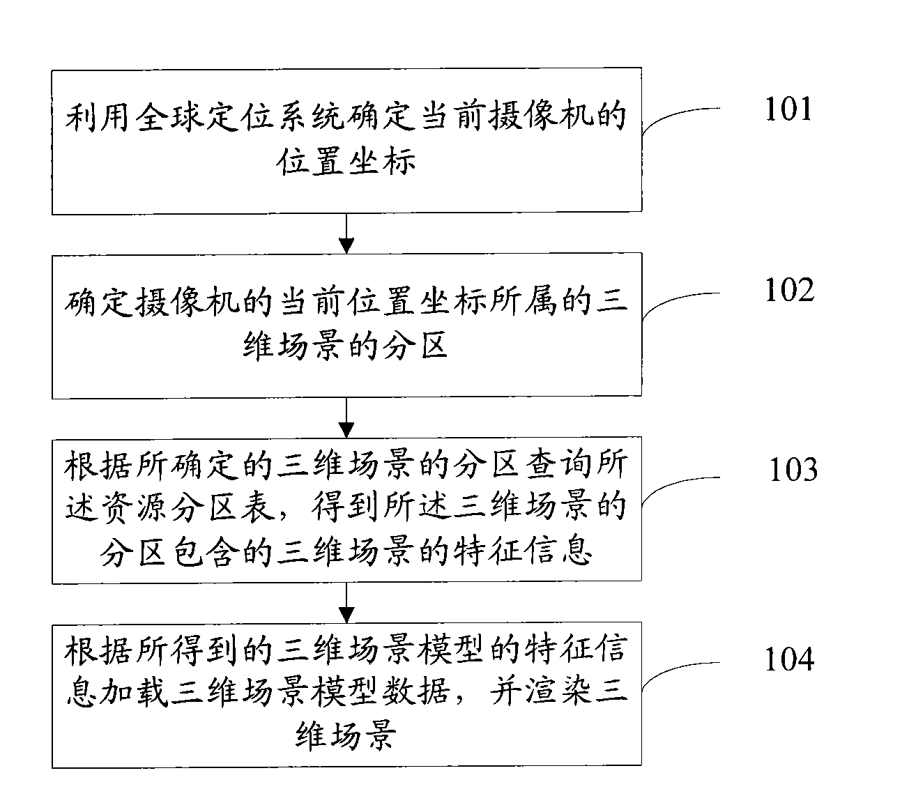
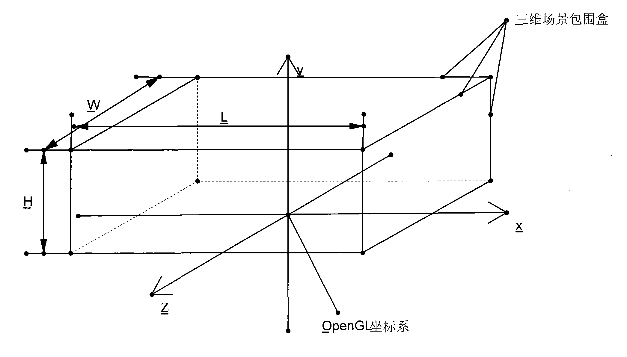
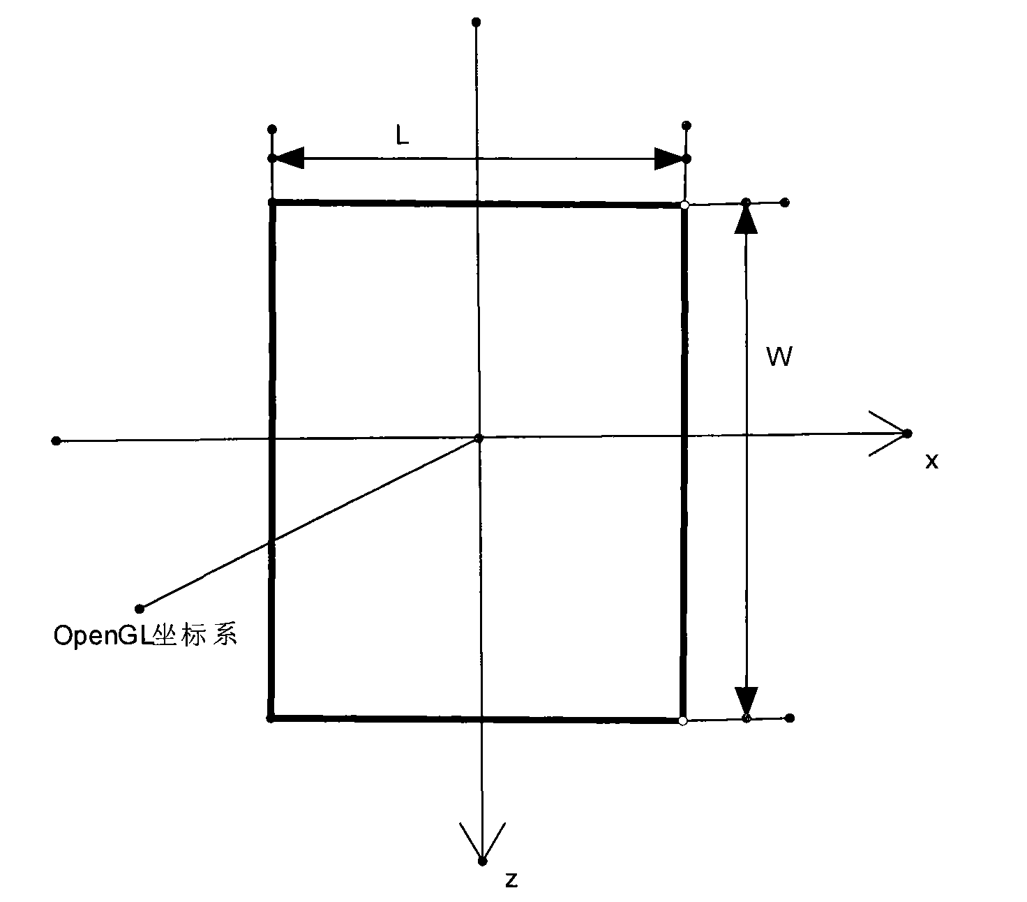
[0182] There are many methods for judging which partitions the projection of the 3D scene model occupies on the x-z plane. Here is a simple implementation method: Since the 3D scene model is actually composed of triangular meshes, record each triangular mesh that makes up the 3D scene model Project the partition to which it belongs on the x-z plane, and the recorded set of resource partitions is the resource partition to which the 3D scene model is projected on the x-z plane.

[0183] The second method is mainly used to solve the problems that cannot be solved by the first method, and it can easily handle the 3D scene model on the x-z plane beyond the scope of a resource partition. Preferably, it can be judged whether the 3D scene model belongs to only one resource partition, and if so, method 1 is used; otherwise, method 2 is used, which can reduce the computation load as much as possible.

[0184] After this process, the feature information of all 3D scene resource models in...


PUM


Abstract

The invention relates to the technical field of geographic location navigation, and discloses a method for realizing three-dimensional navigation. The method comprises the following steps: partitioning a three dimensional scene in a three-dimensional electronic map, and saving the partitioning result; establishing a resource partition table which includes three-dimensional scene model characteristic information and is used for saving the partition of each three-dimensional scene; determining the current position coordinates of a camera by utilizing a global positioning system; searching the partitioning result according to the current position coordinates, determining the partition of the three-dimensional scene of the current position coordinates of the camera, and searching the resourcepartition table to acquire the characteristic information of the three-dimensional scene included in the partition of the three-dimensional scene; and loading a predefined three-dimensional scene model according to the acquired characteristic information of the three-dimensional scene model, and rendering the three-dimensional scene. The invention also discloses a device for realizing three-dimensional navigation. By the technical scheme in the invention, three-dimensional scene navigation can be realized by a small memory space, and the scene switching speed is higher.

Description

technical field [0001] The invention relates to the technical field of geographic location navigation, in particular to a method and device for realizing three-dimensional navigation. Background technique [0002] The Global Positioning System (GPS) was developed by the United States in the 1970s. It took 20 years and cost 20 billion U.S. dollars. It was fully completed in 1994 and has all-round real-time navigation and positioning capabilities in sea, land and air. satellite navigation and positioning system. With its remarkable features such as all-weather, high precision, automation, and high efficiency, as well as its unique powerful functions such as positioning and navigation, timing and frequency calibration, and precision measurement, GPS has been involved in many application fields, making GPS a successor to cellular mobile communications. (GSM), the third new growth point of IT economy in the world after the Internet. [0003] The global positioning system consis...

Claims


Application Information

Patent Timeline
Patent Type & Authority Applications(China)
IPC IPC(8): G01C21/26G01C21/34G01C21/36
Inventor 刘兴国邓高伟徐斌
Owner BYD CO LTD
Why Eureka
Try Eureka