

Mass lightning data space-time analysis method based on GIS
A spatio-temporal analysis and data technology, applied in the intersection of GIS and meteorological information technology, can solve the problems of unintuitive and distinct disaster distribution, huge space, and redundant information.
- Summary
- Abstract
- Description
- Claims
- Application Information
AI Technical Summary
Problems solved by technology
Method used
Image

Examples
Embodiment Construction
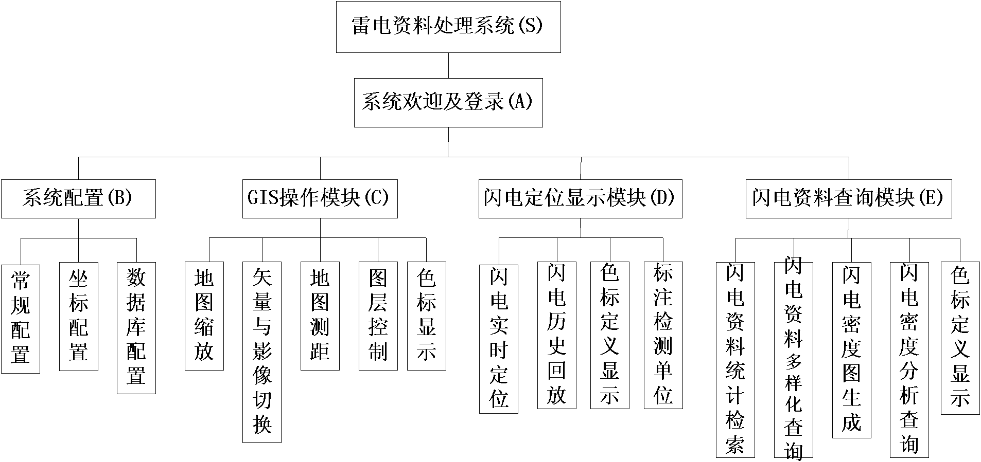
[0045] Such as Figure 8 As shown, in order to solve the data monitoring, storage and display problems of lightning, the present invention mainly includes four modules in combination with the actual situation of lightning data processing: server data monitoring module, client configuration module, GIS operation function module, lightning location display , Lightning data query module, etc.
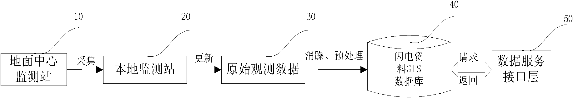
[0046] ①Server data monitoring module
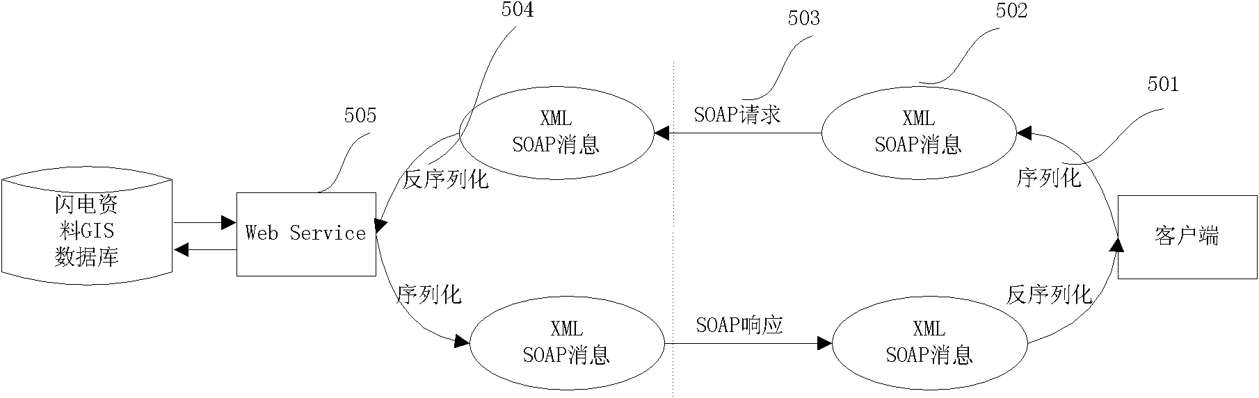
[0047] The main purpose is to collect data from the lightning location monitoring network to the local server monitoring station, update the local data through real-time monitoring algorithms, and import the original data into the lightning data GIS database through the method of noise reduction and preprocessing to form a lightning data resource layer. Realize operations such as inserting, deleting, and modifying the Lightning data database, and the data service interface communicates with the client through the use of XML message processing to enabl...
PUM
 Abstract
Description
Claims
Application Information