Pseudo-three-dimensional positioning method for wireless sensor network based on terrain information

A technology of wireless sensors and positioning methods, applied in wireless communication, network topology, electrical components and other directions, can solve the problems of complex moving paths of HILBERT, and achieve the effect of solving the problem of collinearity of anchor nodes, reducing computational complexity and improving positioning accuracy.

Inactive Publication Date: 2014-08-13
UNIV OF ELECTRONICS SCI & TECH OF CHINA
View PDF2 Cites 0 Cited by
  • Summary
  • Abstract
  • Description
  • Claims
  • Application Information

AI Technical Summary

Problems solved by technology

Although it solves the problem of collinear beacon nodes in SCAN without significantly increasing the traversal path of anchor nodes, the moving path of HILBERT is more complicated.

Method used


Image

  • Pseudo-three-dimensional positioning method for wireless sensor network based on terrain information
  • Pseudo-three-dimensional positioning method for wireless sensor network based on terrain information
  • Pseudo-three-dimensional positioning method for wireless sensor network based on terrain information

Examples


Embodiment Construction

[0026] The existing research on 3D positioning algorithms for wireless sensors generally considers that sensor nodes are randomly distributed in a given 3D space area. , we call the distribution on the surface of the space a pseudo three-dimensional distribution.

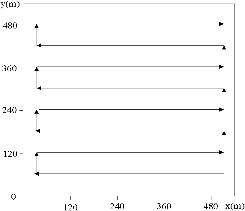
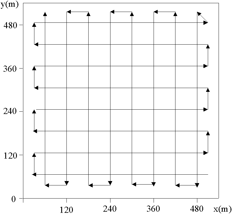
[0027] A pseudo three-dimensional positioning method for wireless sensor networks based on terrain information, such as Figure 5 As shown, it includes the following steps: network initialization layout, path planning, information exchange, anchor point selection, determining the abscissa and ordinate of the unknown node, determining the height value of the unknown node, and completing the positioning of the network node. in:

[0028] (1) Path planning

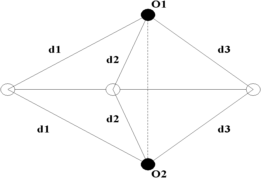
[0029] First introduce in detail the positioning principle of the trilateration method that the present invention will use below:

[0030] According to the trilateration method, at least three anchor nodes are required to achieve node localization in a two-dimens...


PUM


Abstract

The invention discloses a wireless sensor network pseudo-three-dimensional positioning method based on terrain information. By adopting a new simple path planning algorithm and without significantly increasing the traversal path of anchor nodes, it not only solves the problem of anchor node common line problem, and ensure that the selected three anchor nodes can form an equilateral triangle when locating unknown nodes, which further improves the positioning accuracy; at the same time, the present invention converts a complicated three-dimensional space node positioning problem into It is a simple node positioning problem in a two-dimensional plane, which reduces the computational complexity of the positioning algorithm.

Description

technical field [0001] The present invention relates to the technical field of wireless sensor network (WSN), in particular to a pseudo three-dimensional positioning method for wireless sensor network based on terrain information. Background technique [0002] The wireless sensor network is composed of a large number of cheap micro-sensor nodes deployed in the monitoring area. The sensor nodes form a wireless network through self-organization, perceive, collect and process specific information in the network coverage area in a cooperative manner, and collect information is sent to observers. Node positioning technology is one of the key technologies of wireless sensor networks. The problem of node positioning is that unknown nodes (nodes with unknown location information) are based on a small number of anchor nodes (nodes with known location information, and the nodes themselves have GPS positioning devices, which are relatively expensive. ), and determine its own position ...

Claims


Application Information

Patent Timeline
Patent Type & Authority Patents(China)
IPC IPC(8): H04W64/00H04W84/18
Inventor 于富财阮志锋胡光岷
Owner UNIV OF ELECTRONICS SCI & TECH OF CHINA
Why Eureka
Try Eureka