Agricultural environmental monitoring system based on movable unmanned aerial vehicle

An environmental monitoring system and unmanned aerial vehicle technology, applied in the field of agricultural environmental monitoring systems, can solve the problems of low distribution density, high resolution, and low sampling times of meteorological information, and achieve strong practicability, improve accuracy, The effect of high efficiency and flexibility

Inactive Publication Date: 2012-06-20
复旦大学无锡研究院
View PDF2 Cites 28 Cited by
  • Summary
  • Abstract
  • Description
  • Claims
  • Application Information

AI Technical Summary

Problems solved by technology

Meteorological satellites collect meteorological information in a large area with high resolution. The number of sampling meteorological information in the same area in a day is small, and the amount of sampled information is not enough to accurately reflect the information of the local specific agricultural growth environment.
Surface meteorological stations are generally fixed and the distribution density is not high, reflecting the meteorological information in the surrounding area of ​​the weather station, and cannot monitor the environmental information of sensitive or interested areas in real time
At the same time, the cost of weather satellites and ground weather stations are relatively expensive
It cannot meet the needs of real-time monitoring of the crop environment (including temperature field and humidity field, etc.) in large agricultural areas

Method used


Image

  • Agricultural environmental monitoring system based on movable unmanned aerial vehicle
  • Agricultural environmental monitoring system based on movable unmanned aerial vehicle

Examples


specific Embodiment approach

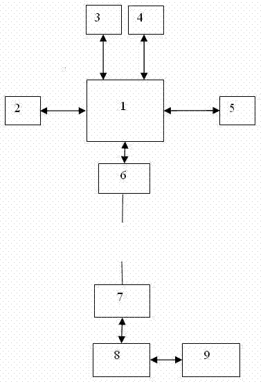
[0016] The intelligent agricultural monitoring system based on the mobile UAV is composed of two parts: the control terminal and the flight section. The control terminal and the flight terminal communicate with each other through GPRS. The structure diagram of the system is as figure 1 shown.

[0017] The specific implementation of the control terminal:

[0018] (1) Realize the control of the flight end through GPRS, that is, realize the real-time control of its flight direction and flight position;

[0019] (2) The temperature, humidity and CO collected each time 2 , illumination and other data are combined with the corresponding GPS position, displayed in the form of a GIS map, and information such as the temperature field and humidity field in the crop area is displayed in different colors, so that the high-resolution meteorological information is clear at a glance. Field and humidity fields and other information to properly irrigate crops.

[0020] The specific implem...


PUM


Abstract

The invention belongs to the technical field of wireless control and sensing and particularly provides an agricultural environmental monitoring system based on a movable unmanned aerial vehicle. The agricultural environmental monitoring system is divided into two parts of a control terminal and a flight terminal. The control terminal comprises GRPS (General Packet Radio Service), a control center and a display center. The flight terminal comprises a sensor of crop growth meteorological parameters, such as temperature, humidity, CO2, illumination and the like, and further comprises peripheral circuits, such as a barrier sensor, a GPS (Global Position System) module, the GPRS, a microprocessor and the like. Long-distance communication is carried out on the control terminal and the flight terminal through the GPRS, so that the flying and the collection of the flight terminal are controlled, environmental information of agricultural crops which is collected by the flight terminal is displayed in a GIS (Geographic Information System) map manner, and the agricultural crop environment is intelligently monitored in real time. With the adoption of the agricultural environmental monitoring system disclosed by the invention, the meteorological and environmental information with high resolution can be automatically and intelligently provided for the agricultural production, so that the basis for decision making is supplied.

Description

technical field [0001] The invention belongs to the technical field of wireless control and sensing, and in particular relates to an agricultural environment monitoring system based on a movable unmanned aerial vehicle. Background technique [0002] The growth monitoring of traditional agricultural crops, when to irrigate, etc., all rely on the experience of farmers, which is inefficient and inaccurate. Especially in places with relatively large agricultural areas, it is a lot of work to do it manually. The current environmental meteorological information mainly comes from meteorological satellites and ground weather stations. Meteorological satellites collect meteorological information in a large area with high resolution. The number of sampling meteorological information in the same area in a day is small, and the amount of sampled information is not enough to accurately reflect the information of the local specific agricultural growth environment. Surface meteorological ...

Claims


Application Information

Patent Timeline
Patent Type & Authority Applications(China)
IPC IPC(8): G01W1/02
CPCY02A90/10
Inventor 陆起涌张群贾思强高翔
Owner 复旦大学无锡研究院
Why Eureka
Try Eureka