Display method and display device for planned roads

A technology for planning a path and a display method, applied in the field of navigation, can solve the problems of high system resource consumption, unable to display road directions, only display road conditions, etc., to achieve the effect of saving system resources

Inactive Publication Date: 2012-08-01
SHENZHEN CARELAND TECH
View PDF5 Cites 5 Cited by
  • Summary
  • Abstract
  • Description
  • Claims
  • Application Information

AI Technical Summary

Problems solved by technology

[0008] In order to solve the problems existing in the existing navigation technology that the system resource consumption in the process of marking the road conditions is large, the direction of the

Method used


Image

  • Display method and display device for planned roads
  • Display method and display device for planned roads
  • Display method and display device for planned roads

Examples


Example Embodiment

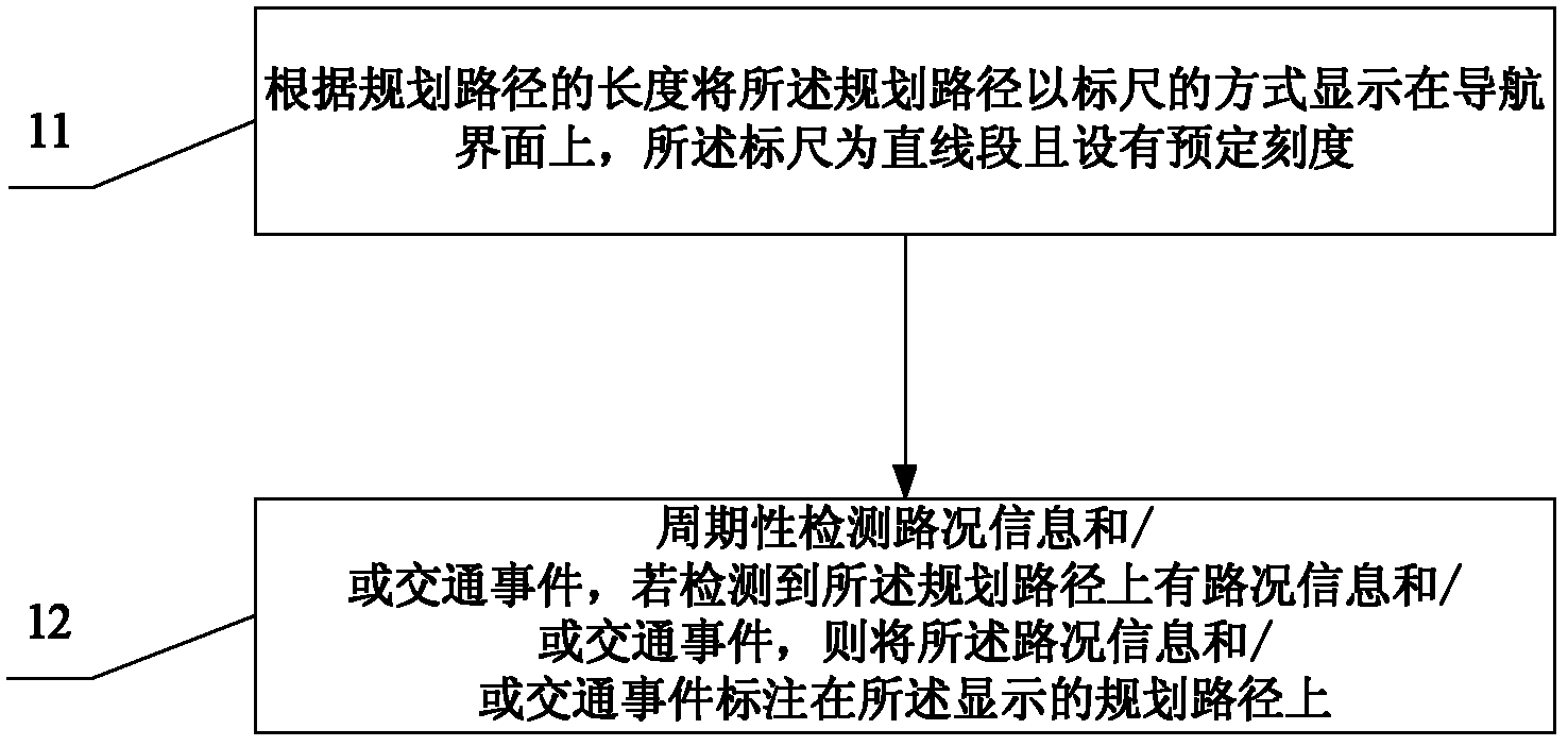
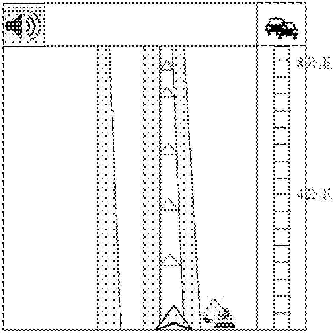
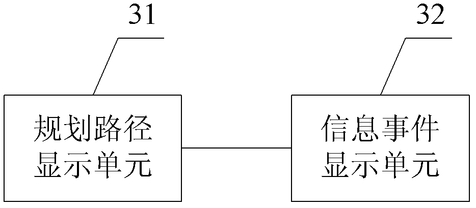
[0019] The specific embodiment of the present invention provides a method for displaying a planned path, which includes displaying the planned path as a ruler on a navigation interface according to the length of the planned path, and the ruler is a straight line segment with a predetermined scale; Detect road condition information and / or traffic events, and if it is detected that there is road condition information and / or traffic events on the planned route, mark the road condition information and / or traffic events on the displayed planned route.

[0020] In the following, the navigation terminal is set in a motor vehicle as an example, and the specific implementation manner is described in detail with reference to the accompanying drawings of the specification, such as figure 1 As shown, the display method of the corresponding planned path includes:

[0021] Step 11: According to the length of the planned path, the planned path is displayed on the navigation interface in the form o...


PUM


Abstract

The invention provides a display method and a display device for planned roads. The display method includes displaying the planned roads on the navigation interface by the aid of a linear scale with preset graduation according to the length of the planned roads; periodically detecting road conditions and/or traffic accidents, and indicating the road conditions and/or the traffic accidents on the planned roads displayed if the road conditions and/or the traffic accidents are detected on the planned roads. By displaying the planned roads by the aid of the scale and displaying the detected road conditions and traffic accidents on the planned roads and the scale, the display method and the display device for planned roads have the advantages that displaying all the road conditions on the navigation interface is avoided, system resources are saved, and road conditions, directions of the roads and traffic accidents on the planned roads can be displayed at the same time.

Description

[0001] This application claims the priority of the Chinese application filed on December 31, 2011 with the application number 201110458422.X and the title of the invention "A Display Method and Device for Planned Route", the entire content of which is incorporated in this application by reference middle. technical field [0002] The invention provides a method and device for displaying a planned route, belonging to the technical field of navigation. Background technique [0003] The existing TMC (Traffic Message Channel, real-time traffic information) generally uses three colors of red, yellow and green to identify road conditions, that is, red indicates severe congestion, yellow indicates slow driving (driving speed below 15 kilometers per hour), and green indicates smooth traffic. . However, this road condition marking method has the following defects: [0004] 1. All road networks are covered by TMC information signs, affecting users' observation of road networks; [0...

Claims


Application Information

Patent Timeline
IPC IPC(8): G01C21/36G08G1/0969
Inventor 张文星
Owner SHENZHEN CARELAND TECH
Why Eureka
Try Eureka