

Real-time searching and combining technology of mobile end three-dimensional city model based on Internet
A city model and three-dimensional model technology, applied in the field of spatial information, can solve the problem of low accuracy and achieve the effect of precise navigation and precise location-based services
- Summary
- Abstract
- Description
- Claims
- Application Information
AI Technical Summary
Problems solved by technology
Method used
Image

Examples
Embodiment 1
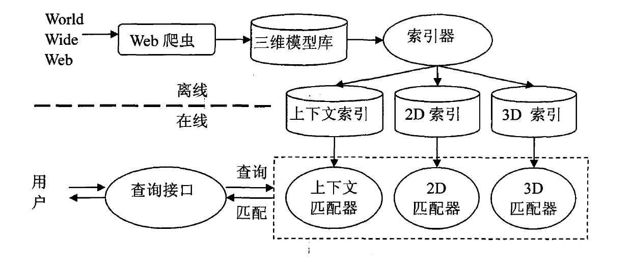
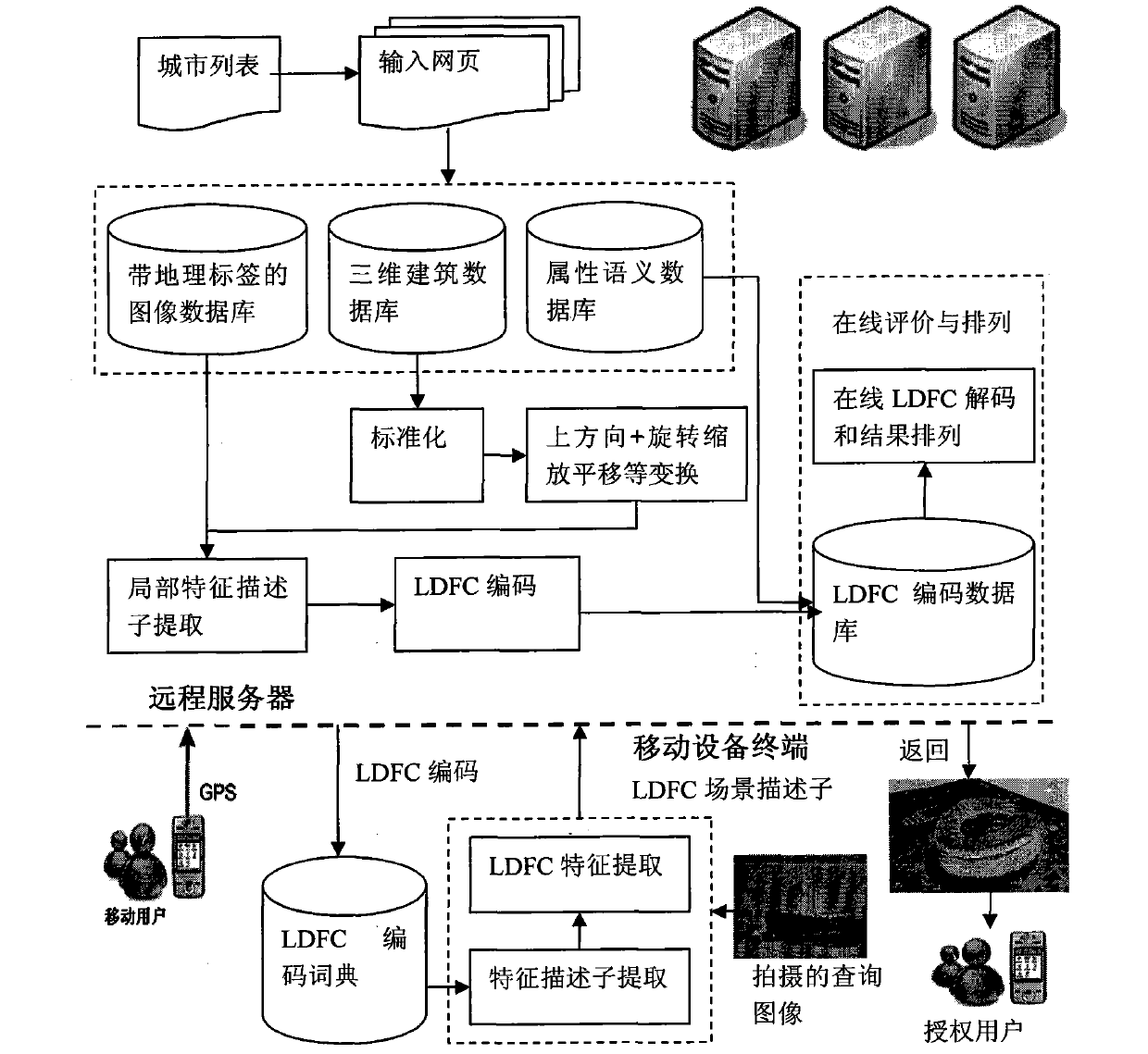
[0034] Figure 4 is the system interface of the present invention. The building facade image and its geographical location taken by smart phones are encoded by LDFC and then transmitted to the server. The mobile terminal, after decoding, superimposes it on a two-dimensional map or image to construct a more realistic three-dimensional urban scene.
[0035] The invention returns the three-dimensional model in near real time, shortens the user's waiting time, and can inquire and browse the three-dimensional scene. The following examples demonstrate the results of the invention.
[0036] Use your smartphone to take photos of surrounding landmarks (such as the National Pavilion of the World Expo, Figure 5 ), extract scale-invariant feature transformation descriptors, and these local descriptors are quantized into a BoW histogram; then, they are encoded and compressed with a nonlinear coding matrix, uploaded to the server, and the server decodes the received LDFC scene descripto...
PUM
 Abstract
Description
Claims
Application Information