Spatial region division based routing method in underwater sensor network

An underwater sensor and area division technology, applied in network topology, data exchange network, transmission system, etc., can solve the problem of inability to save energy consumption, lack of node credibility, and underwater environment specificity metrics, without considering the network In order to improve the reliability, avoid the path loop problem, and achieve the effect of transmission path

Inactive Publication Date: 2013-09-11
HOHAI UNIV CHANGZHOU
View PDF4 Cites 12 Cited by
  • Summary
  • Abstract
  • Description
  • Claims
  • Application Information

AI Technical Summary

Problems solved by technology

[0011] 2. The reliability of nodes and the particularity of the underwater environment are not used as metrics
[0012] 3. It does not consider the situation of the network under the condition of duty cycle sleep mobilization mechanism
Most algorithms do not take this factor into account and cannot achieve the purpose of saving energy

Method used


Image

  • Spatial region division based routing method in underwater sensor network
  • Spatial region division based routing method in underwater sensor network
  • Spatial region division based routing method in underwater sensor network

Examples


Embodiment Construction

[0056] The present invention will be further described below in conjunction with the accompanying drawings and embodiments.

[0057] A routing method based on spatial region division in underwater sensor networks, including three stages:

[0058] (1) The stage of selecting the next hop area: for any ordinary forwarding node, when it selects the next hop forwarding node, first determine the small cube area where the next hop forwarding node is located;

[0059] (2) The node selection stage in the target area: the forwarding node performs sleep scheduling, and is periodically slept and woken up; in the selected target small cube area, the next-hop awake node is selected according to the forwarding rules, and the forwarding path discovery process is completed ;

[0060] (3) Path optimization stage: optimize the path found and select the optimal path.

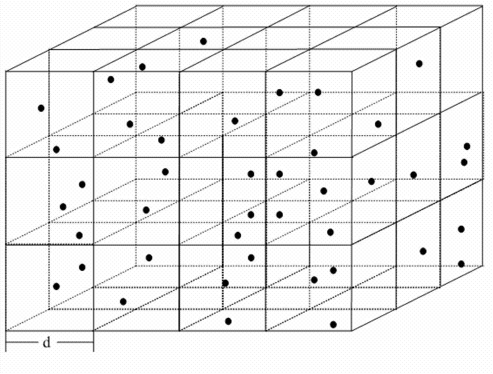
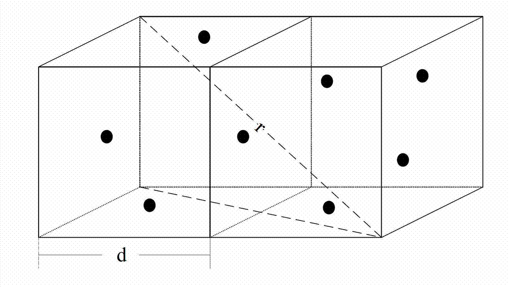
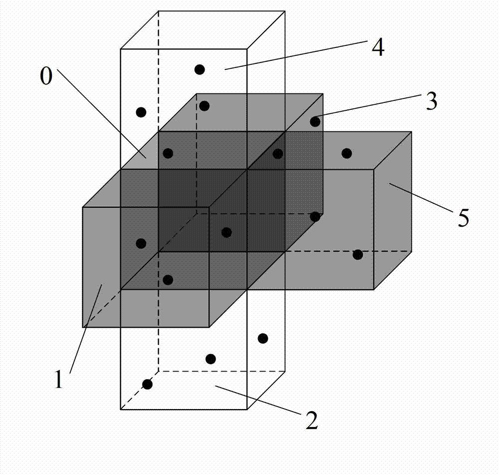
[0061] In stage (1), the underwater sensor network can be equivalent to a three-dimensional model, which has the following char...


PUM


Abstract

The invention relates to a spatial region division based routing method in an underwater sensor network. The routing method comprises stages of (1) selecting a next-hop region, wherein an underwater three-dimensional network monitoring region is treated as a cube and divided equally into a plurality of small cube regions, and a source node selects an optimum forwarding region according to information of the position of the source node and the position of a target node to which information is finally transmitted; (2) selecting a node in a target region, wherein measurement criteria such as node residual energy, duty ratio sleep mechanisms and credibility are considered to select a next-hop waking node to guarantee connectivity of the whole network; and (3) optimizing a path, wherein a tag-based optimizing strategy is introduced to eliminate path rings when path rings exist to select an optimum path. According to the routing method, routing region division and credibility of nodes in the underwater sensor network are considered, so that the reliability and the extendibility of routing are increased, and the network performance is improved.

Description

technical field [0001] The invention belongs to the field of underwater three-dimensional wireless sensor networks, in particular the invention relates to a routing method based on space area division in an underwater sensor network, which seeks multiple reliable paths and selects an optimal path. Background technique [0002] At present, with the further acceleration of the development of the ocean, the underwater sensor network has become a new research hotspot, and it has played an increasingly important role in marine environmental sampling, environmental monitoring, disaster warning, auxiliary navigation and tactical distribution monitoring. At present, scholars have proposed many underwater routing algorithms, but most of them are single-path and do not consider the duty cycle mechanism and node credibility. [0003] The current research on the routing of underwater 3D wireless sensor area network is as follows: [0004] Peng Xie and others published the article "VBF:...

Claims


Application Information

Patent Timeline
IPC IPC(8): H04L12/721H04W84/18H04W40/00
CPCY02D30/70
Inventor 韩光洁郭惠钱爱华巢佳江旭张晨语江金芳
Owner HOHAI UNIV CHANGZHOU
Why Eureka
Try Eureka