Method and system for obtaining airway weather radar chart

A weather radar and route technology, applied in the field of civil aviation data superposition, can solve the problems that flights cannot take off on time, passengers cannot know, etc.

Active Publication Date: 2013-12-18
FEIYOU TECH CO LTD
View PDF8 Cites 8 Cited by
  • Summary
  • Abstract
  • Description
  • Claims
  • Application Information

AI Technical Summary

Problems solved by technology

[0003] In traditional flight information services, passengers cannot know why their flight cannot take off on time

Method used


Image

  • Method and system for obtaining airway weather radar chart

Examples


Embodiment Construction

[0024] In order to make the object, technical solution and advantages of the present invention clearer, the present invention will be further described in detail below in conjunction with the accompanying drawings and embodiments. It should be understood that the specific embodiments described here are only used to explain the present invention, not to limit the present invention.

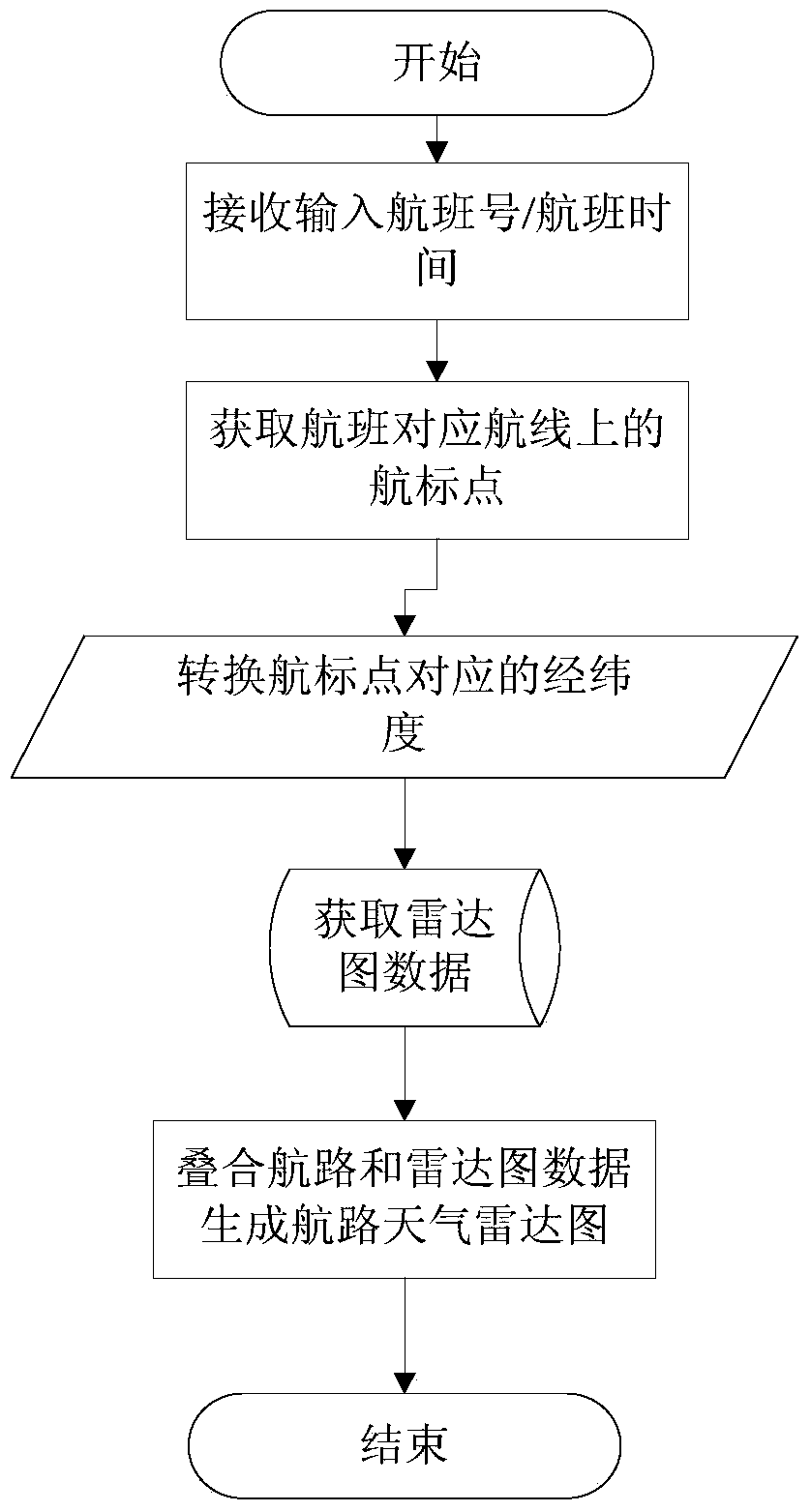
[0025] Please refer to FIG. 1 , which is a flow chart of a method for obtaining en-route weather radar charts provided by a preferred embodiment of the present invention. The method for obtaining the route weather radar map is applied in a civil aviation data query system, which includes the following steps:

[0026] (1) According to the flight number and flight time parameters input by the user, obtain the specific route information, that is, all the navigation points from the start point to the end point.

[0027] (2) Convert the navigation points into two-dimensional parameters (X, Y) by using ...


PUM


Abstract

The invention discloses a method and system for obtaining an airway weather radar chart. The method is applied to a civil aviation data query system. The method comprises the following steps that according to flight number and flight time parameters input by a user, specific airway information is obtained, and namely, all navigation mark points from the starting point to the ending point are obtained; by the utilization of all air route navigation mark values obtained from a data base of the civil aviation data query system, the navigation mark points are converted into two-dimensional parameters (Xes,Ys), wherein Xes are longitude values corresponding to navigation marks and Ys are latitude values corresponding to the navigation marks; third-party radar chart data are obtained, an airway and a third-party radar chart are overlapped to form an airway radar chart, and meteorological values on the airway weather radar chart are updated in real time. The method for obtaining the airway weather radar chart has the advantage that the airway weather radar chart provides a visible platform for tourists to query the air way weather conditions of flights where the tourists are. The invention further relates to a system for obtaining the airway weather radar chart through the method.

Description

technical field [0001] The invention relates to a method for superimposing civil aviation data, in particular to a method and system for obtaining airway weather radar charts. Background technique [0002] The route refers to the specific route that the aircraft flies during the specific flight process. Enroute weather refers to the weather information of cities passing through the flight route. The en-route weather radar map refers to the weather radar map of the cities that the aircraft passes through on its flight route. [0003] With flight information services in the traditional sense, passengers cannot know why their flight cannot take off on time. Passengers may think that the reason why the weather on the route affects the normal departure of the flight is just an explanation for the airline to evade responsibility. There is an urgent need to develop a weather map on the route, so that passengers can clearly see whether the weather on the route has an impact on the...

Claims


Application Information

Patent Timeline
Patent Type & Authority Applications(China)
IPC IPC(8): G08G5/00G06F17/30
Inventor 桑磊宣彤郑洪峰
Owner FEIYOU TECH CO LTD
Why Eureka
Try Eureka