3G police-service unmanned aerial vehicle management and control system

A control system and unmanned aerial vehicle technology, applied in the direction of closed-circuit television system, three-dimensional position/channel control, etc., can solve the problems that the 3G network cannot operate effectively, the external environment of receiving and handling police is complicated, etc., and achieve light weight, convenient operation and use simple effect

Inactive Publication Date: 2014-02-12
常州天鹅科技有限公司
View PDF6 Cites 8 Cited by
  • Summary
  • Abstract
  • Description
  • Claims
  • Application Information

AI Technical Summary

Problems solved by technology

[0004] However, the "police 3G mobile video surveillance and command system" uses fixed monitoring devices and equipment on the ground, or ground patrol vehicles to complete law enforcement in various scenarios during the operation of the 3G network. , the road traffic congestion on the ground is intensifying, there are more and more high-rise buildings, and the external environment for police handling is more complicated. Due to the suddenness, urgency, and frequent occurrence of incidents in police work, traditional ground police and monitoring equipment, such as It has been greatly restricted in patrolling, anti-terrorism, criminal investigation, fire fighting, large-scale security, etc. This kind of ground mobile video surveillance and command system has shown certain limitations under the new situation. Lack of fixed monitoring devices and equipment on the ground, or areas that cannot be reached by ground inspection vehicles, it is difficult for law enforcement agencies to monitor and collect evidence, or to complete the monitoring and evidence collection of ground scenes from a certain space / height, while the 3G network is at a limited height from the ground Therefore, it is urgent to develop a "3G police drone control system" that can cooperate with the "police 3G mobile video surveillance and command system" to realize air / ground integrated 3G mobile The monitoring and command of video can meet the requirements of today's police work and improve the efficiency of police dispatch, monitoring and handling incidents

Method used


Image

  • 3G police-service unmanned aerial vehicle management and control system
  • 3G police-service unmanned aerial vehicle management and control system
  • 3G police-service unmanned aerial vehicle management and control system

Examples


Embodiment 1)

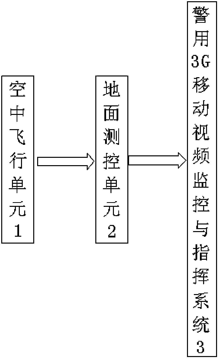
[0026] see Figure 1 to Figure 3 , The 3G police drone management and control system of this embodiment includes an air flight unit 1 and a ground measurement and control unit 2.

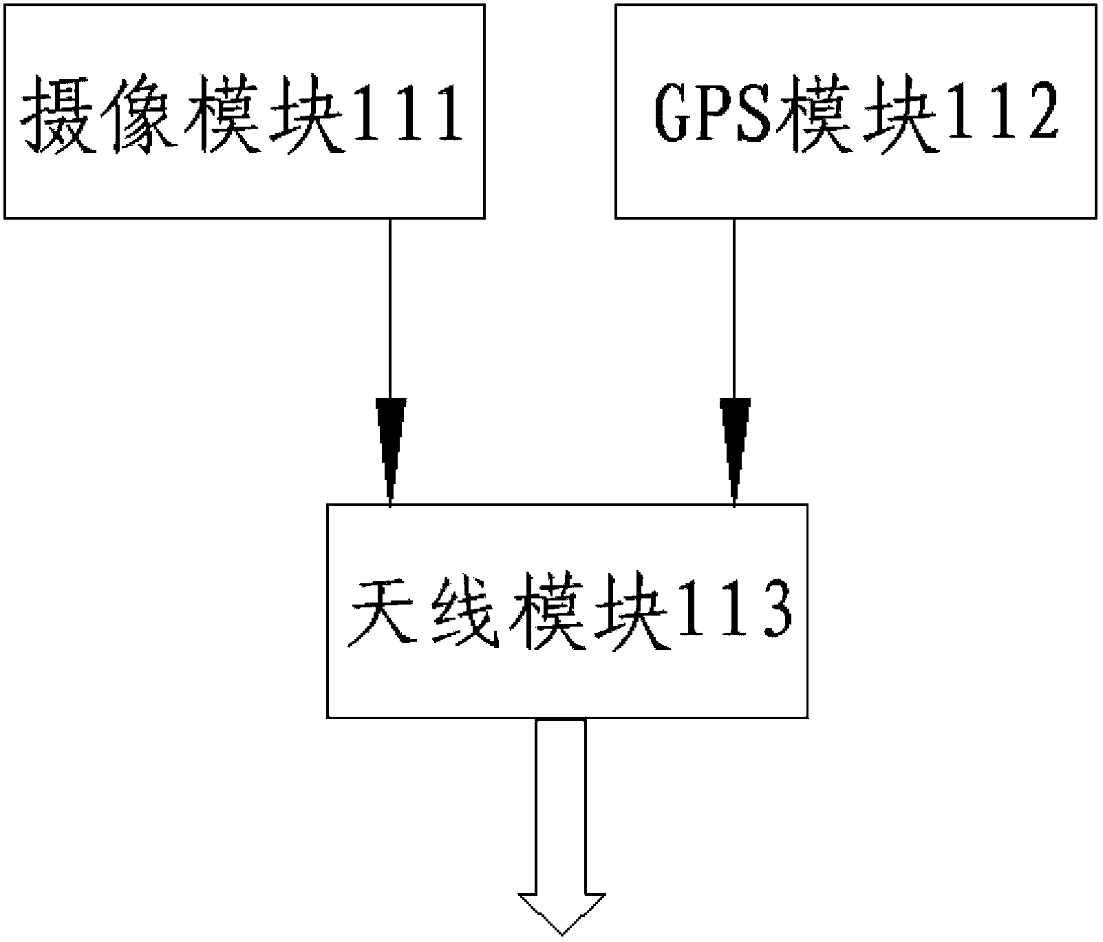
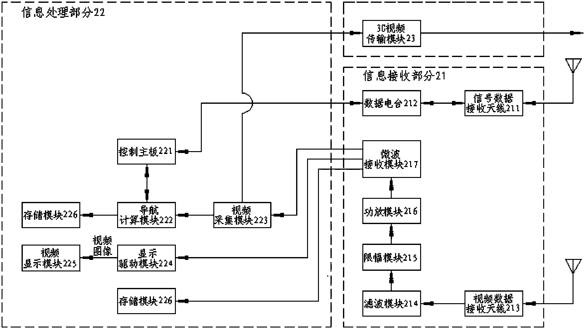
[0027] The air flight unit 1 includes a drone flight platform 11 and an intelligent control device 12 for controlling the flight of the drone flight platform 11. The ground measurement and control unit 2 includes an information receiving part 21, an information processing part 22 and a 3G video transmission module 23. Both the information receiving part 21 and the 3G video transmission module 23 are electrically connected to the information processing part 22. The information receiving part 21 and the 3G video transmission module 23 of the ground measurement and control unit 2 communicate with the drone flight platform 11 of the air flight unit 1 and the police 3G mobile video surveillance and command system 3 respectively. The drone flight platform 11 includes a central body, a power unit, a camera ...


PUM


Abstract

The invention discloses a 3G police-service unmanned aerial vehicle management and control system which comprises an aerial flight unit and a ground measurement and control unit. The aerial flight unit comprises an unmanned aerial vehicle flight platform and an intelligent control device for controlling the flight of the unmanned aerial vehicle flight platform. The unmanned aerial vehicle flight platform comprises a central vehicle body, multiple groups of power devices evenly distributed on the periphery of the outer end of the central vehicle body and a camera shooting module installed on the central vehicle body. The ground measurement and control unit comprises an information receiving portion, an information processing portion and a 3G video transmission module. The information receiving portion and the 3G video transmission module are electrically connected with the information processing portion. The information receiving portion and the 3G video transmission module of the ground measurement and control unit are respectively communicated with the unmanned aerial vehicle flight platform of the aerial flight unit and a police 3G mobile video monitoring and commanding system. The 3G police-service unmanned aerial vehicle management and control system achieves aerial/ground integrated 3G mobile video monitoring and commanding, meets the requirement for current police work and improves the police dispatching, monitoring and event handling efficiency.

Description

Technical field [0001] The invention relates to a 3G police drone management and control system. Background technique [0002] The rapid development of modern communication technology has greatly promoted the wide application of 3G communication networks. Based on years of research and development and service of police work, the applicant has developed a set of systems compatible with PGIS (Police Geographic Information System, police Use geographic information system) seamlessly connected with the "police 3G mobile video command and monitoring system" with high security, high stability and high real-time. It integrates real-time and historical queries of video, voice, and trajectory, and can dispatch and command in real time. Cross-regional and cross-departmental joint operations can be achieved in the true sense of the clairvoyance and smooth ears of police work; at the same time, mobile applications are extended to various office equipment to adapt to the high complexity of po...

Claims


Application Information

Patent Timeline
Patent Type & Authority Applications(China)
IPC IPC(8): G05D1/10H04N7/18
Inventor 李宇霞
Owner 常州天鹅科技有限公司
Why Eureka
Try Eureka