Multi-band high-resolution remote sensing image segmentation method based on gray scale co-occurrence matrix

A gray-scale co-occurrence matrix, remote sensing image technology, applied in image analysis, image data processing, instruments, etc., can solve the problem of loss of detail information in high-resolution remote sensing images, difficulty in accurately locating objects, and ignoring spectral differences. Over-segmentation and under-segmentation, good segmentation effect, and the effect of avoiding the loss of image details

Active Publication Date: 2014-02-12
江苏诚泰测绘科技有限公司
View PDF6 Cites 28 Cited by
  • Summary
  • Abstract
  • Description
  • Claims
  • Application Information

AI Technical Summary

Problems solved by technology

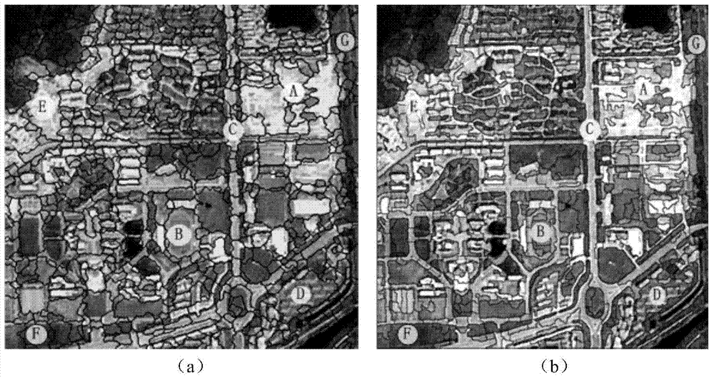
On this basis, Chen Qiuxiao et al. proposed a novel high-resolution remote sensing image segmentation method based on local homogeneity gradients. This algorithm effectively solves the over-segmentation problem of watershed transform, but there are also the following problems: Too rough quantization leads to the serious loss of a large amount of detailed information in high-resolution remote sensing images, which is prone to under-segmentation, and it is difficult to accurately locate the edges of objects; because there are a large number of obj...

Method used


Image

  • Multi-band high-resolution remote sensing image segmentation method based on gray scale co-occurrence matrix
  • Multi-band high-resolution remote sensing image segmentation method based on gray scale co-occurrence matrix
  • Multi-band high-resolution remote sensing image segmentation method based on gray scale co-occurrence matrix

Examples


Embodiment Construction

[0017] Below in conjunction with specific embodiment, further illustrate the present invention, should be understood that these embodiments are only used to illustrate the present invention and are not intended to limit the scope of the present invention, after having read the present invention, those skilled in the art will understand various equivalent forms of the present invention All modifications fall within the scope defined by the appended claims of the present application.

[0018] A multi-band high-resolution remote sensing image segmentation method based on gray level co-occurrence matrix, including the following steps:

[0019] 1 Multi-band texture image generation

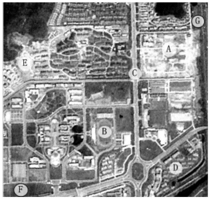
[0020] Because too rough quantization will lose the detailed information of the image, the original image is not quantized, but each band image is segmented separately. The texture features in remote sensing images reflect the spatial arrangement information of objects, and the combination of image te...


PUM


Abstract

The invention discloses a multi-band high-resolution remote sensing image segmentation method based on a gray scale co-occurrence matrix. In texture images based on the gray scale co-occurrence matrix, precipitation watershed transformation is adopted for segmentation of each band image, and therefore band segmentation results are superposed. At last, a region merging strategy based on multi-band spectral information is provided for merging fragment regions in the segmentation results, and finally image segmentation is achieve. A high-resolution ALOS image and an SPOT 5 image are tested respectively through the method which is compared with a traditional segmentation method based on local area homogeneity gradients. As is shown in experimental results, edges of an object can be accurately positioned, over-segmentation and under-segmentation are effectively overcome, and higher segmentation accuracy and stability are achieved.

Description

technical field [0001] The invention relates to a multi-band high-resolution remote sensing image segmentation method based on a gray level co-occurrence matrix, and belongs to the technical field of remote sensing image segmentation. Background technique [0002] At present, high-resolution remote sensing images are widely used in many fields such as urban planning, environmental assessment, and military affairs, and object-oriented analysis methods are receiving more and more attention in the research of high-resolution remote sensing images. Effective image segmentation is the foundation and important guarantee of object-oriented analysis methods. At present, the segmentation methods of high-resolution remote sensing images are mainly divided into five categories: segmentation methods based on pixels, such as threshold method and clustering method; segmentation methods based on edge detection; segmentation methods based on regions; segmentation methods based on physical m...

Claims


Application Information

Patent Timeline
IPC IPC(8): G06T7/00
Inventor 朱立琴王友恒
Owner 江苏诚泰测绘科技有限公司
Why Eureka
Try Eureka