Updating method utilizing full view camera to update streetscape database
A panoramic camera and database technology, applied in database update, geographic information database, electronic digital data processing, etc., can solve the problems of high update cost, long data update cycle, lack of real-time data, etc., and the method is simple, maintenance and update low cost effect
- Summary
- Abstract
- Description
- Claims
- Application Information
AI Technical Summary
Problems solved by technology
Method used
Image
Examples
Embodiment 1
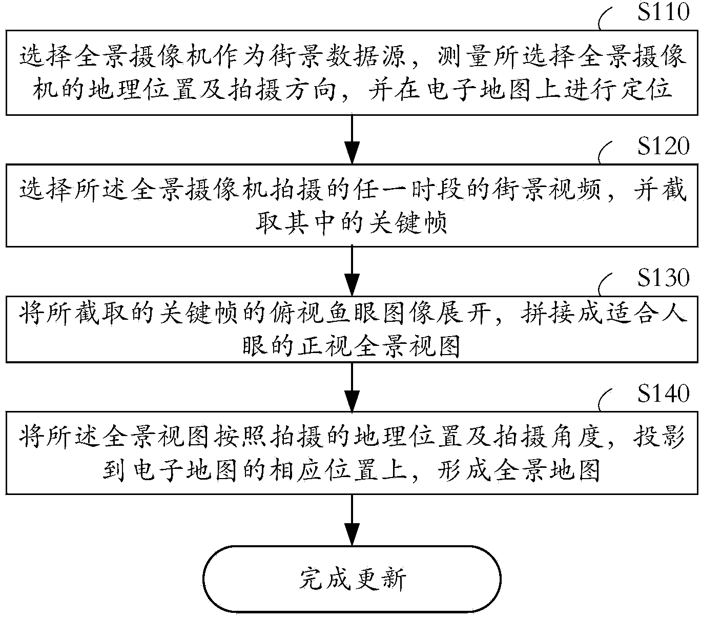
[0018] see figure 1 , showing the method for updating the street view database with a panoramic camera in the present invention, mainly includes the following steps:
[0019] In step S110, a panoramic camera is selected as a street view data source, the geographic location and shooting angle of the selected panoramic camera are measured, and positioning is performed on the electronic map.
[0020] Among them, the panoramic camera includes the existing panoramic monitoring cameras of public security, shops, scenic spots, residential quarters, etc., as well as the panoramic monitoring cameras installed by street view service providers. Among them, using the existing panoramic camera can not only occupy a better geographical location, but also save maintenance costs appropriately.
[0021] In this embodiment, the geographic location, ie (longitude, latitude), is used to correspond to the longitude and latitude in the electronic map.
[0022] The measurement of the shooting angl...
Embodiment 2
[0046] see Figure 4 , showing the method for updating the street view database with a panoramic camera in the present invention, mainly includes the following steps:
[0047] In step S410, select the geographic location of street view data framing on the electronic map, and install a panoramic camera there as a source of street view data, and record the geographic location and shooting angle;
[0048] In this embodiment, the geographic location, ie (longitude, latitude), is used to correspond to the longitude and latitude in the electronic map. The shooting angle is used for subsequent visual image correction.
[0049] In step S420, the street view video of any period captured by the panoramic camera is selected, and the key frames are intercepted.
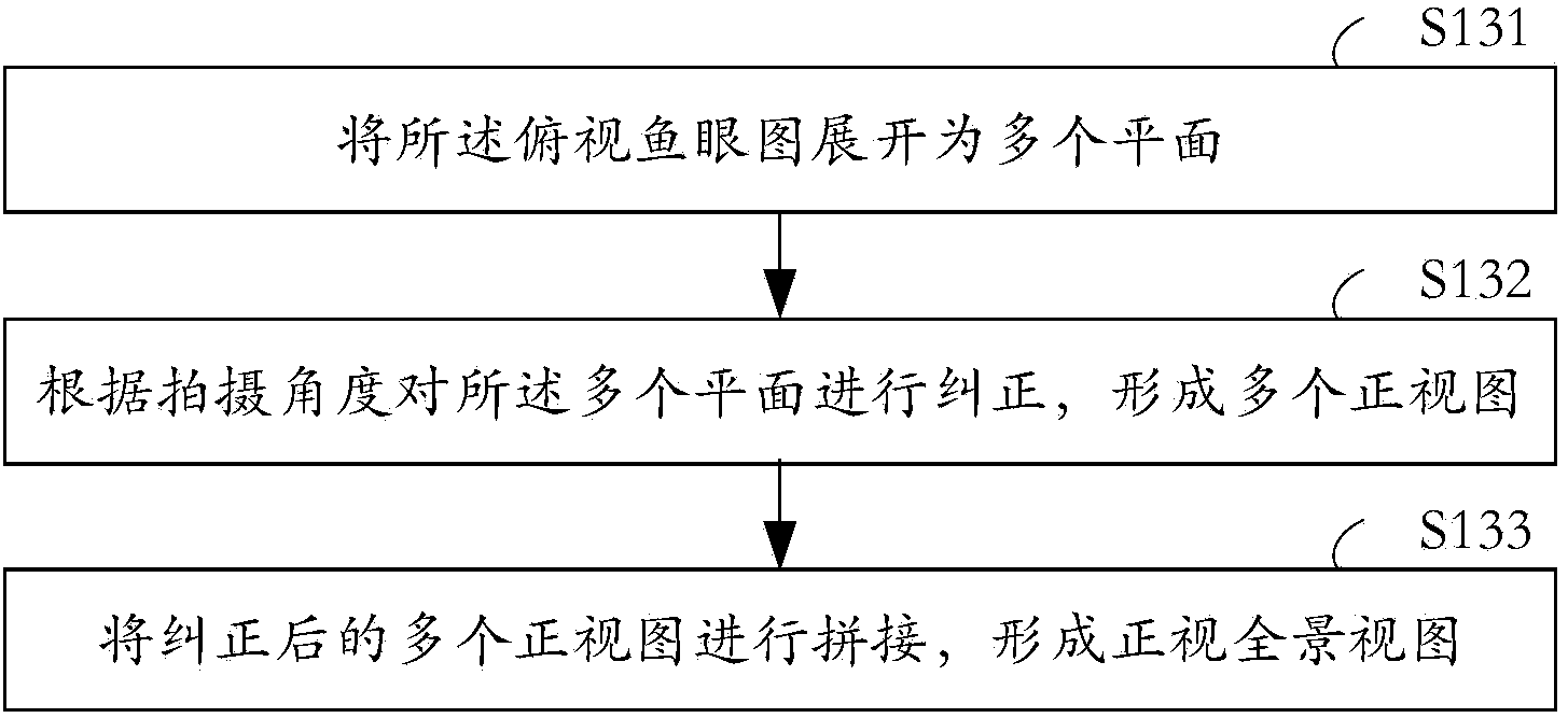
[0050] In step S430, the intercepted top-view fisheye images of the key frames are expanded, and spliced into a full front view view suitable for human eyes.
[0051] In this embodiment, the process of unfolding and splicing i...
PUM
 Abstract
Description
Claims
Application Information
 - R&D
- Intellectual Property
- Life Sciences
- Materials
- Tech Scout
- Unparalleled Data Quality
- Higher Quality Content
- 60% Fewer Hallucinations
Browse by: Latest US Patents, China's latest patents, Technical Efficacy Thesaurus, Application Domain, Technology Topic, Popular Technical Reports.
© 2025 PatSnap. All rights reserved.Legal|Privacy policy|Modern Slavery Act Transparency Statement|Sitemap|About US| Contact US: help@patsnap.com


