Underwater vehicle multi-constrained path planning method based on S57 standard electronic chart

A technology for underwater vehicles and electronic charts, applied in navigation computing tools and other directions, can solve the problems of insufficient route practicability and too simple planning environment

Inactive Publication Date: 2014-07-02
HARBIN ENG UNIV
View PDF4 Cites 19 Cited by
  • Summary
  • Abstract
  • Description
  • Claims
  • Application Information

AI Technical Summary

Problems solved by technology

At present, the route planning of underwater vehicles mostly focuses on the planning method of a given simulation environment. The planning environment is too simple, resulting in insufficient practicability of the planned route.

Method used


Image

  • Underwater vehicle multi-constrained path planning method based on S57 standard electronic chart
  • Underwater vehicle multi-constrained path planning method based on S57 standard electronic chart
  • Underwater vehicle multi-constrained path planning method based on S57 standard electronic chart

Examples


Embodiment Construction

[0061] The present invention will be further described below in conjunction with accompanying drawing:

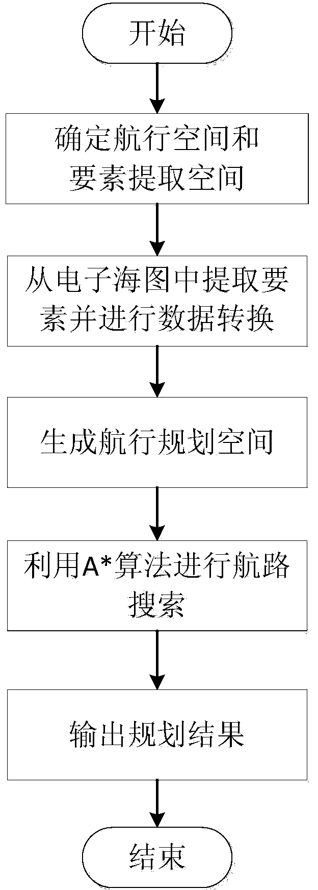
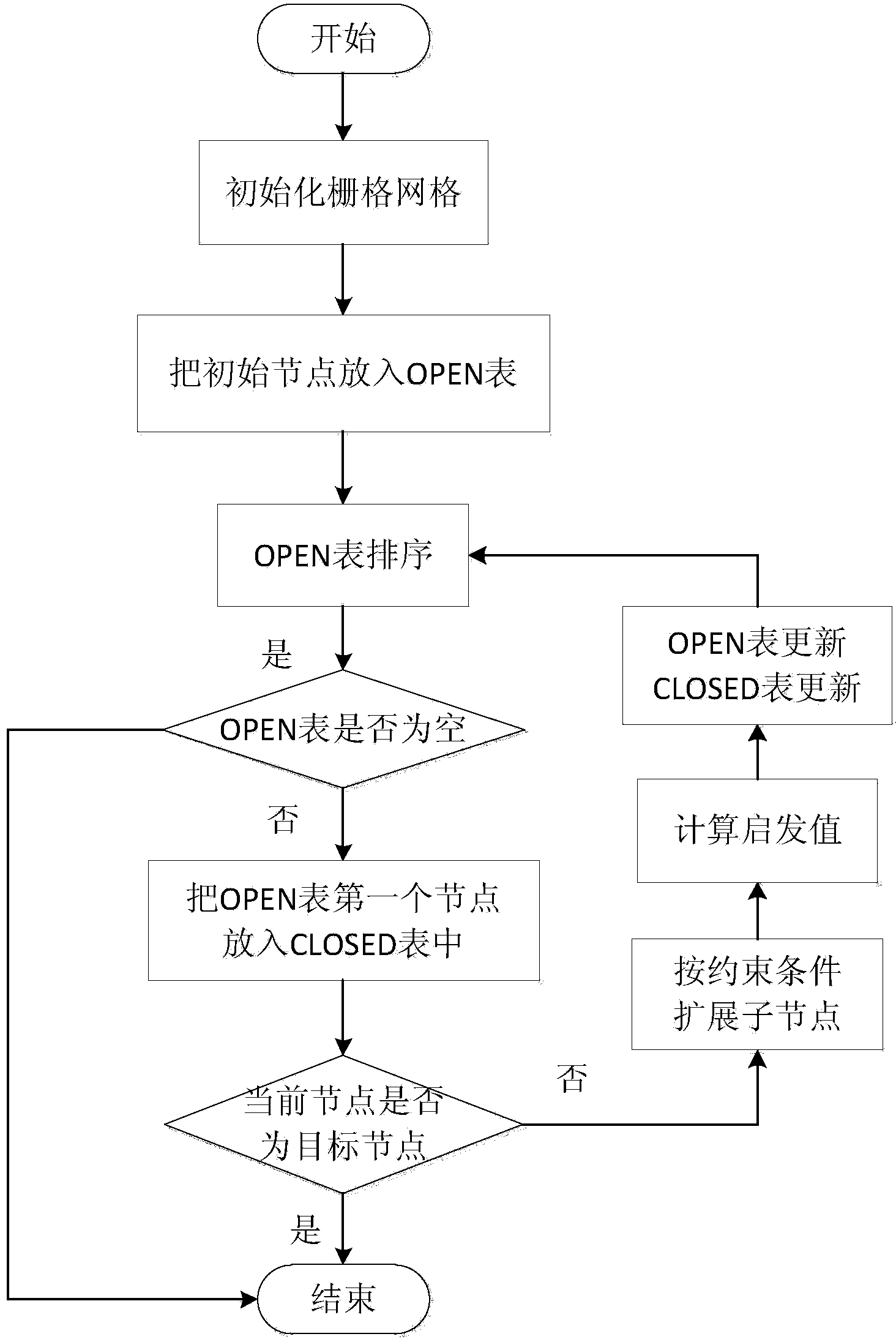
[0062] The invention belongs to the technical field of three-dimensional path planning of an underwater vehicle, and in particular relates to a multi-constraint route planning method for an underwater vehicle based on the S57 standard electronic chart. Specifically, it includes five basic steps: determining the planning space and element extraction space, element extraction and data conversion, navigation space generation, A* algorithm route planning, and planning result output. Compared with most path planning methods using simple cubes to simulate the planning environment, the present invention generates a three-dimensional planning environment by extracting data from the S57 standard electronic chart, thereby ensuring the authenticity of the planning environment and improving the practicability of the planning method. At the same time, the invention improves the A* algor...


PUM


Abstract

The invention belongs to the technical field of underwater vehicle three-dimensional path planning, and particularly relates to an underwater vehicle multi-constrained path planning method based on an S57 standard electronic chart. The method comprises the following steps: determining the planning space and the element extraction space; extracting and converting elements; generating a navigation space; carrying out path search by utilizing a A*algorithm; outputting the planning result; storing the planning result obtained in the fourth step in a file. Compared with most path planning algorithms, simple cubic solids are utilized for simulating a planning environment, and the three-dimensional planning environment is generated by extracting the standard of the S57 standard electronic chart, so that the authenticity and the complexity of the planning environment are ensured, and thus the practicability of the planning method is improved.

Description

technical field [0001] The invention belongs to the technical field of three-dimensional path planning of an underwater vehicle, and in particular relates to a multi-constraint route planning method for an underwater vehicle based on the S57 standard electronic chart. Background technique [0002] Electronic nautical chart is a digital nautical chart that integrates various information that needs to be displayed and explained to navigators. Compared with simple paper nautical charts displayed in color, electronic nautical charts include more geographical and textual information. information. electronic sea Figure 1 It is generally used in some professional application systems, and its representation content, data format and display method can be defined by users or designers. The electronic chart based on the S57 standard conforms to the "Digital Hydrographic Survey Data Transmission Standard" (S-57) standard, which is internationally accepted and the most authoritative da...

Claims


Application Information

Patent Timeline
IPC IPC(8): G01C21/20
CPCG01C21/20
Inventor 刘厂赵玉新金娜沈志峰李刚齐昭
Owner HARBIN ENG UNIV
Why Eureka
Try Eureka