Abandoned land remote sensing recognition method based on texture and vegetation indexes

A vegetation index and remote sensing identification technology, which is applied in the application field of remote sensing technology to achieve the effect of improving efficiency and accuracy, improving identification efficiency and reducing subjectivity.

Active Publication Date: 2014-07-09
INST OF REMOTE SENSING & DIGITAL EARTH CHINESE ACADEMY OF SCI
View PDF3 Cites 20 Cited by
  • Summary
  • Abstract
  • Description
  • Claims
  • Application Information

AI Technical Summary

Problems solved by technology

Compared with the existing remote sensing abandoned land identification method, the present invention solves the accuracy problem caused by fragmented cultivated land, reduces the subjectivity of manual participation, improves the identification efficiency of abandoned land, and thus meets the needs of large-scale areas in terms of accuracy and timeliness. The identification requirements provide important technical support for the investigation and research of abandoned land in my country, and provide auxiliary decision-making data support for land use, food security, etc.

Method used


Image

  • Abandoned land remote sensing recognition method based on texture and vegetation indexes
  • Abandoned land remote sensing recognition method based on texture and vegetation indexes
  • Abandoned land remote sensing recognition method based on texture and vegetation indexes

Examples


Embodiment Construction

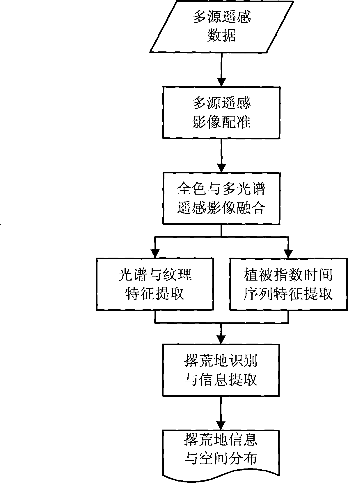
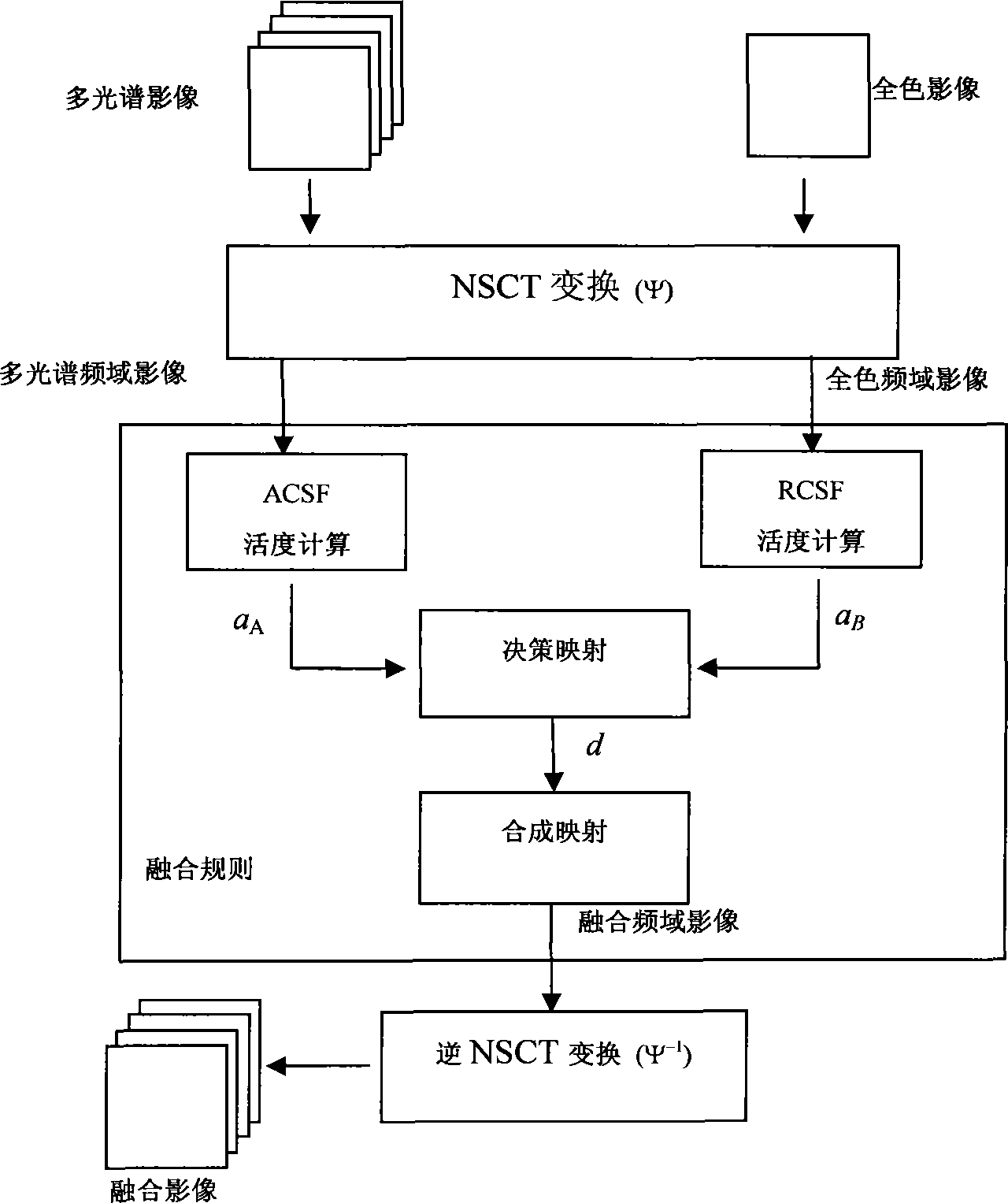
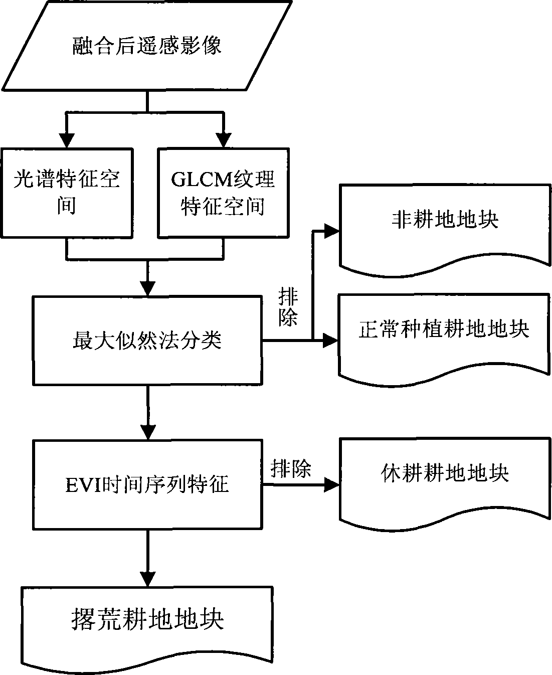
[0023] The flow chart of the invention using multi-source remote sensing data to identify abandoned land and extract information is as follows figure 1 shown. The process of using the method described in the present invention to identify abandoned land and extract information is as follows:

[0024] 1. Multi-source remote sensing image registration

[0025] For the multi-source remote sensing images with high, medium and low spatial resolutions and different temporal phases in the same area, the geographic framework of Universal Transverse Mercator (UTM) and WGS-84 coordinate system is uniformly adopted. A geometrically finely corrected image is used as a reference, and other images are registered with it. Select at least 7 pairs of feature control points with the same name between the images, and realize the geographic coordinate matching of different images through quadratic polynomial correction. The quadratic polynomial correction formula is as follows:

[0026] X=Ax+B...


PUM


Abstract

The invention relates to an abandoned land remote sensing recognition method based on texture and vegetation indexes. The characteristics of multiple sensors, multiple resolutions, multiple spectra and multidate remote sensing data are utilized, the spectra and the textural features of remote sensing images, and the vegetation index features are combined, and the abandoned land remote sensing recognition method based on the texture and the vegetation indexes is established by structuring a remote sensing image registration and fusion framework, a spectrum and texture feature space and a vegetation index time sequence. Compared with an existing abandoned land remote sensing recognition method, the abandoned land remote sensing recognition method based on the texture and the vegetation indexes solves the precision problem brought by broken cultivated land, reduces artificial involvement subjectivity and improves abandoned land recognition efficiency. The abandoned land remote sensing recognition method based on the texture and the vegetation indexes is characterized in that a remote image registration and fusion unit, a typical spectrum and texture feature unit, a vegetation index time sequence feature unit and an abandoned land recognition and information extraction unit are included. Through the abandoned land remote sensing recognition method with the four units, the distribution information and data of abandoned land in a large range area can be recognized fast and precisely, and auxiliary decision-making data support can be provided for land utilization, grain guarantee and the like.

Description

technical field [0001] The invention belongs to the application field of remote sensing technology, in particular to a method for identifying abandoned land and extracting information by using multi-sensor, multi-resolution, multi-spectrum and multi-temporal remote sensing data in a large-scale cultivated land area. Background technique [0002] The phenomenon of cultivated land abandonment is becoming more and more serious in our country. With the significant changes in my country's political and economic structure, abandoned land has gradually developed into a common phenomenon in the past few decades. Chinese people have more land but less land, and the per capita level of arable land is low. The retention of arable land is closely related to food security. Abandoned cultivated land will seriously affect food production and has become another important factor threatening food security. Carrying out investigation and research on abandoned land is of great significance to...

Claims


Application Information

Patent Timeline
Patent Type & Authority Applications(China)
IPC IPC(8): G06K9/00
Inventor 周艺王世新王福涛李文俊王丽涛
Owner INST OF REMOTE SENSING & DIGITAL EARTH CHINESE ACADEMY OF SCI
Why Eureka
Try Eureka