A spatial information cloud computing system and its implementation method
A technology of spatial information and implementation methods, applied in computing, instruments, electrical digital data processing, etc., can solve problems such as high operation and maintenance costs, poor scalability, and high prices, and achieve the effect of rapid deployment services
- Summary
- Abstract
- Description
- Claims
- Application Information
AI Technical Summary
Problems solved by technology
Method used
Image
Examples
Embodiment Construction
[0034] The present invention will be further described below in conjunction with the accompanying drawings and specific embodiments.
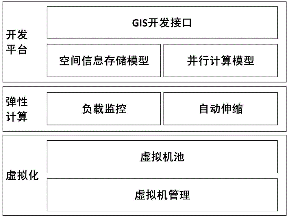
[0035] The basic idea of the present invention is to use technologies such as virtualization and load monitoring to realize automatic elastic expansion of the system, and provide this capability to the development platform, so that all applications developed by using this platform have automatic elastic expansion.
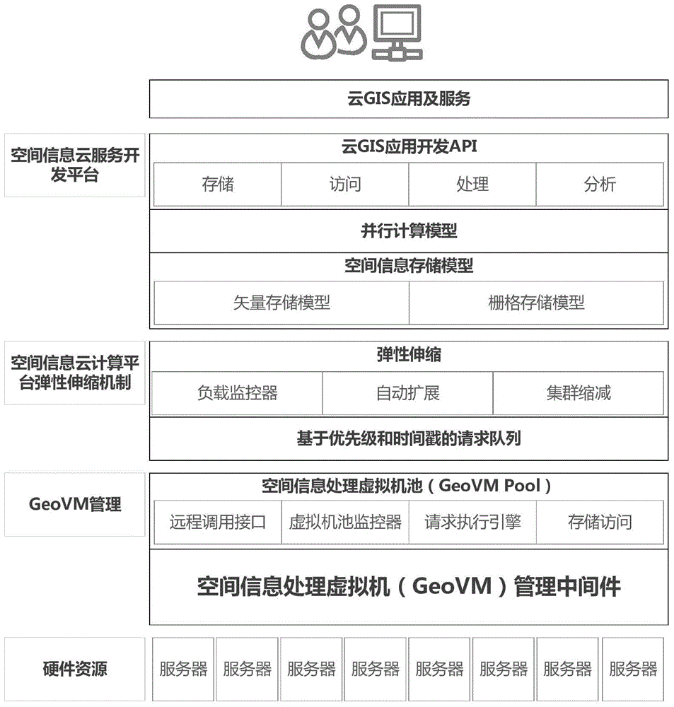
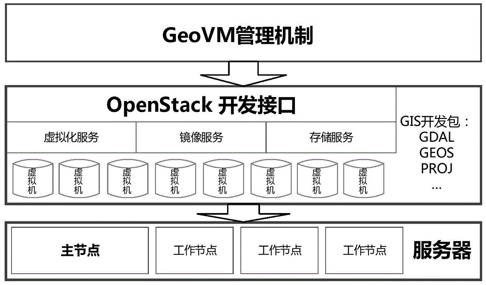
[0036] The structural block diagram of the spatial information cloud computing system of the present invention is as follows: figure 1 As shown, in this embodiment, the implementation method of the spatial information cloud computing system mainly includes creating a spatial information processing virtual machine (GeoVM), an elastic scaling mechanism of the spatial information cloud platform, and a spatial information cloud service development platform, specifically including the following steps:
[0037] S1, by creating a spatial...
PUM
 Abstract
Description
Claims
Application Information
 - R&D
- Intellectual Property
- Life Sciences
- Materials
- Tech Scout
- Unparalleled Data Quality
- Higher Quality Content
- 60% Fewer Hallucinations
Browse by: Latest US Patents, China's latest patents, Technical Efficacy Thesaurus, Application Domain, Technology Topic, Popular Technical Reports.
© 2025 PatSnap. All rights reserved.Legal|Privacy policy|Modern Slavery Act Transparency Statement|Sitemap|About US| Contact US: help@patsnap.com


