Space sampling scheme optimizing method for crop planting area monitoring
A technology of spatial sampling and optimization method, applied in the field of remote sensing spatial sampling, which can solve the problems of less research on the quantitative evaluation of spatial correlation and heterogeneity of sampling samples.
- Summary
- Abstract
- Description
- Claims
- Application Information
AI Technical Summary
Problems solved by technology
Method used
Image
Examples
Embodiment Construction
[0047] The present invention will be further described in conjunction with accompanying drawing:
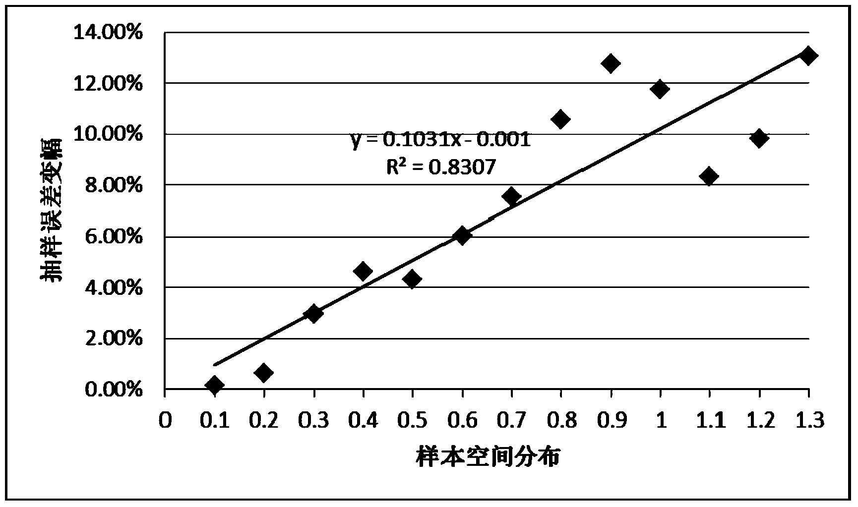
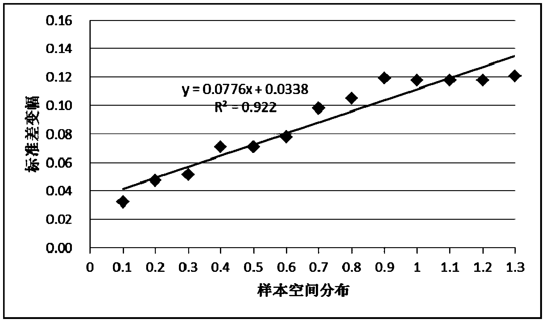
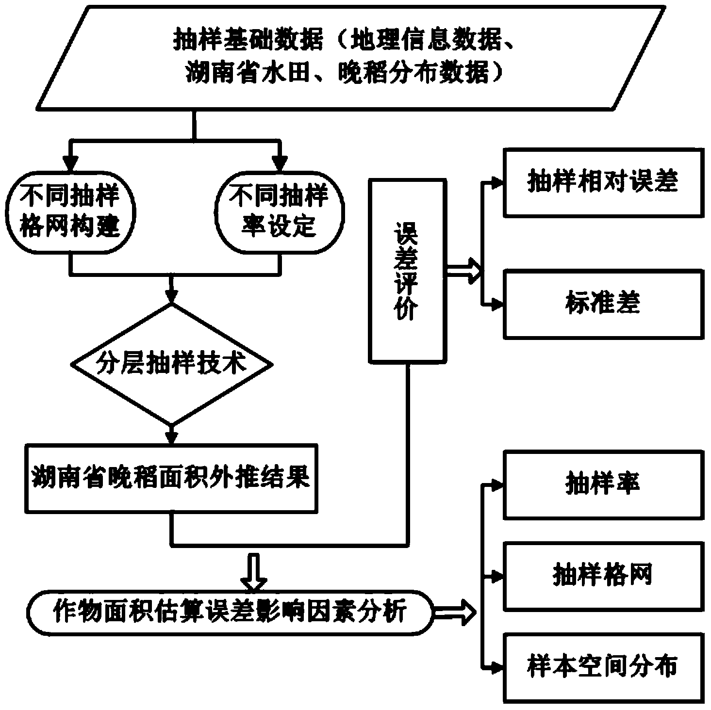
[0048] In this embodiment, the crop planting area monitoring spatial sampling plan optimization method, in order to comprehensively examine the influence of sampling grid size, sampling rate and sample space distribution on the crop planting area survey, this embodiment constitutes a sampling survey by constructing different grid series Design a stratified sampling plan, and use different sampling rates for repeated sampling, refer to the distribution map of late rice planting in 2012, calculate the late rice area and spatial distribution index in the quadrat, statistically infer the late rice planting area in the province, and calculate Inference error per sample. On this basis, the size and mode of influence of sampling grid size, sample size and sample space distribution on sampling inference error are analyzed. Specifically include the following steps (see the specific proce...
PUM
 Abstract
Description
Claims
Application Information
 - R&D
- Intellectual Property
- Life Sciences
- Materials
- Tech Scout
- Unparalleled Data Quality
- Higher Quality Content
- 60% Fewer Hallucinations
Browse by: Latest US Patents, China's latest patents, Technical Efficacy Thesaurus, Application Domain, Technology Topic, Popular Technical Reports.
© 2025 PatSnap. All rights reserved.Legal|Privacy policy|Modern Slavery Act Transparency Statement|Sitemap|About US| Contact US: help@patsnap.com


