

Information point clustering method based on geographic information system
A technology of geographic information system and clustering method is applied in the field of information point clustering based on geographic information system to achieve the effect of realizing cluster display and avoiding secondary development.
- Summary
- Abstract
- Description
- Claims
- Application Information
AI Technical Summary
Problems solved by technology
Method used
Image

Examples
Embodiment Construction
[0025] In order to better understand the technical content of the present invention, specific embodiments are given together with the attached drawings for description as follows.
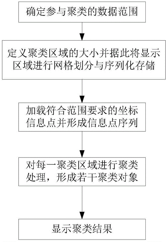
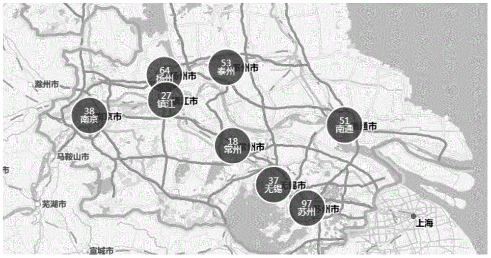
[0026] Such as figure 1 As shown, according to a preferred embodiment of the present invention, a method for clustering information points based on a geographic information system includes the following steps:
[0027] Step 1. Determine the data range participating in the clustering according to the geographic location, scale and display size of the display area;
[0028] Step 2. Define the size of the clustering area and accordingly divide the display area into grids and serialize storage;
[0029] Step 3. According to the data range determined in the aforementioned step 1, load coordinate information points meeting the range requirements and form a sequence of information points;
[0030] Step 4. According to the clustering area of the aforementioned step 2, one information point is sequentia...
PUM
 Abstract
Description
Claims
Application Information