

Method for remote sensing and estimating woodland soil organic carbon
A technology of organic carbon and soil, which is applied in special data processing applications, instruments, electrical digital data processing, etc., and can solve problems such as observation and calculation
- Summary
- Abstract
- Description
- Claims
- Application Information
AI Technical Summary
Problems solved by technology
Method used
Image

Examples
Embodiment Construction
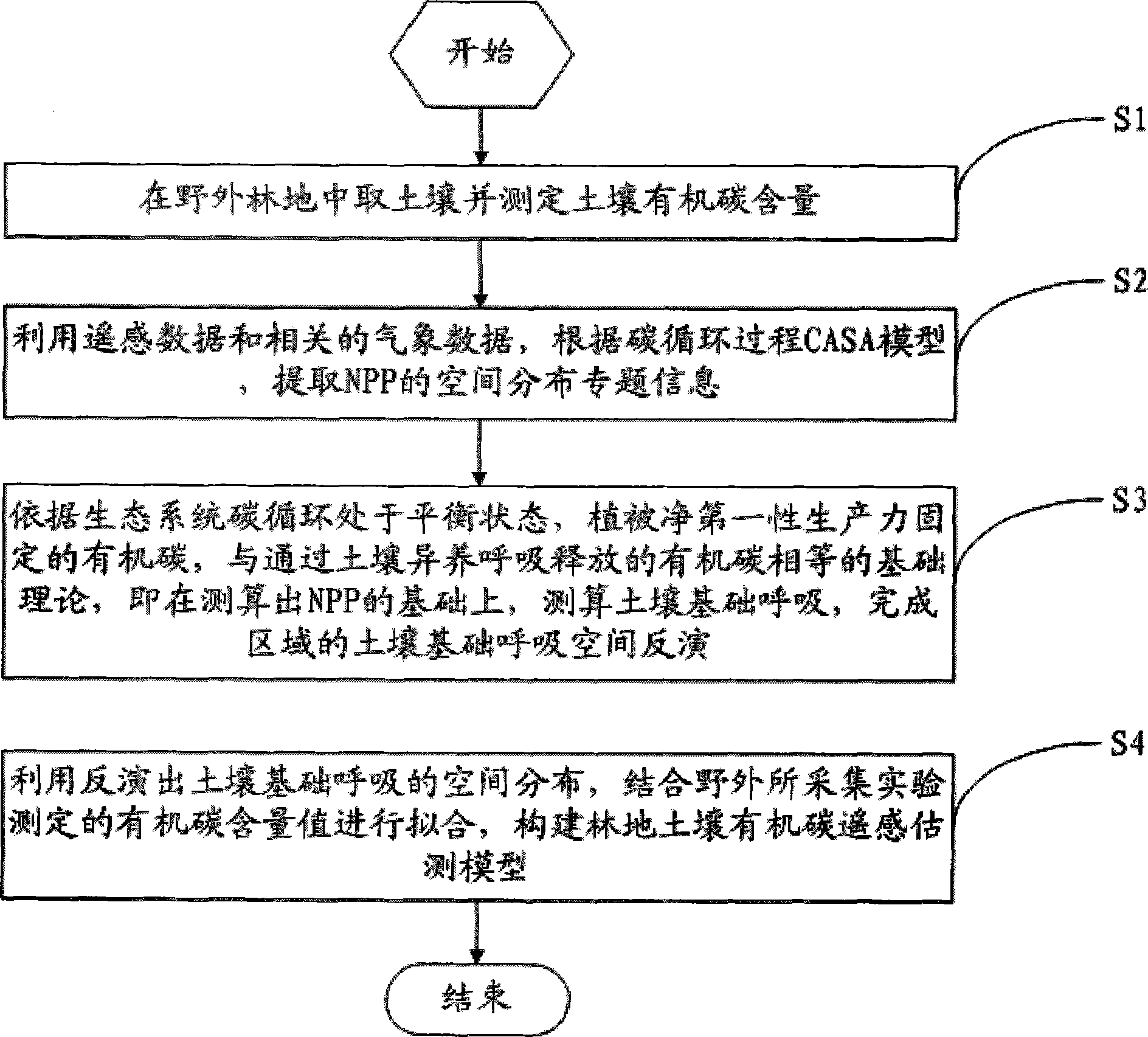
[0058] In order to make the objectives, technical solutions and advantages of the present invention clearer, the present invention will be further described in detail below with reference to the accompanying drawings and embodiments. It should be understood that the specific embodiments described herein are only used to explain the present invention, but not to limit the present invention.
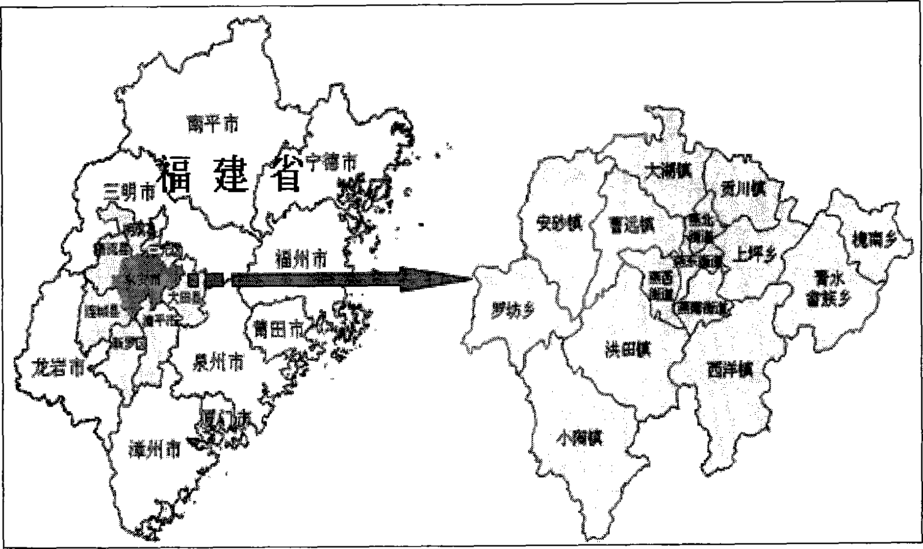
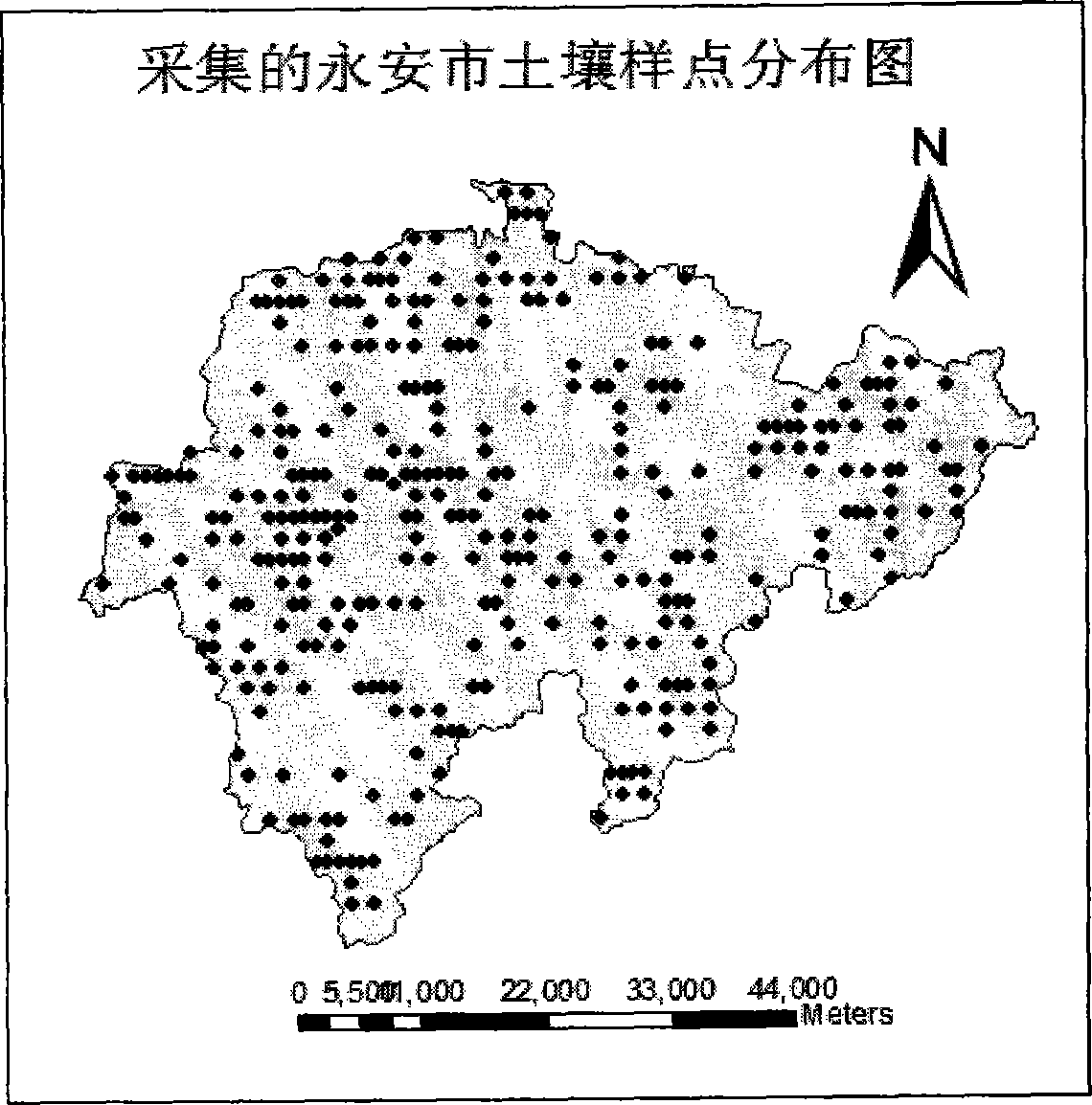
[0059] In the embodiment of the present invention, a specific research area is selected for description. Overview of the study area: Yong'an City is located in Sanming City, in the west-central part of Fujian Province ( figure 1 ), east longitude 116°56′~117°47′, north latitude 25°33′~26°12′, east-west width is about 82km, north-south length is about 71km, total land area is 294110hm 2 . Yong'an is known as "nine mountains, half water and half fields". There are mountains in the territory. The mountainous area accounts for 59% of the city's area, reaching 174,900hm2, and the hilly area i...
PUM
 Abstract
Description
Claims
Application Information