Geologic horizon automatic tracking method and device

A geological horizon, automatic tracking technology, applied in seismic signal processing and other directions, can solve problems such as low accuracy of geological horizons

Active Publication Date: 2014-12-03
BGP OF CHINA NAT GASOLINEEUM CORP
View PDF7 Cites 24 Cited by
  • Summary
  • Abstract
  • Description
  • Claims
  • Application Information

AI Technical Summary

Problems solved by technology

[0005] The example of the present invention provides a method and device for automatic tracking of geological horizons, which solves the technical problem of low precision of geological horizon tracking in the prior art

Method used


Image

  • Geologic horizon automatic tracking method and device
  • Geologic horizon automatic tracking method and device
  • Geologic horizon automatic tracking method and device

Examples


Embodiment Construction

[0025]In order to make the object, technical solution and advantages of the present invention clearer, the present invention will be described in further detail below in conjunction with the embodiments and accompanying drawings. Here, the exemplary embodiments and descriptions of the present invention are used to explain the present invention, but not to limit the present invention.

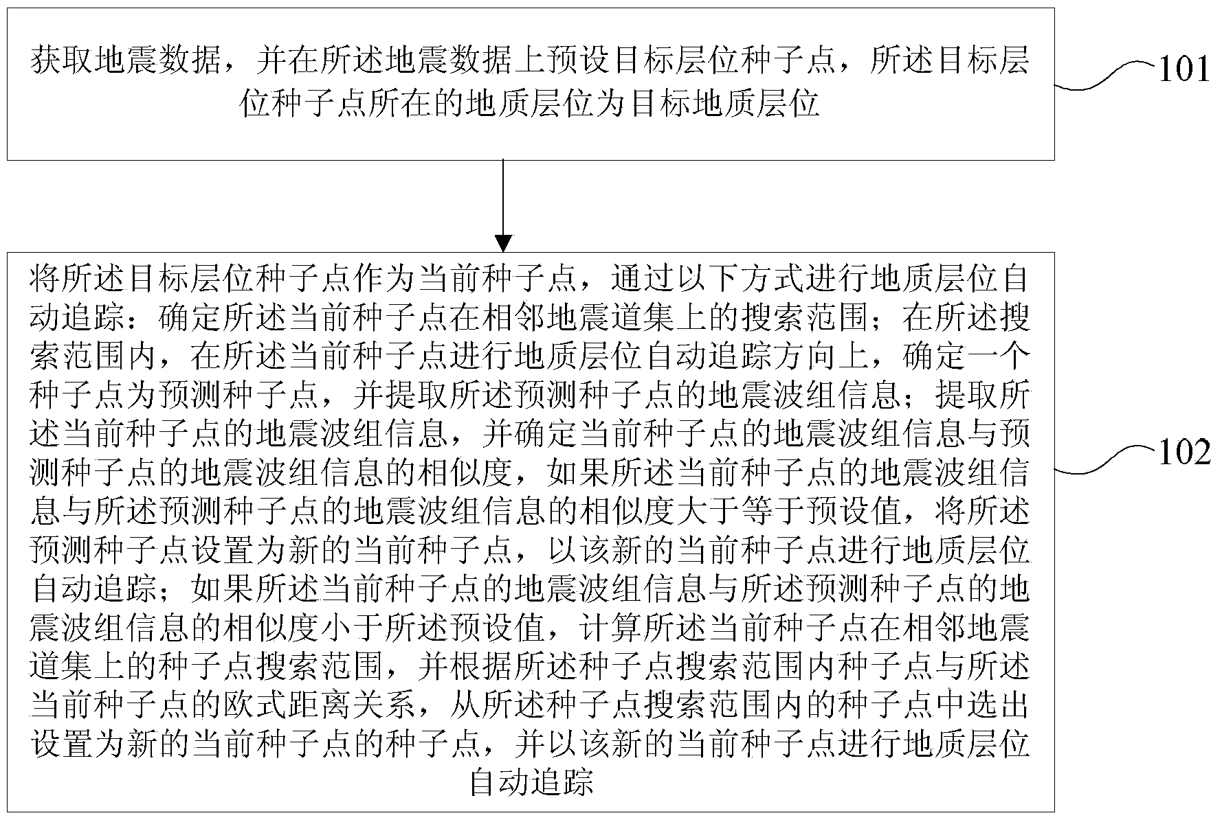
[0026] In the example of the present invention, a kind of geological horizon automatic tracking method is provided, such as figure 1 As shown, the method includes:

[0027] Step 101: Acquire seismic data, and preset a target horizon seed point on the seismic data, the geological horizon where the target horizon seed point is located is the target geological horizon;

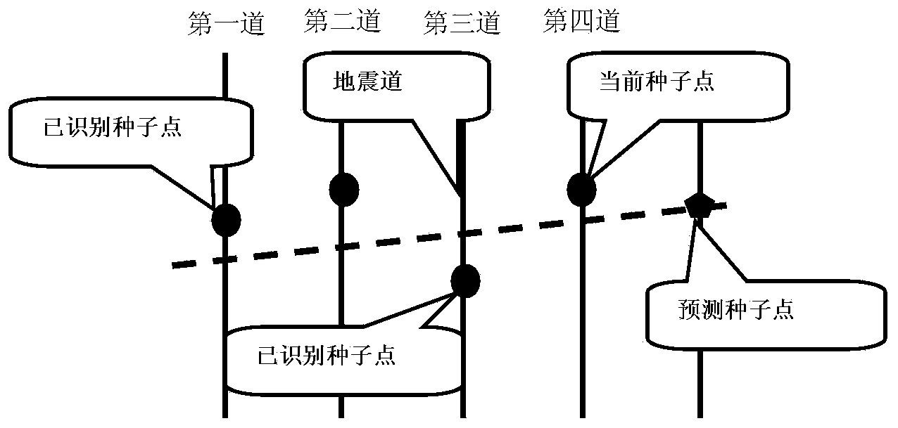
[0028] Step 102: Using the target horizon seed point as the current seed point, the geological horizon is automatically tracked in the following manner:

[0029] determining the search range of the current seed point on adjacent ...


PUM


Abstract

An embodiment of the invention provides a geologic horizon automatic tracking method and device. The method comprises the steps that a target horizon seed point is preset on seismic data; the target horizon seed point is taken as a current seed point, and geologic horizon automatic tracking is performed in the following manner: a seed point is determined to be a prediction seed point in the geologic horizon automatic tracking direction in a search range on a seismic trace set adjacent to the current seed point, and seismic wave group information of the prediction seed point is extracted; seismic wave group information of the current seed point is extracted, and the similarity of the seismic wave group information of the prediction seed point and the seismic wave group information of the current seed point is determined, if the similarity is larger than or equal to a preset value, the prediction seed point is set to be a new current seed point, and otherwise, a seed point selected from seed points in a seed point search range is set to be a new current seed point for continuous search. According to the scheme, the anti-noise capacity of geologic horizon automatic tracking and the horizon tracking accuracy are improved.

Description

technical field [0001] The invention relates to the technical field of geophysical exploration seismic data interpretation, in particular to a method and device for automatic tracking of geological horizons. Background technique [0002] Seismic data interpretation is an important stage in seismic exploration engineering. In the interpretation of seismic data, the identification and tracking of geological horizons are very important tasks. At the same time, since the actual geological horizons often have a corresponding relationship with the events on the seismic section, the continuous analysis of the events on the actual seismic records Sexual tracking is a prerequisite for obtaining valid stratigraphic positions. The process of identifying and tracking waves reflected from the same interface in a seismic record is called event tracking. However, in seismic data processing, the tracking of events is a laborious and time-consuming work. The reason is that these tasks need...

Claims


Application Information

Patent Timeline
Patent Type & Authority Applications(China)
IPC IPC(8): G01V1/30G01V1/28
Inventor 张玮詹仕凡李磊万忠宏陶春峰冉贤华
Owner BGP OF CHINA NAT GASOLINEEUM CORP
Why Eureka
Try Eureka