

GNSS/IMU integrated unmanned aerial vehicle surveying and mapping method and system
A technology of UAV and GPS data, which is applied in the direction of radio wave measurement system, satellite radio beacon positioning system, measurement device, etc., which can solve the problems of application area limitation, difficulty of mapping accuracy to meet the needs of surveying and mapping engineering, poor stability, etc.
- Summary
- Abstract
- Description
- Claims
- Application Information
AI Technical Summary
Problems solved by technology
Method used
Image

Examples
Embodiment Construction
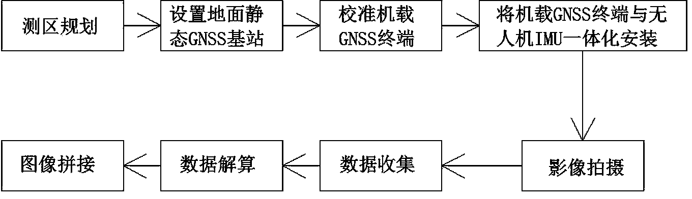
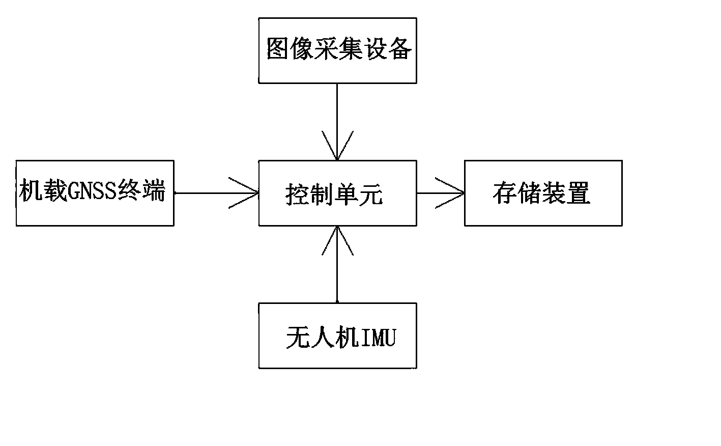
[0024] GNSS positioning technology and inertial navigation technology (IMU) are the core technologies for UAV systems to reduce or even eliminate ground control points. In the field of aerial survey of large aircraft, POS positioning and orientation technology based on the integration of IMU / DGNSS (differential positioning system) has been fully valued and developed under this background. In this way, it can perform direct geographic positioning and realize direct directional placement and mapping without ground control points. In the field of unmanned aerial vehicles, there are systematic errors in the position and attitude parameters obtained by the POS system, and these positioning and orientation parameters are not the outer orientation elements of aerial photos, which need to be converted according to the spatial position relationship between the aerial photography system and the POS system. Calibrate and compensate various errors of the integrated system.
[0025] The i...
PUM
 Abstract
Description
Claims
Application Information