

An intelligent surveying and mapping platform and its implementation method
An implementation method and platform technology, applied in the field of intelligent surveying and mapping platform, can solve the problems of large impact on site, single data collection method, low integration of archaeological technology, etc.
- Summary
- Abstract
- Description
- Claims
- Application Information
AI Technical Summary
Problems solved by technology
Method used
Image

Examples
Embodiment Construction
[0052] The present invention provides an intelligent surveying and mapping platform and an implementation method thereof. In order to make the objectives, technical solutions and effects of the present invention clearer and clearer, the present invention will be further described in detail below with reference to the drawings and embodiments. It should be understood that the specific embodiments described herein are only used to explain the present invention, but not to limit the present invention.
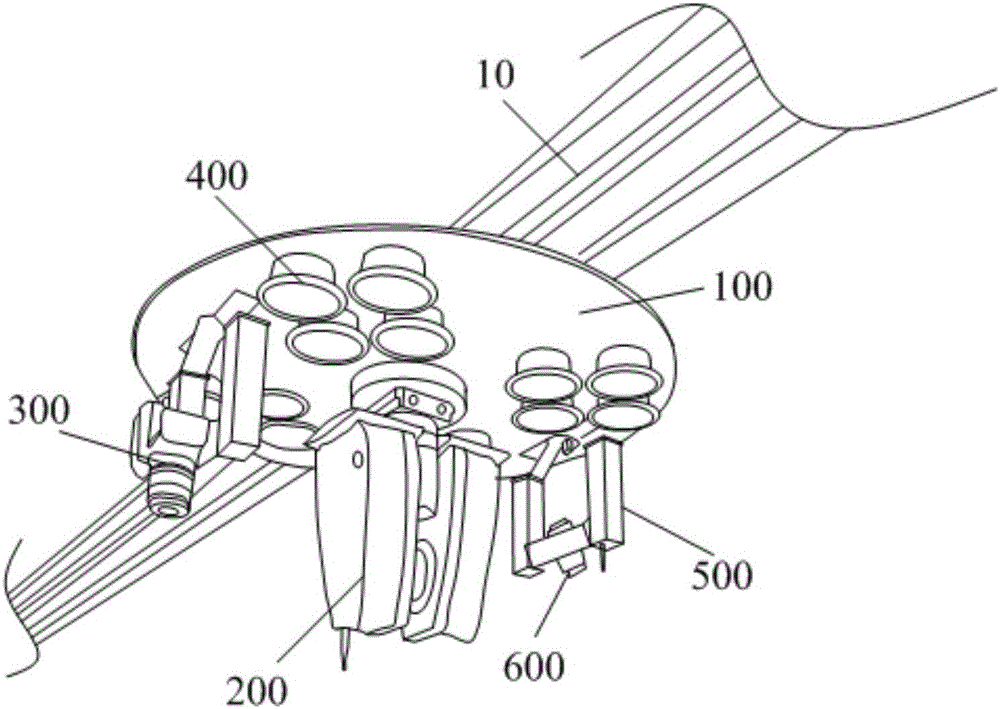
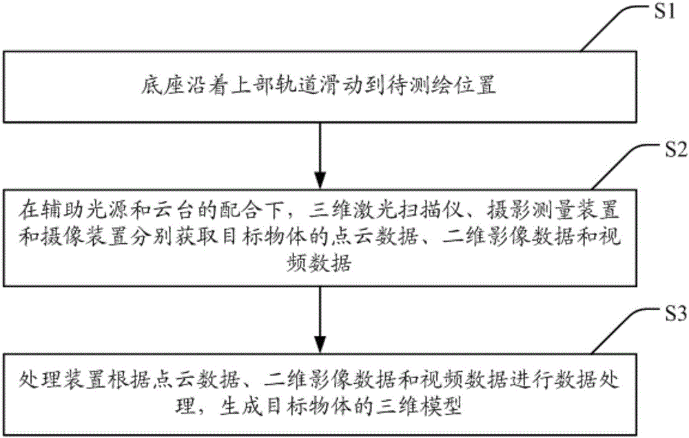
[0053] See figure 1 , Which is a schematic diagram of a preferred embodiment of the intelligent surveying and mapping platform of the present invention. As shown in the figure, the intelligent surveying and mapping platform includes: a base 100 slidably connected to the upper track 10 of the archaeological excavation site, and the base 100 is further provided with a three-dimensional laser scanner 200, a photogrammetric device 300, an auxiliary light source 400, and a cloud Stage 500...
PUM
 Abstract
Description
Claims
Application Information