Physical geography data processing method based on layered geography models

A technology of geophysical data and geophysical parameters, applied in the field of geophysical exploration, can solve problems affecting the calculation efficiency and complexity of geophysical forward modeling and inversion, and achieve self-adaption, avoid segmentation, and improve calculation efficiency Effect

Active Publication Date: 2015-04-22
INST OF GEOLOGY & GEOPHYSICS CHINESE ACAD OF SCI
View PDF4 Cites 6 Cited by
  • Summary
  • Abstract
  • Description
  • Claims
  • Application Information

AI Technical Summary

Problems solved by technology

However, in the actual calculation, due to the different complexity of different layers of media, the subdivision methods of the bottom layer and top layer of the interlayer medium are not the same in the model grid division, which usually results in complex geophysical calculations, affecting geophysical forward modeling and Inversion Calculation Efficiency

Method used


Image

  • Physical geography data processing method based on layered geography models
  • Physical geography data processing method based on layered geography models
  • Physical geography data processing method based on layered geography models

Examples


Embodiment 1

[0043] Embodiment 1: Taking two-layer underground medium modeling to calculate gravity anomaly as an example, implement underground medium density modeling. According to the present invention, the specific steps of modeling are as follows:

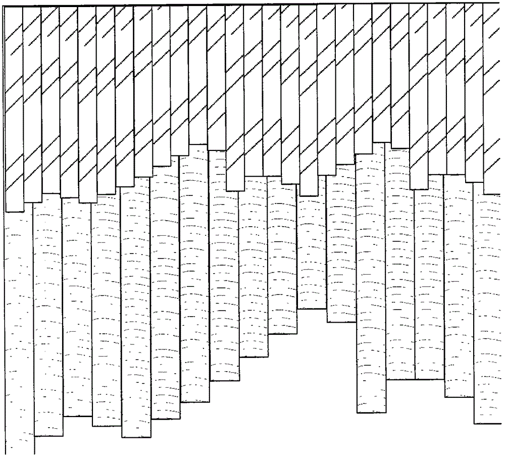
[0044] (1) Input the original data. In this example, there are two strata, the upper crust and the lower crust. The input data are the depth of the upper crustal bottom interface and the lower crustal bottom interface depth;

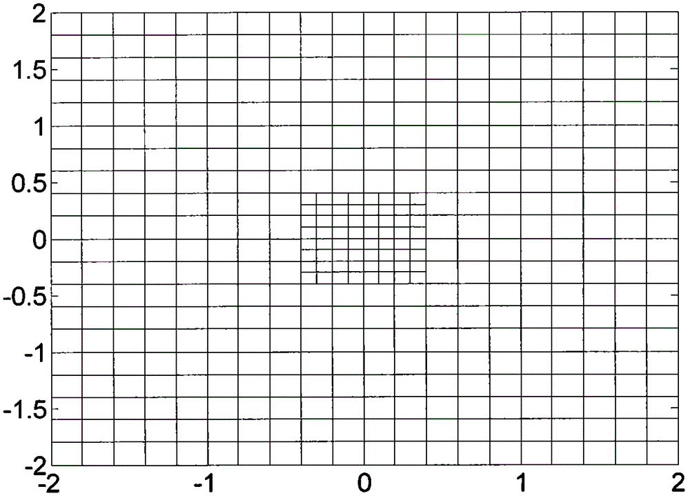
[0045] (2) Establish the stratigraphic model corresponding to the lower crust. According to the stratigraphic distribution data of the lower crust, the distribution range of the layer is divided into rectangular grids along the xy plane, and the depth of the layer represented by each grid is determined by the interpolation of the input values ​​(see appendix figure 1 );

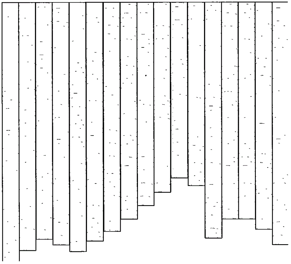
[0046] (3) Use the rectangular subdivision grid shown in step (2) as the cross section to establish an upright hexahedron to subdivide the range...


PUM

PropertyMeasurementUnit
densityaaaaaaaaaa

Abstract

The invention discloses a method used for establishing underground medium models through physical geography calculation. On the basis of the hypothesis of underground medium layered models, with bottom boundaries of all stratums being bottoms and the surface layer being the top, a multi-layer combined model with coincidence regions is established, each layer of the model can be dissected freely through a vertical polygonal prism to establish a space model, and through performing attribute simulation on physical properties of the multi-layer model, real layered stratum properties are established. Through the method, underground layered media can be sufficiently and fine described, and the calculation efficiency of the physical geography effect is improved. The method can be used for the application field of forward-inversion calculation of physical geography gravity and magnetic prospecting and others.

Description

technical field [0001] The invention relates to geophysical detection technology, in particular to a geophysical data processing method based on layered geological models, which can finely describe complex layered models and improve geophysical calculation efficiency. Background technique [0002] Geophysical modeling is the basis for geophysical forward modeling. The modeling approach determines how the subsurface is described and has a direct impact on geophysical calculations. Subsurface media usually have layered characteristics, so modeling based on layered media is a more general method in geophysical research. When there are multiple layers of media, the properties of the subsurface medium between layers are usually described through the model division of the interlayer media. However, in the actual calculation, due to the different complexity of different layers of media, the subdivision methods of the bottom layer and top layer of the interlayer medium are not the...

Claims


Application Information

Patent Timeline
Patent Type & Authority Applications(China)
IPC IPC(8): G01N1/28
Inventor 徐亚郝天珧黄松姬莉莉胡卫建邢健
Owner INST OF GEOLOGY & GEOPHYSICS CHINESE ACAD OF SCI
Why Eureka
Try Eureka