Remote and real-time ground surface settlement monitoring system based on connected vessel principle

A monitoring system and connector technology, applied in the direction of hydrostatic pressure, etc., can solve the problems of inability to realize large-area monitoring, inability to realize real-time automatic monitoring, high price, etc., and achieve the effect of improving data accuracy and processing efficiency

Inactive Publication Date: 2015-05-13
BEIHANG UNIV
View PDF5 Cites 12 Cited by
  • Summary
  • Abstract
  • Description
  • Claims
  • Application Information

AI Technical Summary

Problems solved by technology

GPS displacement monitoring can realize automatic remote real-time monitoring, but it is expensive, and can only monitor local important points, and cannot realize large-scale monitoring
Although the InSAR monitoring method can realize large-scale remote monitoring, it is currently unable to realize real-time automatic monitoring.

Method used


Image

  • Remote and real-time ground surface settlement monitoring system based on connected vessel principle
  • Remote and real-time ground surface settlement monitoring system based on connected vessel principle
  • Remote and real-time ground surface settlement monitoring system based on connected vessel principle

Examples


Embodiment Construction

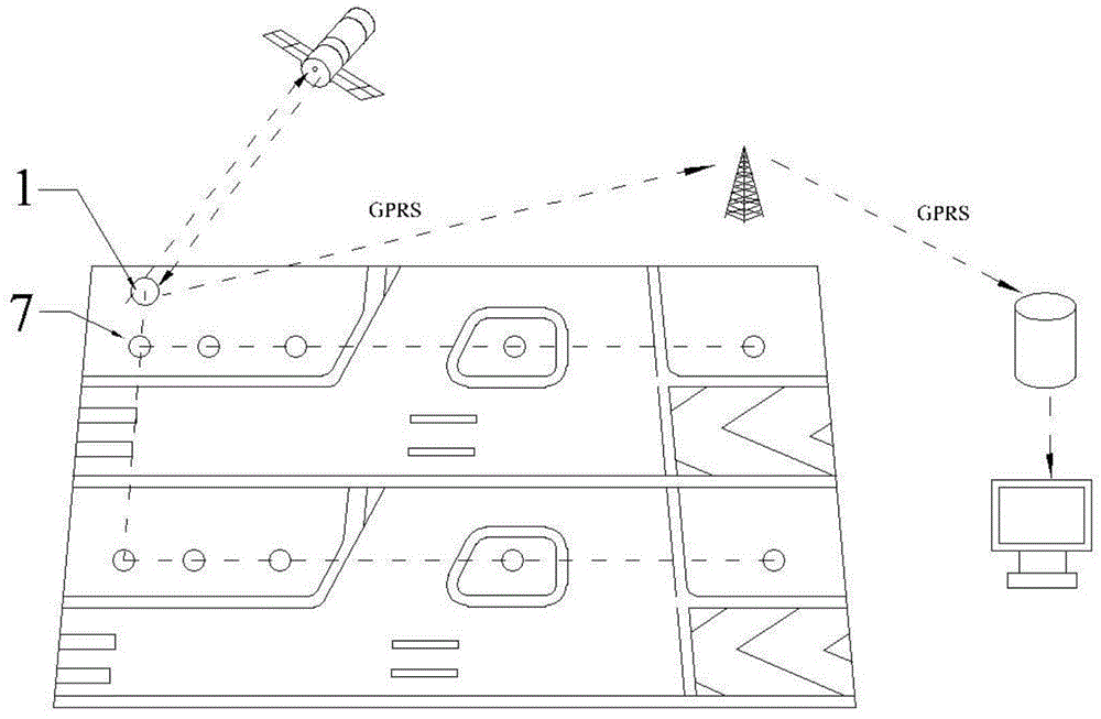
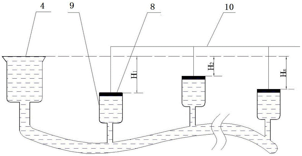
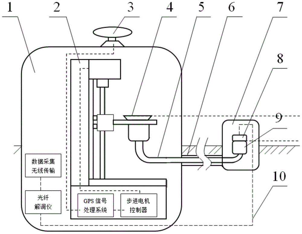
[0037] See Figure 1-4 , the present invention is a remote real-time surface subsidence monitoring system based on the principle of a connector, which is composed of three parts: a ground monitoring network, a remote real-time data transmission system and a remote monitoring system. The relationship between the three is: the subsidence information of the ground monitoring network is transmitted to the optical fiber demodulator, which demodulates the subsidence information, and after the demodulation is completed, the demodulated information is transmitted to the data acquisition system of the remote real-time data transmission system The wireless transmitter uses GPRS for wireless transmission, and finally the data receiver of the remote monitoring system receives the information and transmits it to the computer for data processing and real-time display.

[0038] Monitoring network of the present invention such as figure 1 As shown, 1 is a reference station, and 7 is a monito...


PUM


Abstract

A remote and real-time ground surface settlement monitoring system based on the connected vessel principle consists of three parts, namely, a ground monitoring network, a remote and real-time data transmission system and a remote monitoring system, wherein settlement information of the ground monitoring network is transmitted to an optical fiber demodulator, the optical fiber demodulator demodulates the settlement information and transmits the demodulated information to a data acquisition wireless transmitter of the remote and real-time data transmission system after demodulation, GPRS is used for wireless transmission, and finally, a data receiver of the remote monitoring system receives the information and transmits the information to a computer for data processing and real-time display. The system can realize automatic, real-time and remote monitoring of large-area surface settlement and can be popularized and applied to areas such as airports, large building groups, high-speed railways, tunnels and the like which require large-area surface settlement monitoring.

Description

technical field [0001] The invention relates to a remote real-time land subsidence monitoring system based on the principle of a connector, in particular to a system capable of remote real-time automatic monitoring of large-area land subsidence, and belongs to the technical field of land subsidence monitoring. Background technique [0002] In the existing surface settlement monitoring methods, the conventional monitoring methods include the sedimentation plate method, the sedimentation water cup method, the iron ring layered sedimentation instrument method, the profile sedimentation instrument method, etc. The sedimentation plate method is widely used in construction, and the cost is low, but it requires labor. Monitoring affects the construction; the sedimentation cup method is low in cost and does not affect the construction, but the operation is complicated; the iron ring layered sedimentation instrument method is low in cost and can measure the settlement of different lay...

Claims


Application Information

Patent Timeline
Patent Type & Authority Applications(China)
IPC IPC(8): G01C5/04
CPCG01C5/04
Inventor 姚仰平祁生钧陈军方雨菲
Owner BEIHANG UNIV
Why Eureka
Try Eureka