

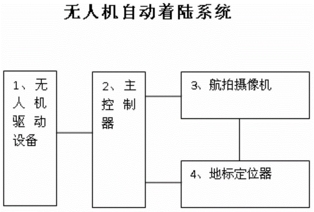
Unmanned plane automatic landing system
An automatic landing and unmanned aerial vehicle technology, applied in the field of unmanned aerial vehicle navigation, can solve the problems of unable to realize automatic landing of unmanned aerial vehicle, unable to realize intelligent landing, expensive equipment and so on.
- Summary
- Abstract
- Description
- Claims
- Application Information
AI Technical Summary
Problems solved by technology
Method used
Image

Examples
Embodiment Construction
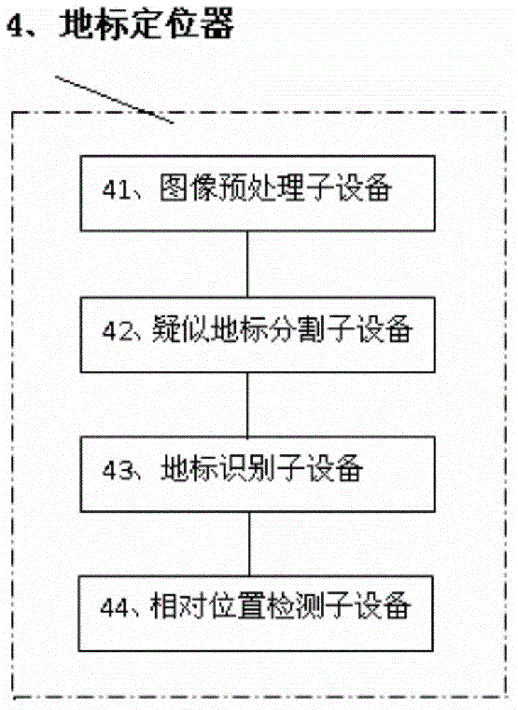
[0017] The implementation of the UAV automatic landing system of the present invention will be described in detail below with reference to the accompanying drawings.
[0018] Unmanned aerial vehicle, or unmanned aircraft, whose English abbreviation is "UAV", is an unmanned aircraft controlled by radio remote control equipment and its own program control device. From a technical point of view, it can be divided into several categories: unmanned helicopters, unmanned fixed-wing aircraft, unmanned multi-rotor aircraft, unmanned airships, and unmanned parawing aircraft. In terms of usage, it can be divided into military drones and civilian drones. For military use, it can be used to complete battlefield reconnaissance and surveillance, positioning and calibration, damage assessment, electronic warfare, and for civilian use, it can be used for border patrol, nuclear radiation detection, aerial photography, aerial prospecting, disaster monitoring, traffic patrol and security monitor...
PUM
 Abstract
Description
Claims
Application Information