Aircraft tracing method and aircraft tracing system

A technology for tracking systems and aircraft, applied in closed-circuit television systems, instruments, and special data processing applications, etc., can solve the problems of high difficulty, large search range, and the inability of drones to reflect the location scene and flight trajectory, etc., to reduce data The effect of increasing the volume and improving the transmission speed

Inactive Publication Date: 2015-06-03
SHENZHEN AUTEL INTELLIGENT AVIATION TECH CO LTD
View PDF7 Cites 42 Cited by
  • Summary
  • Abstract
  • Description
  • Claims
  • Application Information

AI Technical Summary

Problems solved by technology

[0004] For this reason, the technical problem to be solved by the present invention is that the method of retrieving the drone in the prior art cannot reflect the actual location scene and flight trajectory, the search range is large, and the difficulty is high

Method used


Image

  • Aircraft tracing method and aircraft tracing system
  • Aircraft tracing method and aircraft tracing system
  • Aircraft tracing method and aircraft tracing system

Examples


Embodiment 1

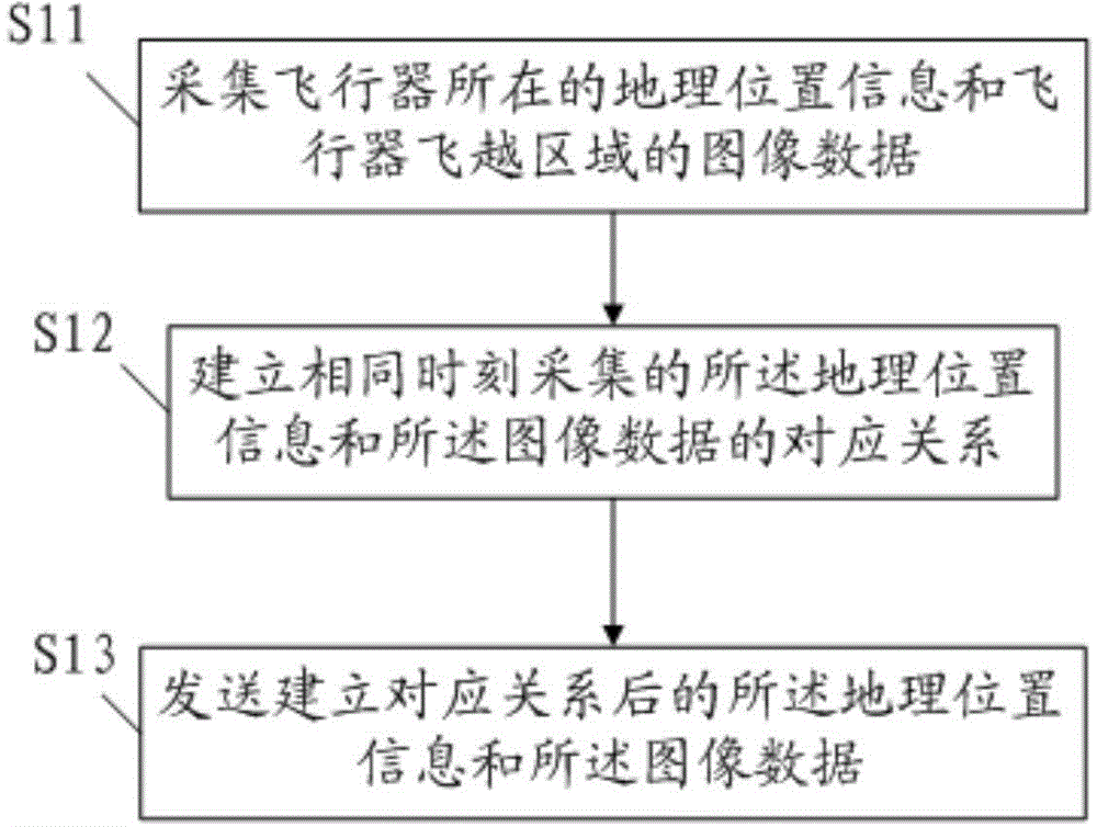
[0077] The aircraft tracking method in this embodiment, such as figure 1 As shown, it is used on the aircraft side, including the following steps:

[0078] S11. Collect geographic location information of the aircraft and image data of the flight position of the aircraft.

[0079] Preferably, the geographic location information of the aircraft can be obtained through a GPS module, and the latitude and longitude coordinate information of the aircraft location is obtained through the GPS module, and the latitude and longitude coordinate information is used as the geographic location information of the aircraft, through which the latitude and longitude coordinate information can be used to locate the space where the aircraft is located Location. Usually, one or more cameras can be installed at different positions of the aircraft to obtain the image data of the flight position of the aircraft. Or set one or more cameras around the outside to acquire image data inside the aircraft...

Embodiment 2

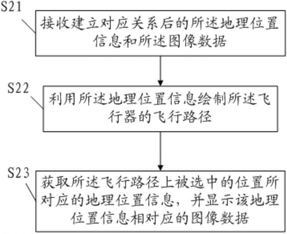
[0088] This embodiment provides an aircraft tracking method, which is used in a user terminal to facilitate the operator to track the aircraft. This method corresponds to the tracking method in Embodiment 1, and is to restore and process the data after obtaining the data sent by the aircraft in Embodiment 1. The user terminal here can be a computer or server with the following functions, the aircraft tracking method in this embodiment, the flow chart is as follows figure 2 shown, including:

[0089] S21. Receive geographic location information where the aircraft is located and image data of an area the aircraft flies over, wherein a corresponding relationship is established between the geographic location information and the image data collected at the same time. Since in Embodiment 1, the geographical location information is marked in the corresponding image data, and the image data marked with the geographical position information is sent, so what is received in this step ...

Embodiment 3

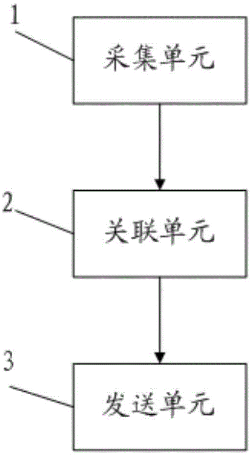
[0100] This embodiment provides an aircraft tracking system, which is set on an unmanned aerial vehicle and uses the aircraft tracking method described in Embodiment 1. The mechanism block diagram of the aircraft tracking system is as follows image 3 shown, including:

[0101] The collection unit 1 is used to collect the geographic location information of the aircraft and the image data of the area the aircraft flies over; specifically, the collection unit 1 obtains the latitude and longitude coordinate information of the location of the aircraft through the GPS module, and collects the inside of the aircraft and its surroundings through the camera. image data for one or more locations of the

[0102] An associating unit 2, configured to establish a corresponding relationship between the geographic location information collected at the same time and the image data;

[0103] The sending unit 3 is configured to send the geographical location information and the image data afte...


PUM


Abstract

The invention provides an aircraft tracing method and an air aircraft tracing system. The method comprises the following steps: acquiring geographical location information of an aircraft and image data of an aircraft flyover area; establishing a corresponding relationship of the geographical location information and the image data which are acquired at the same moment; sending the data with the corresponding relationship; receiving the geographical location information and the image data with the established corresponding relationship at a receiving end; drawing a flight path of the aircraft by utilizing the geographical location information; obtaining the geographical location information corresponding to a position selected in the flight path and displaying the image data corresponding to the geographical location information. According to the aircraft tracing method disclosed by the invention, the geographical location information corresponding to each frame image is added in video information by establishing the corresponding relationship of the geographical location information and the image data, so that the geographical location corresponding to each frame video image can be conveniently obtained subsequently, and basis is provided for tracing a track of the aircraft and monitoring the flight condition of the aircraft.

Description

technical field [0001] The invention relates to video tracking technology, in particular to an aircraft tracking method and system. Background technique [0002] Aircraft such as unmanned aerial vehicles (flight vehicles) are manufactured by humans, can fly off the ground, fly in space, and are controlled by humans to fly in the atmosphere or outside the atmosphere (space). With the advantages of light weight and small size, it is widely used in geographic map surveying and mapping, logistics distribution and other fields. Due to the long flight distance of the drone, if it falls due to improper control, it is very difficult to search for the dropped drone. Although in the auxiliary method, an alarm is installed on the drone, the alarm range of the alarm is limited. [0003] Based on this, in the Chinese patent document CN103344240A, a retrieving device and method for an unmanned aerial vehicle are disclosed. The method includes regularly obtaining and storing the flight p...

Claims


Application Information

Patent Timeline
Patent Type & Authority Applications(China)
IPC IPC(8): G06F17/30H04N7/18
Inventor 李红京颜家松陈志辉陈远亮
Owner SHENZHEN AUTEL INTELLIGENT AVIATION TECH CO LTD
Why Eureka
Try Eureka