Polarization SAR terrain classification method based on deep RPCA

A ground object classification and depth technology, which is applied in the field of image processing, can solve the problems of multiple redundant information, failure to effectively reflect the essential characteristics of polarimetric SAR images, and decline in classification efficiency, so as to improve classification accuracy, improve classification results and classification. Accuracy, the effect of preserving spatial correlation

Active Publication Date: 2015-06-03
XIDIAN UNIV
View PDF5 Cites 13 Cited by
  • Summary
  • Abstract
  • Description
  • Claims
  • Application Information

AI Technical Summary

Problems solved by technology

However, the shortcomings of this method are that the extracted scattering, polarization and texture information are simply stacked, and then directly input into the support vector machine (SVM) for classification, which leads to more redundant features in the input features. The remaining information cannot effectively reflect the essential characteristics of the polarimetric SAR image, which greatly reduces the classification efficiency

Method used


Image

  • Polarization SAR terrain classification method based on deep RPCA
  • Polarization SAR terrain classification method based on deep RPCA
  • Polarization SAR terrain classification method based on deep RPCA

Examples


Embodiment Construction

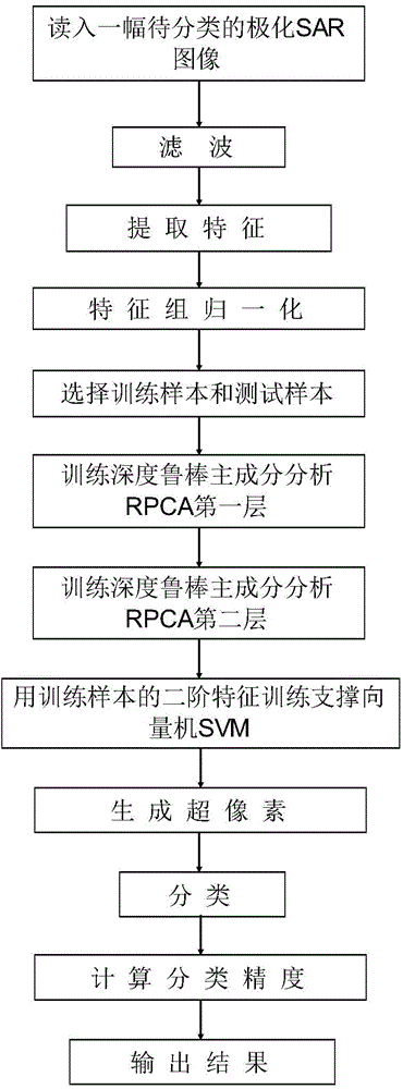
[0070] The present invention will be further described below in conjunction with the accompanying drawings.

[0071] refer to figure 1 , The specific implementation steps of the present invention are as follows.

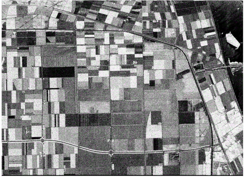
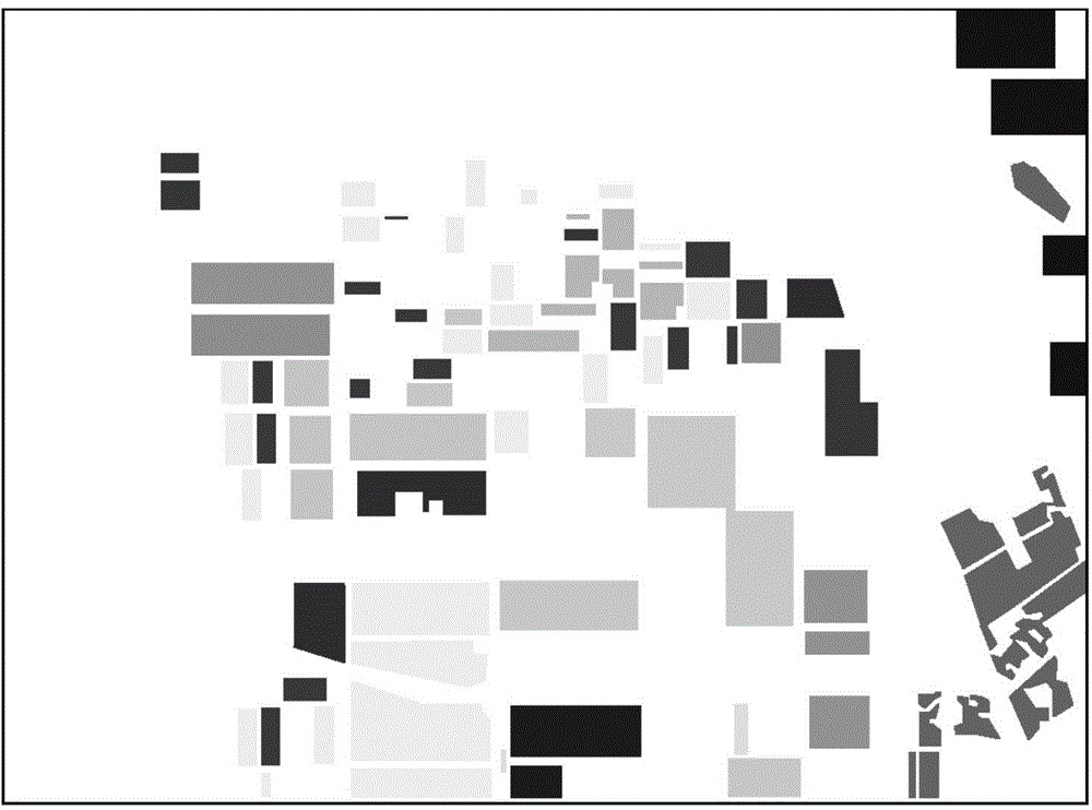
[0072] Step 1. Read in a polarimetric SAR image to be classified.

[0073] Step 2. Filtering.

[0074] The refined polarization LEE filtering method is used to filter all the pixels in the polarization SAR image. The edge window size of the refined polarization LEE filtering method is 3 × 3 pixels, and the filtered polarization SAR image pixels are obtained. coherence matrix.

[0075] Step 3. Extract features.

[0076] Firstly, the power of each pixel, characteristic parameters of data distribution and relative peak values ​​are extracted from the coherence matrix of the filtered polarimetric SAR image.

[0077] Then, use the Pauli Pauli decomposition method to extract 3 scattering characteristic parameters representing Pauli decomposition for each pixel; use Fr...


PUM


Abstract

The invention discloses a polarization SAR terrain classification method based on deep RPCA. The polarization SAR terrain classification method comprises the following steps: (1) reading a polarization SAR image; (2) filtering; (3) extracting characteristics; (4) normalizing characteristic groups; (5) selecting a training sample and a testing sample; (6) training a first layer of deep robust principal component analysis RPCA; (7) training a second layer of deep robust principal component analysis RPCA; (8) training a support vector machine SVM; (9) generating superpixels; (10) classifying; (11) calculating classification precision; (12) outputting a result. Compared with scattering characteristics of the polarization SAR image, the image characteristics extracted according to the method comprise relatively rich terrain information, when the terrain information is classified, the classification precision is effectively improved, and the polarization SAR terrain classification method can be applied to detection and recognition of polarization SAR image targets.

Description

technical field [0001] The invention belongs to the technical field of image processing, and further relates to a deep RPCA-based polarization SAR object classification method in the technical field of image classification. This method can be applied to target detection and target recognition of polarimetric SAR images, and can effectively improve the classification accuracy of polarimetric SAR images. Background technique [0002] Polarimetric SAR images describe the observed land cover and targets by transmitting and receiving polarized radar waves, and it is one of the most advanced sensors in the field of remote sensing in recent years. As an important means of remote sensing image acquisition, polarimetric SAR images are widely used in agriculture, forestry, military affairs, oceanography, hydrology and geology. The purpose of polarimetric SAR image classification is to use the polarimetric measurement data obtained by airborne or spaceborne polarimetric sensors to det...

Claims


Application Information

Patent Timeline
Patent Type & Authority Applications(China)
IPC IPC(8): G06K9/62G06K9/54G06K9/46
Inventor 焦李成马文萍白雪莹杨淑媛侯彪刘芳王爽刘红英熊涛屈嵘
Owner XIDIAN UNIV
Why Eureka
Try Eureka