Inertial navigation-fingerprint location-combined positioning error correction method

A technology of inertial navigation and fingerprint positioning, which is applied in navigation, surveying and mapping and navigation, navigation calculation tools, etc., can solve the problem of error accumulation and increase, and achieve the effect of reducing the range of error estimation and improving positioning accuracy

Active Publication Date: 2015-10-28
沈向东
View PDF7 Cites 25 Cited by
  • Summary
  • Abstract
  • Description
  • Claims
  • Application Information

AI Technical Summary

Benefits of technology

The invention helps locate people accurately by collectively identifying their location from multiple sources such as images or videos captured during an event. By comparing these locations against known ones for better precision, it can help identify any errors that may occur over time.

Problems solved by technology

This patented problem addressed in this patents relates to improving accurate indoor localization systems through satellite navigational technologies called radio frequency identification (RI). However, these methods have their drawbacks: they cannot accurately determine when there'revanes outdoors caused by factors like obstructions within walls, flooring, furniture, and wall corners. These issues limit how effective indoor locating techniques may work because traditional radar tracking requires multiple receivers and reference sensors, making updoor measurements impractical without interfering with surrounding areas.

Method used


Image

  • Inertial navigation-fingerprint location-combined positioning error correction method
  • Inertial navigation-fingerprint location-combined positioning error correction method
  • Inertial navigation-fingerprint location-combined positioning error correction method

Examples


Embodiment Construction

[0046] In order to overcome the defects existing in the prior art, the present invention provides a positioning error correction method combining inertial navigation technology and fingerprint positioning technology. In the indoor positioning based on inertial navigation technology, an autonomous calibration mechanism is introduced to correct the accumulated errors of inertial navigation. The error is corrected to ensure the positioning accuracy.

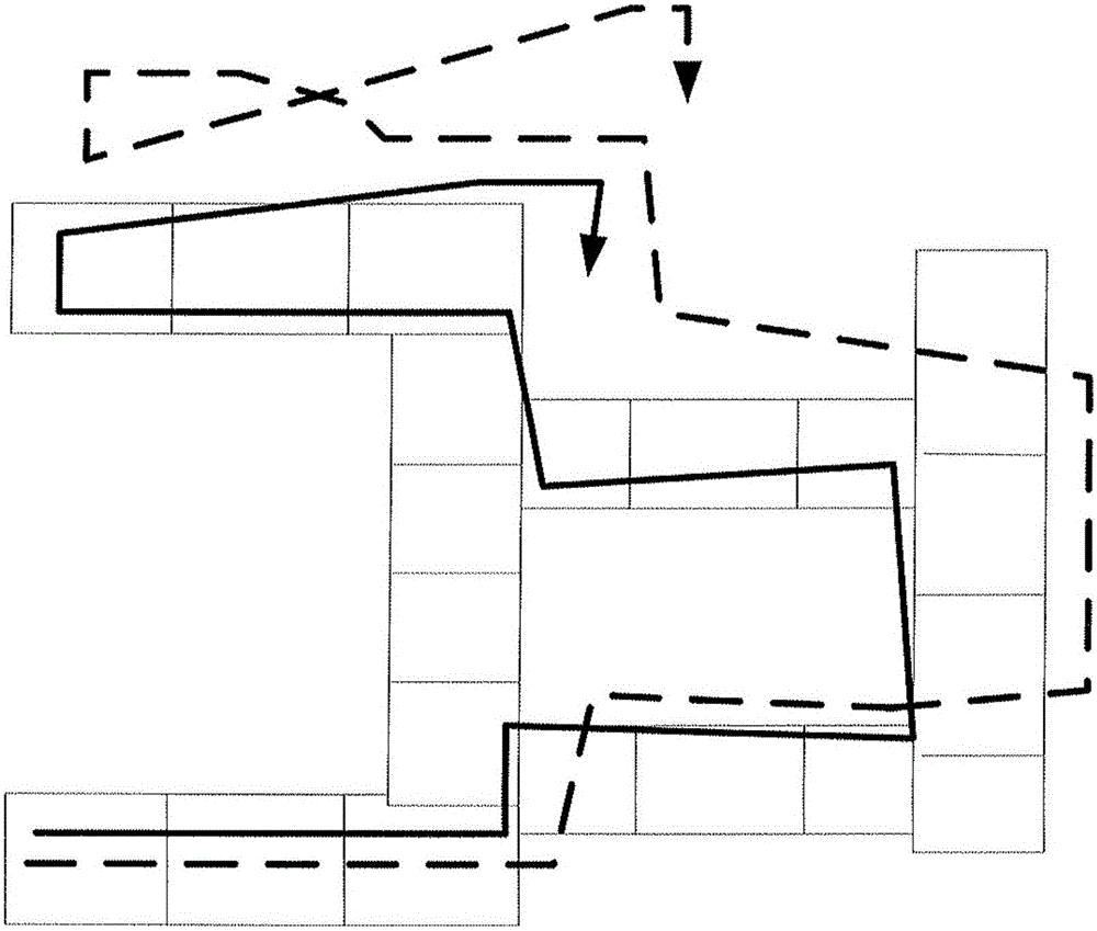
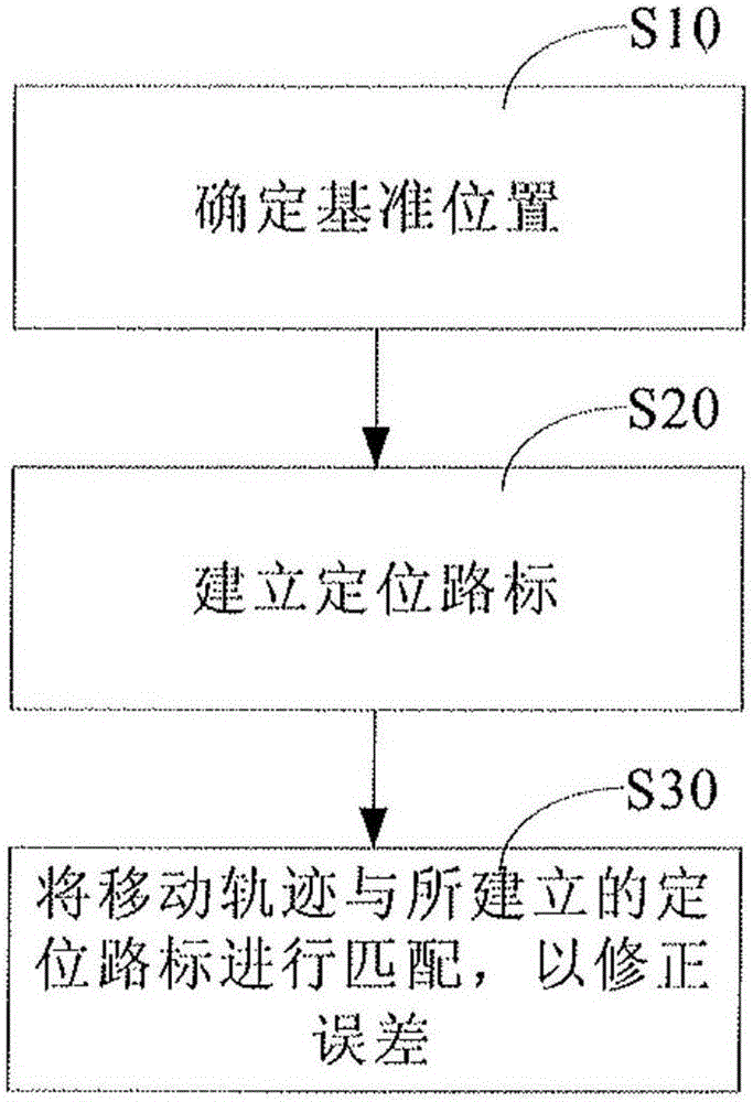
[0047] like image 3 Shown is a flowchart of the present invention, comprising the following steps:

[0048] S10: Determine the reference position.

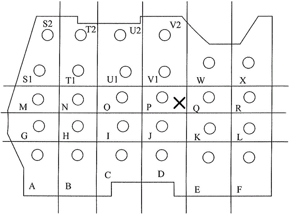
[0049] When the user enters the room from outdoors with a mobile terminal, it is necessary to use a reference position with reliable accuracy as the initial position (x 0 ,y 0 ,z 0 ). The reference position can be set at the door of the room, and the position information can be obtained by setting RFID. Or, since entering the room from the outside will cause a large attenuation o...


PUM


Abstract

The invention discloses an inertial navigation-fingerprint location-combined positioning error correction method. The method comprises A, determining a reference position, B, in movement, building positioning road signs at intervals by an inertial navigation method and recording the information of the positioning road signs, wherein the information comprises space coordinates, a wireless signal set and inertial navigation errors of a travel distance relative to the reference position, and C, according to the wireless signal set measured in real time, determining if the wireless signal matches with the recorded positioning road sign, and when the recorded positioning road sign is matched, based on coordinates of the matched positioning road sign, calibrating and correcting coordinates determined by the current inertial navigation technology. When the on-site positioning error is small, fingerprint is acquired and is used as a road sign, and through fingerprint coupling, when a user passes through the road sign again, the current position coordinates are calibrated by the small-error position coordinates so that an error estimation range is reduced and positioning precision is improved.

Description


Claims


Application Information

Patent Timeline
Owner 沈向东
Why Eureka
Try Eureka