An Online Automatic Matching Method for Geometric Correction of Remote Sensing Images
A remote sensing image and geometric correction technology, applied in image analysis, image enhancement, image data processing, etc., can solve problems such as complex geometric deformation, large scenes, and high cost
- Summary
- Abstract
- Description
- Claims
- Application Information
AI Technical Summary
Problems solved by technology
Method used
Image
Examples
Embodiment Construction
[0029] The online automatic matching method proposed by the present invention is described in detail as follows in conjunction with the accompanying drawings.
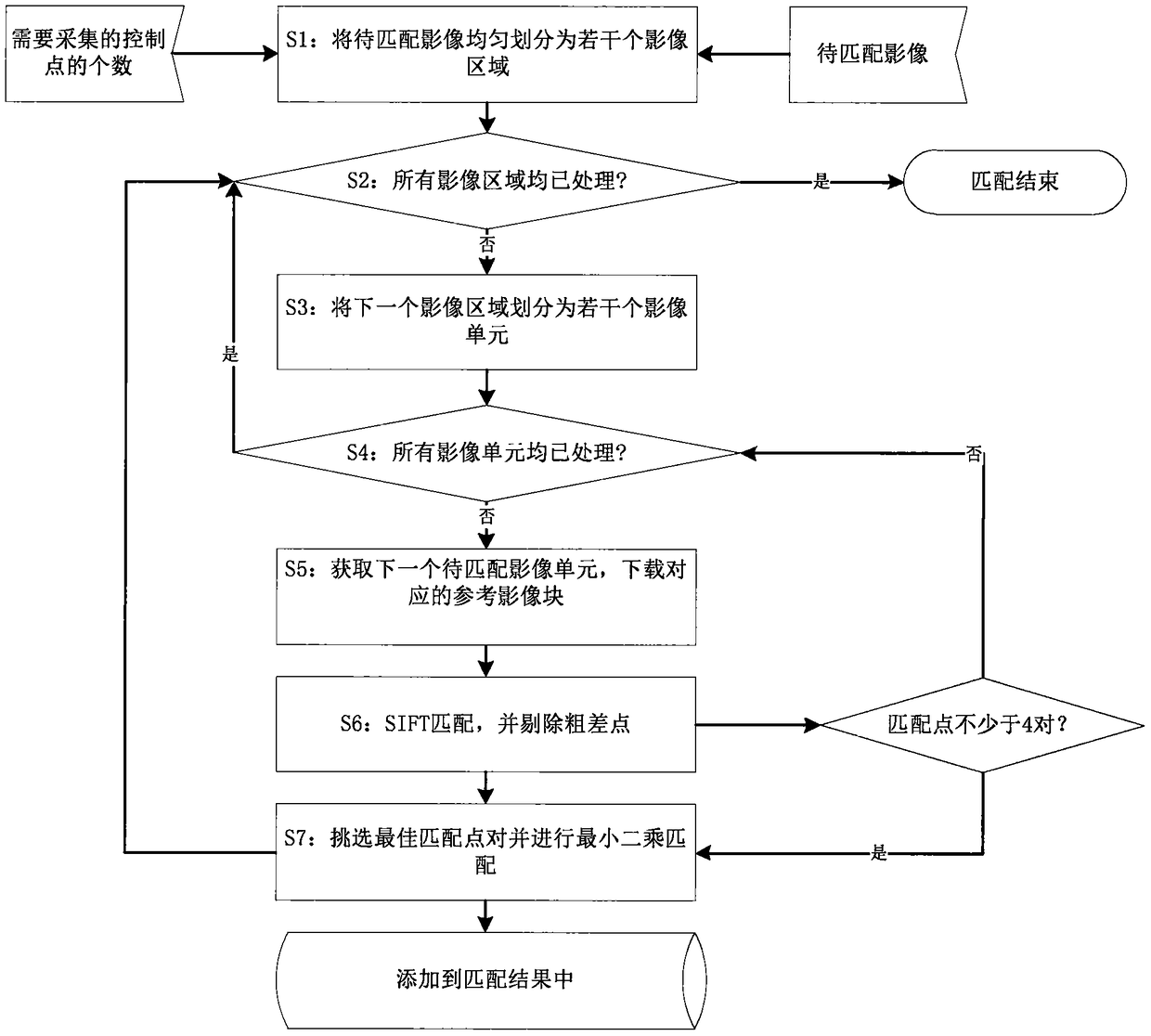
[0030] like figure 1 As shown, an automatic matching method according to an embodiment of the present invention includes steps:
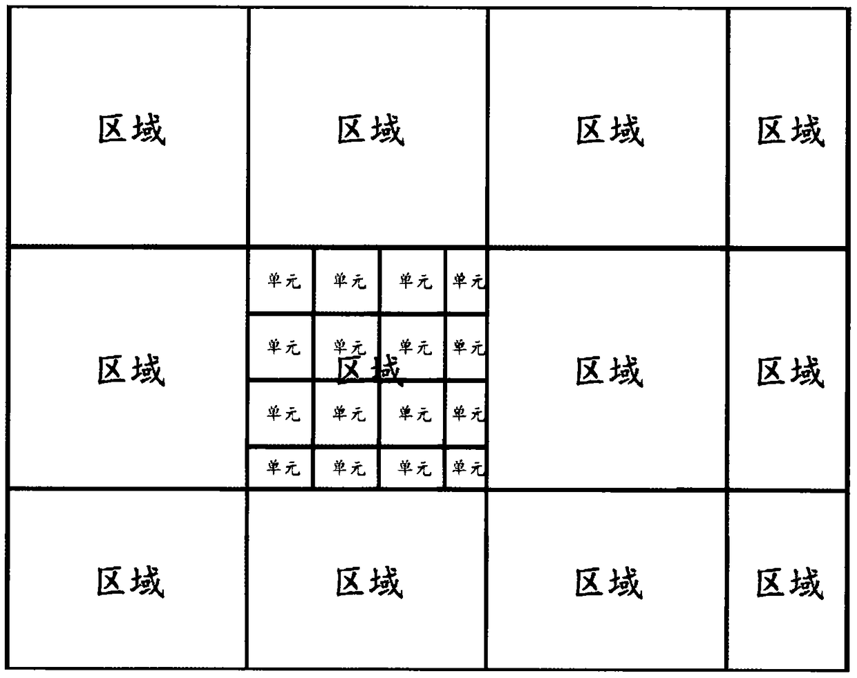
[0031] S1. According to the number of control points to be collected, the remote sensing image to be matched is evenly divided into several regions, and each image region is marked as unprocessed. The schematic diagram of the image region is shown in figure 2 ;
[0032] S2. If all image regions have been processed, complete and end the entire image matching process; otherwise, start processing the next image region;
[0033] S3. Divide the current image area into several image units according to the size of 256 pixels × 256 pixels, and record each image unit as an unprocessed state. See the image unit schematic diagram figure 2 ;
[0034] S4. If all image units in the current image are...
PUM
 Abstract
Description
Claims
Application Information
 - R&D
- Intellectual Property
- Life Sciences
- Materials
- Tech Scout
- Unparalleled Data Quality
- Higher Quality Content
- 60% Fewer Hallucinations
Browse by: Latest US Patents, China's latest patents, Technical Efficacy Thesaurus, Application Domain, Technology Topic, Popular Technical Reports.
© 2025 PatSnap. All rights reserved.Legal|Privacy policy|Modern Slavery Act Transparency Statement|Sitemap|About US| Contact US: help@patsnap.com


