Multi-rising-and-landing-point course planning method used for cruising power of unmanned aircraft

A technology of unmanned aerial vehicles and capabilities, applied in the field of surveying and mapping remote sensing, can solve the problems of short operation routes, no consideration, no estimation of cooperative operation of unmanned aerial vehicles, etc., and achieve the effect of reducing flight distance and improving operation efficiency

Active Publication Date: 2016-05-04
武汉大势智慧科技有限公司
View PDF5 Cites 48 Cited by
  • Summary
  • Abstract
  • Description
  • Claims
  • Application Information

AI Technical Summary

Problems solved by technology

The existing methods basically do not consider the endurance limit of the rotor UAV, frequent battery replacement, and the characteristics of taking off from multiple take-off and landing points when operating in a large-scale survey area, and do not estimate the number of aircraft in the same survey area. The characteristics of the cooperative operation of two UAVs
Most of the existing UAV operation track planning software originated from the needs of fixed wings, and did not take into account the reality that rotor UAVs need to frequently plan battery replacement and transition, and the operating route is relatively short.

Method used


Image

  • Multi-rising-and-landing-point course planning method used for cruising power of unmanned aircraft
  • Multi-rising-and-landing-point course planning method used for cruising power of unmanned aircraft
  • Multi-rising-and-landing-point course planning method used for cruising power of unmanned aircraft

Examples


Embodiment Construction

[0026] Specific embodiments of the present invention will be further described in detail below.

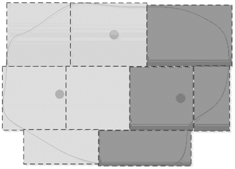
[0027] Such as figure 1 with figure 2 As shown, a multi-take-off and landing point route planning method for unmanned aerial vehicle endurance of the present invention is characterized in that the method uses the take-off and landing point of the unmanned aerial vehicle as a parameter for track planning, and according to The limitation of the single flight operation capability of the UAV, combined with the distribution of take-off and landing points, divides a survey area; it includes the following steps:

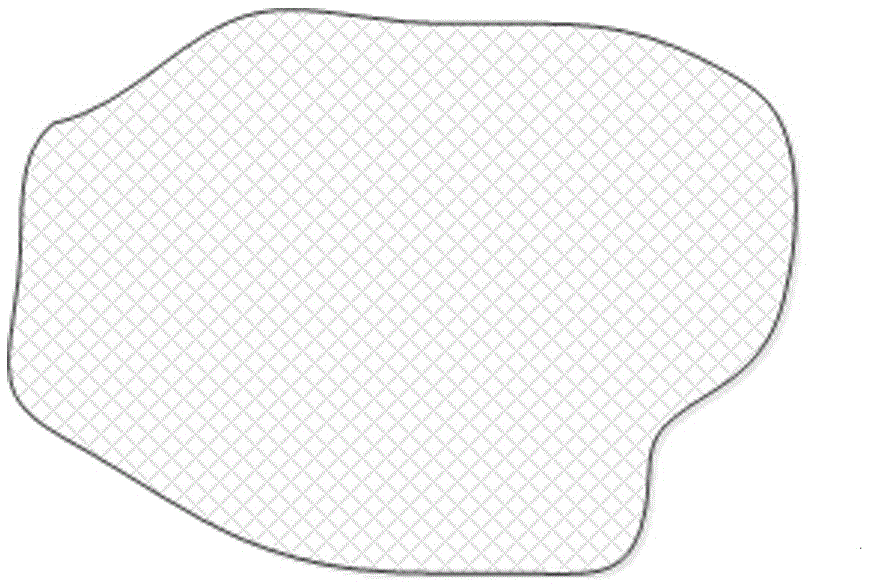
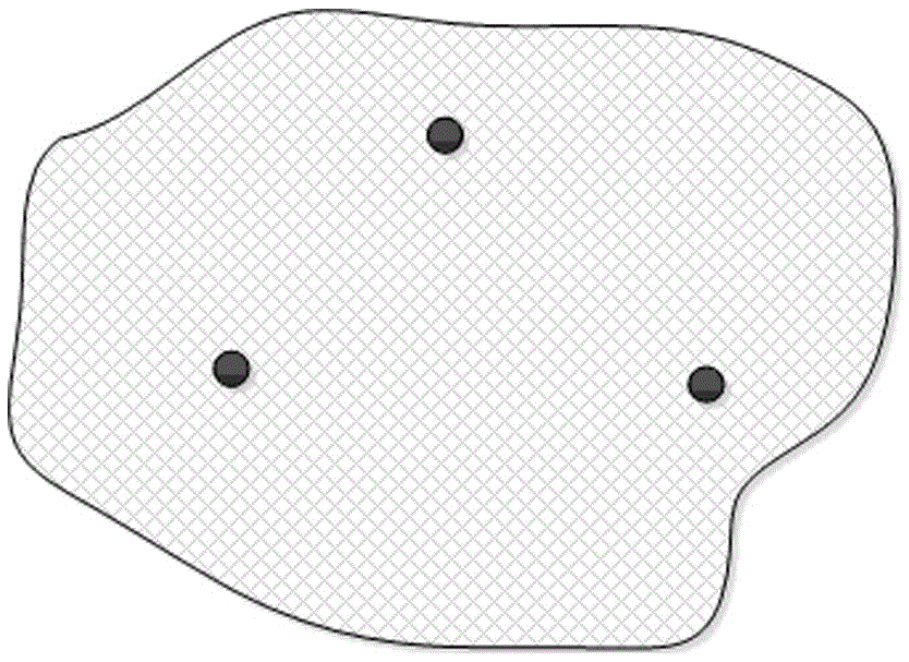
[0028] (1) The user draws the flight boundary of the survey area on the map, and the user sets the take-off and landing points on the map according to the convenience of the on-site flight operation and the visibility conditions;

[0029] (2) Calculate the flight altitude to be flown through the image resolution and other parameters specified by the user, combined with the o...


PUM


Abstract

The invention discloses a multi-rising-and-landing-point course planning method used for cruising power of a unmanned aircraft, which is characterized by using a rising-and-landing point of the unmanned aircraft as a parameter for planning the track, and dividing a testing zone by combining with the distribution of the rising-and-landing points according to the limitation of the capability of the single flight of the unmanned aircraft. In the invention, the operator of the rotor wing unmanned aircraft can appoint a rising-and-landing point, the course planning system generates an estimation rising-and-landing point and a partitioning course plan of the unmanned aircraft operation capability according to the rising-and-landing points, and the operation scope and the operation parameters which are provided by the operator. The operator can perform checking and adjustment through the generated partitioning course so as to generate a relatively optimized unmanned operation course. Except for reducing the flight distance of the rotor wing unmanned aircraft and improving the working efficiency in the practical operation, and the partitioning course planning can also support the collaborative operation by a plurality of the unmanned aircraft in one test area.

Description

technical field [0001] The invention relates to the technical field of surveying, mapping and remote sensing, especially the technology and method for performing partitioned collection in the observation area when a rotor UAV is difficult to complete the entire operation task in one flight during a large-scale aerial photography. Background technique [0002] In the application of photogrammetry or remote sensing, the UAV collects ground targets through the optical sensor on the UAV. In surveying and mapping or remote sensing applications, it is necessary to collect complete and full-coverage image data for the perceived area. Due to the limitations of the battery capacity of the UAV and the flight control radio communication distance, the range of data that can be collected in one flight is limited. Therefore, within a large survey area, multiple sorties of flights are required to complete the data collection of the entire large survey area. [0003] UAV remote sensing dat...

Claims


Application Information

Patent Timeline
Patent Type & Authority Applications(China)
IPC IPC(8): G05D1/10
CPCG05D1/101
Inventor 黄先锋张帆王瑞林
Owner 武汉大势智慧科技有限公司
Why Eureka
Try Eureka