Generation method three-dimensional land utilization present situation data model

A technology of data model and digital elevation model, which is applied in image data processing, 3D modeling, instruments, etc., and can solve problems such as only two-dimensional current map

Active Publication Date: 2016-06-29
SOUTHEAST UNIV
View PDF4 Cites 8 Cited by
  • Summary
  • Abstract
  • Description
  • Claims
  • Application Information

AI Technical Summary

Problems solved by technology

[0009] Purpose of the invention: In order to overcome the deficiencies in the prior art, the present invention provides a method for generating a ...

Method used


Image

  • Generation method three-dimensional land utilization present situation data model
  • Generation method three-dimensional land utilization present situation data model

Examples


Embodiment Construction

[0025] The present invention will be further described below in conjunction with the accompanying drawings.

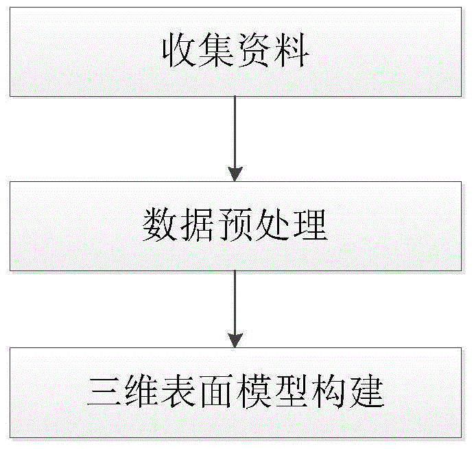
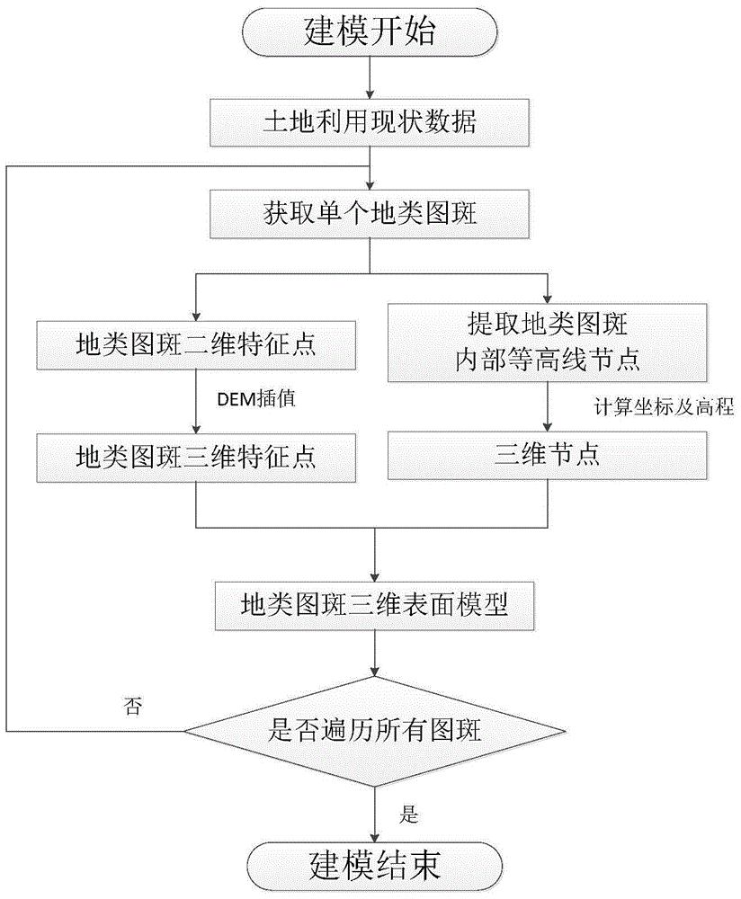
[0026] The present invention provides a three-dimensional land use status data model and a generation method thereof, which is a method for rapidly constructing a land use status three-dimensional surface model data by obtaining modeling data through two-dimensional land use status data and DEM data. And as a preferred example of the present invention, the main process of the whole modeling is as follows figure 1 As shown, it mainly includes three steps: the collection of two-dimensional land use status data, the preprocessing of data and the construction of three-dimensional model. figure 2 The detailed process of generating 3D land use status data, the main parts of the process include DEM data simplification and extraction, boundary point extraction of terrain map spots, elevation calculation and 3D surface model generation under boundary constraints.

[0027] Spe...


PUM


Abstract

The invention discloses a generation method a three-dimensional land utilization present situation data model. According to the invention, the data model takes land type pattern spots as organization units; a surface model is used for simulating a three-dimensional terrain surface; by using DEM data and two-dimensional land utilization present situation data and taking the land type pattern spots as units, simple DEM data points in the land type pattern spots are extracted; feature points of boundary features of the land type pattern spots are extracted, kept and allowed to be three-dimensional via the DEM data interpolation algorithm; and at last, a three-dimensional surface model is constructed under restraints of the two-dimensional boundaries of the land type pattern spots and two-dimensional land utilization present situation land type pattern spot data is transverse, thereby finishing construction of the whole three-dimensional land utilization present situation model. According to the invention, three-dimensional land utilization present situation data can be quickly generated and the generation method provides strong data supports for compensation of land acquisition and targeted planning.

Description

technical field [0001] The invention relates to the technical field of land management electronic information and its corresponding processing, in particular to a three-dimensional data modeling of land. Background technique [0002] Land is the basis for human survival, real-time grasp of land use status is the basis for macro-control and micro-management of land, and it is the scientific basis for the government to use land for economic decision-making. Since 1992, my country has started a unified survey of national land use status data, carried out land change surveys in the later period, conducted dynamic monitoring of land ownership, quantity, distribution and utilization status, regularly updated land statistical data, and accumulated a wealth of land use data. Current data results. [0003] The survey results of land use status all the time are shown as two-dimensional status maps, which are based on abstract symbols and cannot express geographical information directl...

Claims


Application Information

Patent Timeline
IPC IPC(8): G06T17/05
CPCG06T17/05
Inventor 王慧青张小国郭敬磊王庆
Owner SOUTHEAST UNIV
Why Eureka
Try Eureka