A method for generating data model of 3D land use status
A data model, digital elevation model technology, applied in image data processing, 3D modeling, instruments, etc., can solve problems such as only two-dimensional status map
- Summary
- Abstract
- Description
- Claims
- Application Information
AI Technical Summary
Problems solved by technology
Method used
Image
Examples
Embodiment Construction
[0025] The present invention will be further described below in conjunction with the accompanying drawings.
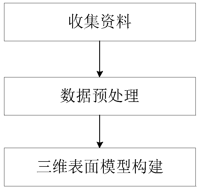
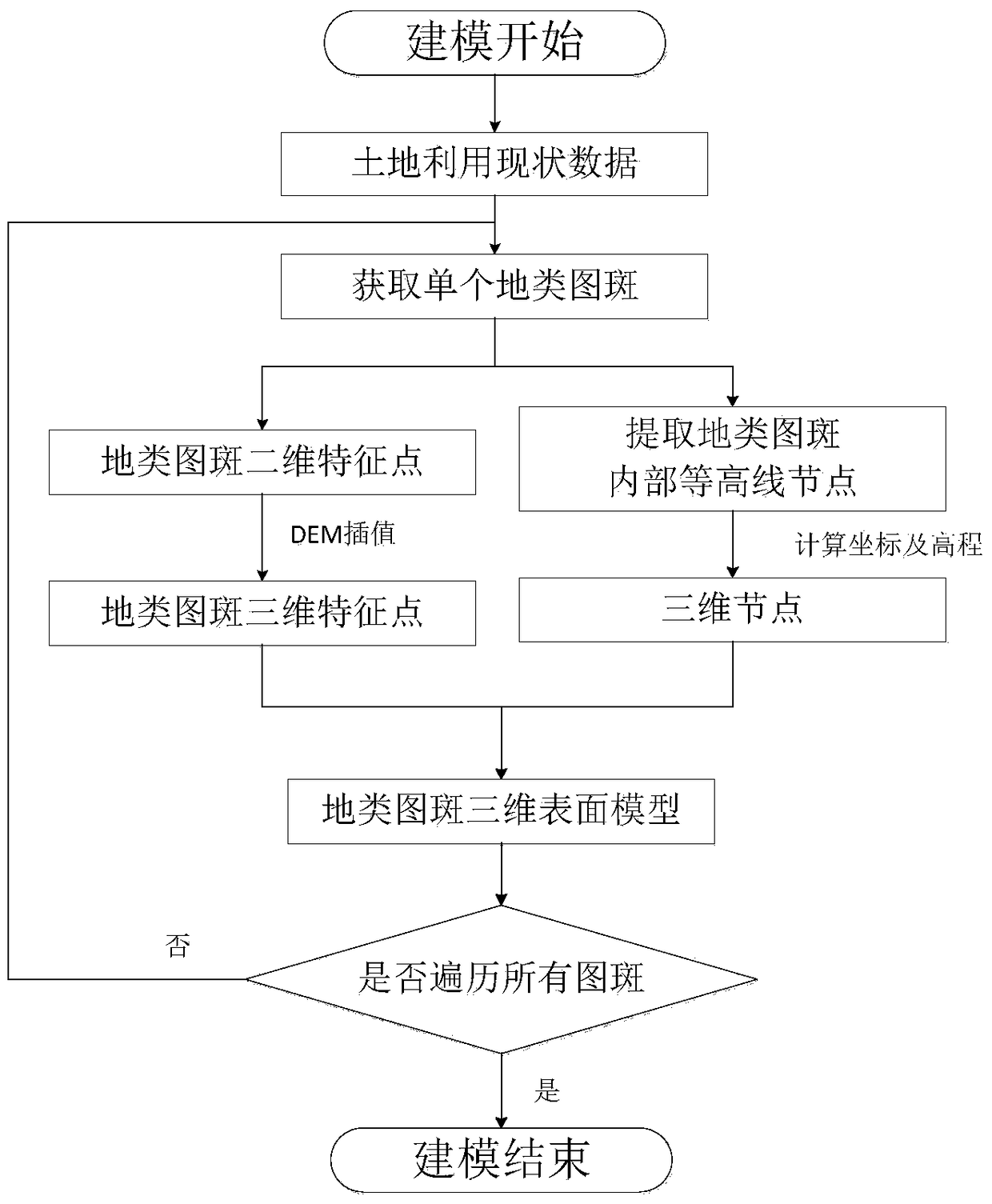
[0026] The present invention provides a three-dimensional land use status data model and a generation method thereof, which is a method for rapidly constructing a land use status three-dimensional surface model data by obtaining modeling data through two-dimensional land use status data and DEM data. And as a preferred example of the present invention, the main process of the whole modeling is as follows figure 1 As shown, it mainly includes three steps: the collection of two-dimensional land use status data, the preprocessing of data and the construction of three-dimensional model. figure 2 The detailed process of generating 3D land use status data, the main parts of the process include DEM data simplification and extraction, boundary point extraction of terrain map spots, elevation calculation and 3D surface model generation under boundary constraints.
[0027] Spe...
PUM
 Abstract
Description
Claims
Application Information
 - R&D
- Intellectual Property
- Life Sciences
- Materials
- Tech Scout
- Unparalleled Data Quality
- Higher Quality Content
- 60% Fewer Hallucinations
Browse by: Latest US Patents, China's latest patents, Technical Efficacy Thesaurus, Application Domain, Technology Topic, Popular Technical Reports.
© 2025 PatSnap. All rights reserved.Legal|Privacy policy|Modern Slavery Act Transparency Statement|Sitemap|About US| Contact US: help@patsnap.com


