Indoor positioning or navigation method and device, and map database generation method

An indoor positioning and database technology, applied in the field of communications, can solve problems such as complex data collection methods, and achieve the effects of reducing data collection work, accurate positioning, and reducing storage space

Inactive Publication Date: 2016-09-28
FAFA AUTOMOBILE (CHINA) CO LTD
View PDF11 Cites 66 Cited by
  • Summary
  • Abstract
  • Description
  • Claims
  • Application Information

AI Technical Summary

Problems solved by technology

[0007] Embodiments of the present invention provide an indoor positioning or navigation method, device, and map database generation method to solve the defects in the prior art that the data collection method of the database used for positioning and navigation is complicated and needs to be re-collected according to environmental changes, and at the same time It solves the defect that a large number of devices need to be set up and maintained in the prior art

Method used


Image

  • Indoor positioning or navigation method and device, and map database generation method
  • Indoor positioning or navigation method and device, and map database generation method
  • Indoor positioning or navigation method and device, and map database generation method

Examples


Embodiment 1

[0058] based on figure 1 The method for generating the map database, the embodiment of the present invention provides an indoor positioning method, such as Figure 4 shown, including:

[0059] Step 201: Obtain real-time image information of the user's location;

[0060] Specifically, the real-time image information of the user's location can be acquired through the camera device carried by the user, such as the vehicle camera of the vehicle driven by the user, the camera of the mobile terminal such as the mobile phone carried by the user, etc., which are not limited by the present invention;

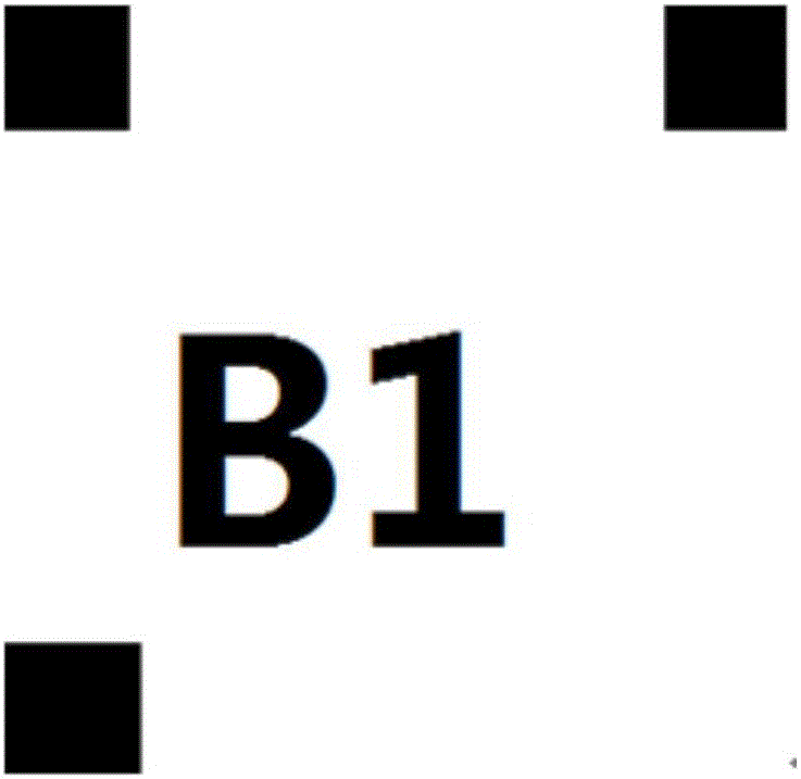
[0061] Step 202: Identify the preset identifier contained in the real-time image information;

[0062] Specifically, the real-time image information acquired by the user includes at least one preset identifier set in the indoor scene, and the preset identifier contained in the real-time image can be identified by processing the real-time image, which can be achieved by Digital image p...

Embodiment 2

[0089] Based on the indoor positioning method provided in Embodiment 1, this embodiment of the present invention provides another indoor positioning method, see Image 6 , the method includes:

[0090] Step 401: Obtain the location request information of the requesting user, the location request information including the requesting user ID and the target user ID;

[0091] Specifically, the requesting user may send a positioning request to the server through network communication, and the requesting user ID and the target user ID may include the positioning system ID of the mobile terminal carried by the user or the vehicle positioning system ID of the vehicle driven by the user. , the present invention is not limited;

[0092] Step 402: Obtain relative location information between the requesting user and the target user;

[0093] Specifically, by determining the current location information of the requesting user and the current location information of the target user, the r...

Embodiment 3

[0105] see Figure 8 , an embodiment of the present invention provides an indoor positioning device, including:

[0106] An acquisition module 10, configured to acquire real-time image information of the user's location, the real-time image information including a preset identification;

[0107] The processing module 20 is configured to identify a preset identifier contained in the real-time image information; based on the preset identifier, search a map database to obtain position information corresponding to the preset identifier, wherein, in the map database wherein, the preset identifier corresponds to the location information one by one;

[0108] The generating module 30 is configured to generate the current location information of the user according to the location information.

[0109] The indoor positioning device provided by the embodiment of the present invention compares the preset identifier included in the real-time image information of the user's location with ...


PUM


Abstract

The embodiment provides an indoor positioning or navigation method and device, and a map database generation method, and relates to the communication technical field. The method includes the steps: acquiring real-time image information of a position of a user; identifying a preset identification contained in the real-time image information; based on the preset identification, searching in a map database, to obtain position information corresponding to the preset identification, wherein in the map database, the preset identification and the position information are in one-to-one correspondence; and according to the position information, generating user current position information. According to the indoor positioning or navigation method and device, and the map database generation method provided by the embodiment of the invention, positioning is accurate, the operations are simple and easy, maintenance is almost not required, and the method can be used even if other environments are updated as long as the preset identification exists; at the same time, the work of data acquisition during construction of the map database is greatly reduced, and occupied storage space after the map database is constructed and the calculation amount during matching of the map database are also greatly reduced.

Description

technical field [0001] Embodiments of the present invention relate to the field of communication technologies, and in particular, to an indoor positioning or navigation method and device, and a method for generating a map database. Background technique [0002] When the indoor area is large and complex, people usually need to use a positioning system for positioning and navigation. GPS, Galileo, Beidou and other positioning and navigation systems mostly rely on geosynchronous orbit satellites for target positioning. Due to obstructions, indoor satellite signal attenuation is relatively large, so satellites are not suitable for indoor positioning and navigation. Currently commonly used indoor positioning and navigation methods mainly include the following: [0003] Wifi-based positioning method: use the wifi signal strength of the user's mobile phone in different locations in public places to calculate the user's location; the disadvantage is that it is necessary to build a...

Claims


Application Information

Patent Timeline
Patent Type & Authority Applications(China)
IPC IPC(8): G01C21/20G01C21/32
CPCG01C21/206G01C21/32
Inventor 吕天雄周珣臧成杰
Owner FAFA AUTOMOBILE (CHINA) CO LTD
Why Eureka
Try Eureka