Positioning system and method

A technology of video positioning and location information, applied in the field of spatial information, can solve the problems of high cost, difficult to automatically complete, long cycle, etc., to achieve the effect of improving efficiency and reducing cost

Active Publication Date: 2016-10-12
SHENZHEN INST OF ADVANCED TECH
View PDF8 Cites 12 Cited by
  • Summary
  • Abstract
  • Description
  • Claims
  • Application Information

AI Technical Summary

Problems solved by technology

[0003] The current surveillance cameras are managed by number, without precise spatial positioning capabilities
On the other hand, to carry out camera measurement and positioning, it is necessary to manually calibrate the camera (including: control point selection-space mapping-coordinate input-coordinate conversion, etc.), the process is complicated, the cost is high, the cycle is long, and it is difficult to complete automatically

Method used


Image

  • Positioning system and method
  • Positioning system and method
  • Positioning system and method

Examples


Embodiment Construction

[0026] In order to make the object, technical solution and beneficial effects of the present invention more clear, the present invention will be further described in detail below in conjunction with the accompanying drawings and embodiments. It should be understood that the specific embodiments described here are only used to explain the present invention, not to limit the present invention.

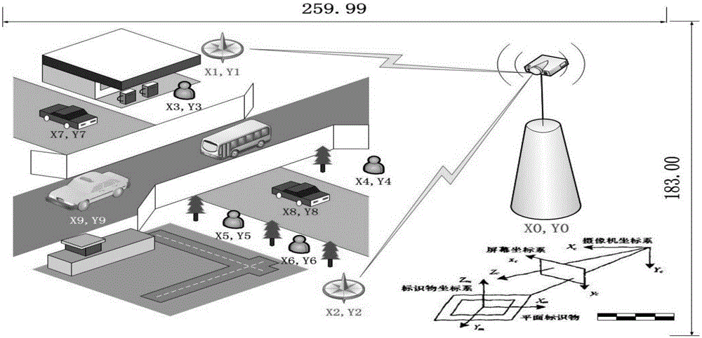
[0027] Such as figure 1 As shown, the present invention provides a video positioning system, comprising:

[0028] A video positioning system, comprising a monitoring camera 100, a mobile terminal 200 and a background server 300, wherein:

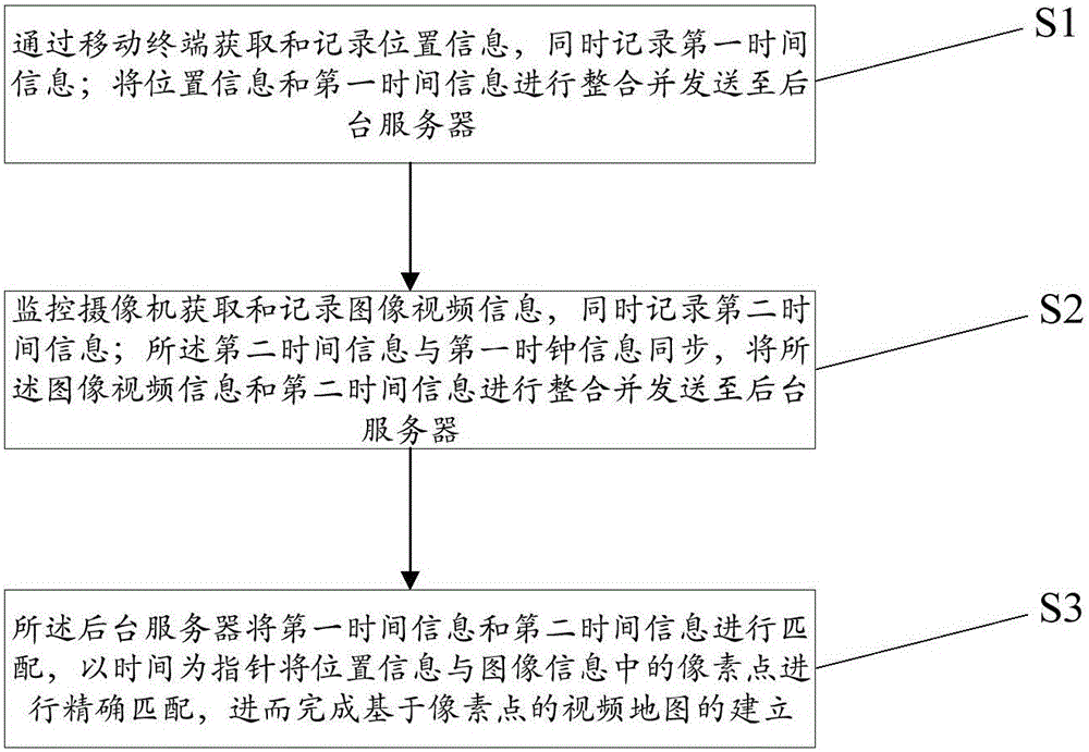
[0029] The mobile terminal is an intelligent terminal device installed with positioning, timing, and communication functions APP, including smart phones, tablet computers, etc.

[0030] Described mobile terminal 200 comprises position unit 201, first clock unit and first communication unit 202, and described position unit 201 is used for acquiring an...


PUM


Abstract

The invention relates to a spatial information technology, in particular to a video positioning system and method. The method comprises the following steps: establishing a mapping relationship between target pixels and spatial coordinates of the target pixels through an interactive operation and data transmission between a mobile terminal and a monitoring camera; performing processing through spatial calibration software to automatically finish spatial coordinate calibration of a video monitoring range; and building a video map in order that target pixel points on a monitoring video matrix have corresponding spatial coordinate values, thereby realizing spatial positioning of any dynamic/static target pixel within the monitoring range. Meanwhile, space-time coordinate calibration is performed semi-automatically through WIFI (Wireless Fidelity) functions of a mobile terminal positioning device and a wireless router, so that conventional manual processing is replaced; the working efficiency is increased; and the cost is reduced.

Description

technical field [0001] The invention relates to spatial information technology, in particular to a video positioning system and method. Background technique [0002] The integrated deployment of wireless routers and cameras has become the development trend of urban infrastructure, such as WIFI cameras and other products and patents. The combination of the two can not only share resources and save costs, but also can transmit data and function interoperably. [0003] Currently, surveillance cameras are managed by number and do not have precise spatial positioning capabilities. On the other hand, to carry out camera measurement and positioning, it is necessary to manually calibrate the camera (including: selection of control points-spatial mapping-coordinate input-coordinate conversion, etc.), the process is complex, costly, and the cycle is long, so it is difficult to complete automatically. [0004] Patent application number 201310443078.6 provides "a method for adding geo...

Claims


Application Information

Patent Timeline
Patent Type & Authority Applications(China)
IPC IPC(8): H04N7/18H04N5/232H04W4/02H04W84/12G06F17/30
CPCH04N7/181H04W4/025H04W84/12G06F16/7867H04N23/60
Inventor 修文群
Owner SHENZHEN INST OF ADVANCED TECH
Why Eureka
Try Eureka