Mining area surface deformation resolving method through fusion of pixel element offset tracking and short baseline set

A technology of short baseline set and pixel offset, which is applied in the direction of radio wave reflection/re-radiation, radio wave measurement system, and utilization of re-radiation, etc. It can solve problems such as time-consuming, large deformation, and small monitoring magnitude. Achieve the effects of maintaining the relationship between mine groups, managing the ecological environment, and monitoring with high precision

Active Publication Date: 2016-11-02
CHINA UNIV OF MINING & TECH
View PDF5 Cites 22 Cited by
  • Summary
  • Abstract
  • Description
  • Claims
  • Application Information

AI Technical Summary

Problems solved by technology

However, this method first needs to unwrap the differential phase when solving the calculation, and the mining subsidence speed is fast and the deformation is large, so the phase unwrapping can only solve the settlement value of the deformation gradient of adjacent points between (-π, π] , the surface subsidence in the large deformation area is difficult to obtain correctly through the phase unwrapping method, resulting in a small monitoring level in these areas, which is difficult to meet the large deformation monitoring requirements of the mining area
At the same time, the pixel offset tracking algorithm can solve large surface deformation, and is currently mainly used in glacier movement, earthquake deformation, etc., but the accuracy of surface deformation obtained by using SAR amplitude information is low, and it is very time-consuming. The error is not equivalent to the terrain error in the short baseline set technology based on the differential phase, and it cannot be brought into the short baseline set model for direct solution
Therefore, there is currently no method to combine pixel offset tracking and short baseline set to solve surface deformation and elevation error

Method used


Image

  • Mining area surface deformation resolving method through fusion of pixel element offset tracking and short baseline set
  • Mining area surface deformation resolving method through fusion of pixel element offset tracking and short baseline set
  • Mining area surface deformation resolving method through fusion of pixel element offset tracking and short baseline set

Examples


Embodiment Construction

[0033] The present invention will be described in further detail below in conjunction with figure and specific implementation process:

[0034] Such as figure 1 As shown, the mine area surface deformation solution method of fusion pixel offset tracking and short baseline set of the present invention includes the following steps:

[0035] Step 1: Estimation of surface deformation area in mining area:

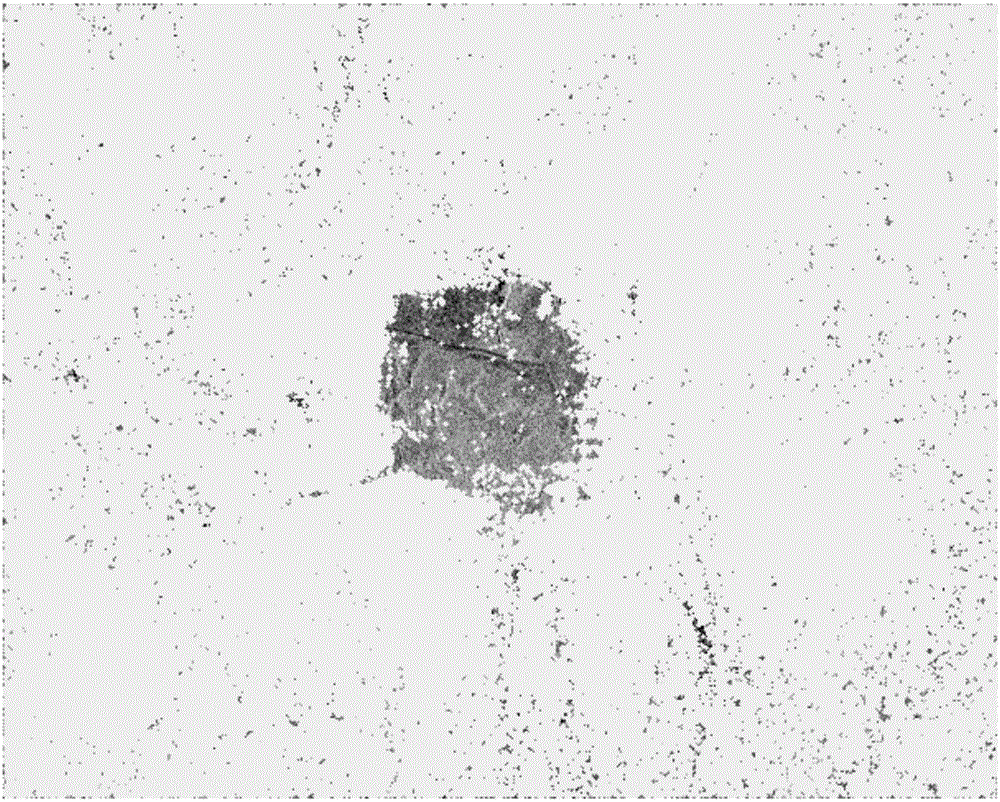
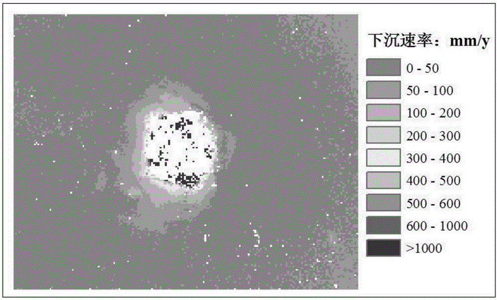
[0036] In this example, the mining area caused by coal mining is selected, and the cropped Terrasar-X satellite images of 11 scenes and 1m resolution of the selected mining area acquired by satellite are used, with a range of 2000×1600 pixels. Using the surface subsidence results predicted by DInSAR or mining subsidence, subsidence basins in which the deformation difference of adjacent pixels in the SAR image area is greater than half the wavelength of the SAR image are initially divided into large deformation areas, and the pixel deformation value is less than 10mm. Set as invi...


PUM


Abstract

The invention provides a mining area surface deformation resolving method through fusion of pixel element offset tracking and a short baseline set, and is suitable for the research of surface mining area surface deformation. The method comprises the steps that a mining area surface deformation area is pre-estimated; high-coherence points in coherence images on time sequences are selected; the number N of integer phase cycles of the high-coherence points of a large-deformation area is recovered by utilizing a time sequence offset tracking algorithm; the high-coherence points of the large-deformation area and a small-deformation area are combined to establish a short baseline set resolving model; and resolving of mining area surface elevation error and deformation rate is performed. The method is high in monitoring precision, large in range, simple in implementation operation process and low in cost so that the problem that the conventional time sequence InSAR method cannot correctly acquire surface settlement under large mining area deformation gradient can be overcome, the problem that the time sequence pixel element offset tracking algorithm based on SAR amplitude information and the short baseline set technology based on differential phase are difficult to combine to resolve the surface deformation rate and the elevation error can also be solved, and thus the method has wide practicality.

Description

technical field [0001] The invention relates to a method for calculating surface deformation in a mining area, and is especially suitable for a method for calculating surface deformation in a mining area that combines pixel offset tracking and a short baseline set. technical background [0002] Interferometric Synthetic Aperture Radar (InSAR, Interferometric Synthetic ApertureRadar) has the advantages of all-weather, large coverage, high precision, and penetrating power. It is widely used in terrain mapping, deformation monitoring, and surface parameter inversion. DInSAR (Differential InSAR) is mainly used for surface deformation monitoring, and has great application potential in fields such as volcano monitoring, land subsidence, seismic deformation field acquisition, and landslide monitoring. However, this technology is affected by factors such as time baseline, space baseline, and atmospheric delay. The time-series InSAR method that only processes and analyzes some high-c...

Claims


Application Information

Patent Timeline
Patent Type & Authority Applications(China)
IPC IPC(8): G01S13/90
CPCG01S13/9023
Inventor 范洪冬杜森黄继磊闫世勇邓喀中汪云甲
Owner CHINA UNIV OF MINING & TECH
Why Eureka
Try Eureka