
Territory site displaying method and related devices

A client device and map technology, applied in the field of communication, can solve the problems of long waiting time for the client, long data loading process, and poor user experience.

Active Publication Date: 2017-03-08
TENCENT TECH (SHENZHEN) CO LTD
View PDF5 Cites 3 Cited by
  • Summary
  • Abstract
  • Description
  • Claims
  • Application Information

AI Technical Summary

Problems solved by technology

[0005] However, in practical applications, because the map data storage server stores the information of site points at each location on the map, this method requires the map data storage server to traverse the positions of the site points in the statistical area and calculate the number of site points in real time , involving more database interaction and logical calculations, will cause the data loading process to take too long, making the client wait for a long time, and the user experience is poor

Method used


Image

  • Territory site displaying method and related devices
  • Territory site displaying method and related devices
  • Territory site displaying method and related devices

Examples


Embodiment Construction

[0081] The technical solutions in the embodiments of the present invention will be clearly and completely described below in conjunction with the accompanying drawings in the embodiments of the present invention. Obviously, the described embodiments are only a part of the embodiments of the present invention, rather than all the embodiments. Based on the embodiments of the present invention, all other embodiments obtained by those skilled in the art without creative work shall fall within the protection scope of the present invention.

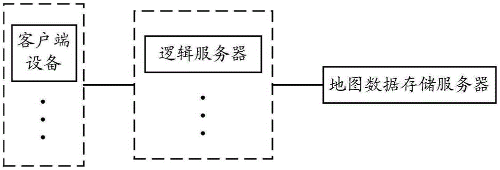
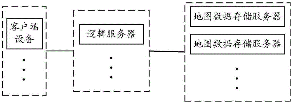
[0082] The present invention provides a site inventory presentation method and related equipment, which are used to reduce real-time calculations required when a map data storage server obtains site inventory information in a statistical area, speed up the data loading process, reduce client waiting time, and improve human-computer interaction performance.

[0083] The method for presenting an inventory point of the present invention is applied to an...


PUM


Abstract

The embodiment of the invention discloses a territory site displaying method and related devices and is used for reducing real-time calculation needing to be carried out when a map data storage server obtains territory site information in a statistic region, accelerating a data loading process, reducing the waiting time of a client and improving the man-machine interaction performance. The method provided by the embodiment of the invention comprises the steps that a logic server receives a first information pull request sent by a client device, wherein the first information pull request comprises a current map scaling on the client device and current position coordinate information of the client device; determining the statistic region of which territory site information needs to be pulled according to the current position coordinate information of the client device; selecting a matched map specification from N sets of different map specifications according to the map scaling; and sending a second information pull request to a map data storage server, wherein the second information pull request comprises the statistic region and the matched map specification, and the map data storage server reads the territory site information in the statistic region according to the matched map specification.

Description

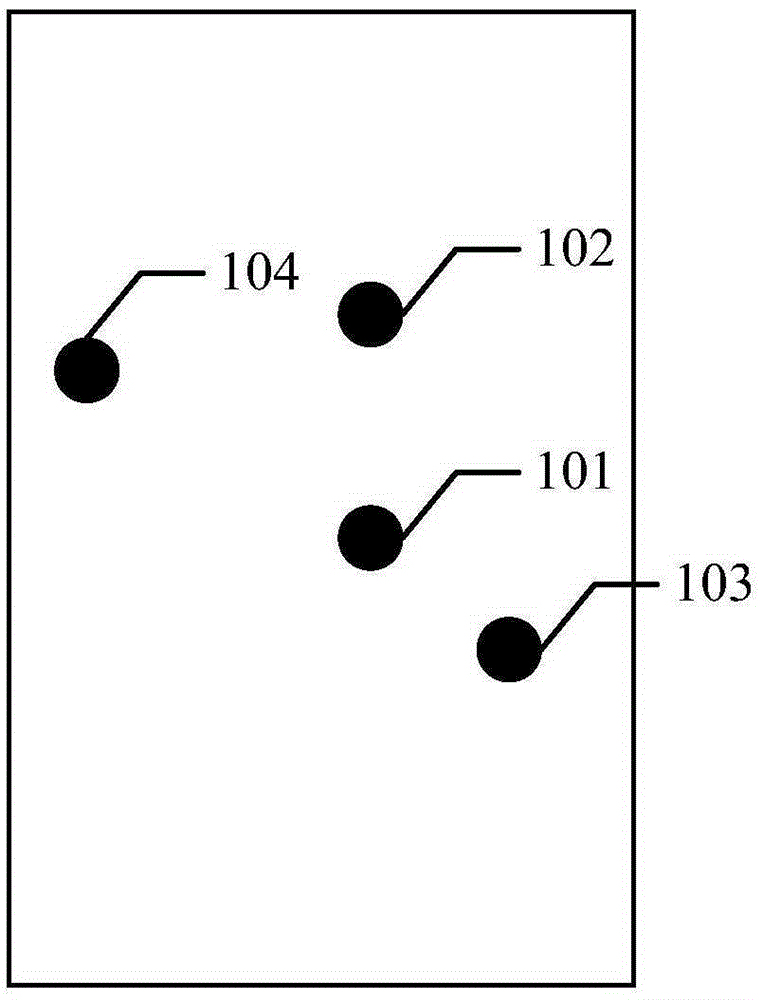
Technical field [0001] The present invention relates to the field of communications, in particular to a method for presenting a site inventory and related equipment. Background technique [0002] Occupying a site inventory is a location-based service (LBS) gameplay that crosses the line of fire on the palm. In this gameplay, we need to display information about the user's surrounding sites on the map, such as name and details. For example figure 1 As shown, 101 represents the location of the user on the map, and 102, 103, and 104 represent locations displayed around the user. [0003] The user will zoom in and out of the map when viewing the site. When the map is reduced to a certain ratio, there are too many surrounding sites to display, so site clusters can be used for display. Site clusters are a collection of site inventories in an area. According to the merger rules, the sites in different areas can be divided into a site group. [0004] To display the site group, you need to...

Claims


Application Information

Patent Timeline
IPC IPC(8): H04W4/02H04L29/08
CPCH04W4/02H04L67/52G06F16/00
Inventor 冯锋
Owner TENCENT TECH (SHENZHEN) CO LTD
Learn More