

Delaunay triangular net-based road center line extraction method
An extraction method and centerline technology, applied in the field of road centerline extraction based on Delaunay triangulation, to achieve the effect of maintaining topological relationship and avoiding manual processing or data re-acquisition process
- Summary
- Abstract
- Description
- Claims
- Application Information
AI Technical Summary
Problems solved by technology
Method used
Image

Examples
Embodiment Construction
[0025] In order to make the object, technical solution and advantages of the present invention clearer, the present invention will be further described in detail below in conjunction with the accompanying drawings. It should be understood that the specific embodiments described here are only used to explain the present invention, and are not intended to limit the present invention.
[0026] The main purpose of the present invention is to obtain a single-line network that meets the requirements by performing a series of automatic processing on the road network data with mixed single-line and double-line in the data processing category of the geographic information system, especially during the acquisition of single-line network data. data for use in industries such as geographic information network analysis. Heavy manual processing workload, or the process of redoing data collection is avoided.
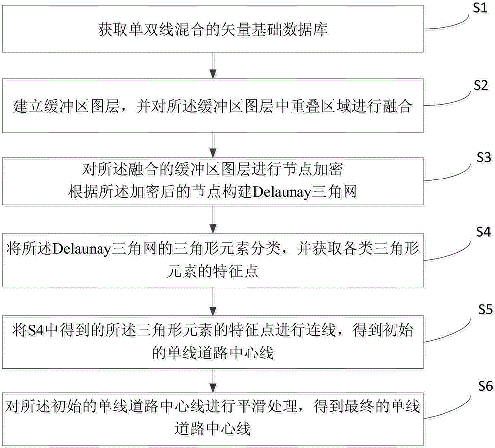
[0027] like figure 1 As shown, the embodiment of the present invention provides ...
PUM
 Abstract
Description
Claims
Application Information