Method for representing navigation grid map for 3D scene
A technology for navigation meshes and scenes, applied in 3D modeling, image data processing, instruments, etc., can solve problems such as being unable to adapt to large 3D scenes, consuming large memory storage nodes, and being difficult to adapt to dynamic scenes.
- Summary
- Abstract
- Description
- Claims
- Application Information
AI Technical Summary
Problems solved by technology
Method used
Image
Examples
Embodiment Construction
[0062] The specific implementation manners of the present invention will be described in detail below in conjunction with the accompanying drawings.
[0063] A navigation grid map representation method oriented to 3D scenes, the flow chart of the method is as follows figure 1 shown, including:
[0064] Step 1. Extract the walkable hierarchical planes in the 3D scene to obtain a set of walkable hierarchical planes;
[0065] The step 1, as in Figure 11 shown, including:
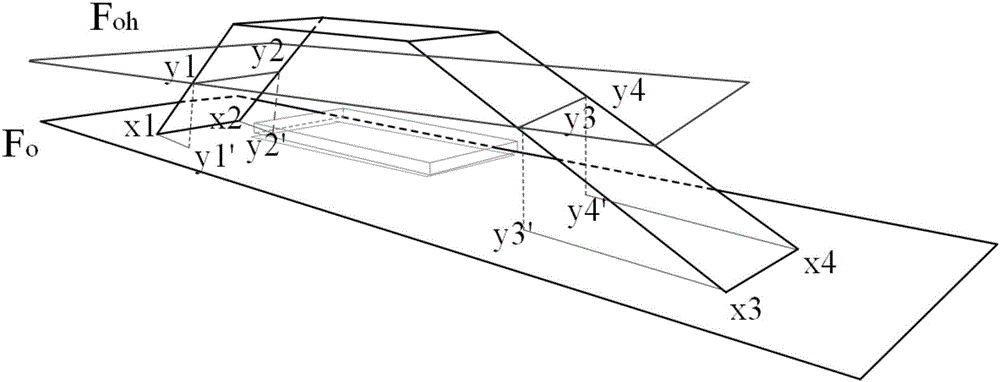
[0066] Step 1.1. In the 3D scene, the layer plane F whose Y axis is 0 0 (Ground) As the initial walkable layer plane, the layer plane F 0 Add to the walkable hierarchical plane set F, and then perform step 1.2;
[0067] A 3D scene may have multiple hierarchical planes. Pathfinding characters can walk on different hierarchical planes, but the hierarchical planes are connected and can be connected by slopes. There is no isolated hierarchical plane, that is, all hierarchical planes are connected. of. The h...
PUM
 Abstract
Description
Claims
Application Information
 - R&D
- Intellectual Property
- Life Sciences
- Materials
- Tech Scout
- Unparalleled Data Quality
- Higher Quality Content
- 60% Fewer Hallucinations
Browse by: Latest US Patents, China's latest patents, Technical Efficacy Thesaurus, Application Domain, Technology Topic, Popular Technical Reports.
© 2025 PatSnap. All rights reserved.Legal|Privacy policy|Modern Slavery Act Transparency Statement|Sitemap|About US| Contact US: help@patsnap.com


