Intelligent navigation system and navigation method based on satellite positioning and Wi-Fi positioning

An intelligent navigation and satellite positioning technology, applied in the field of positioning and navigation, can solve problems such as driving troubles, losing routes, and being unable to confirm the current position, and achieve the effect of improving positioning accuracy and good navigation experience

Pending Publication Date: 2017-05-10
享位科技有限公司
View PDF0 Cites 2 Cited by
  • Summary
  • Abstract
  • Description
  • Claims
  • Application Information

AI Technical Summary

Problems solved by technology

Usually, people use satellite positioning system for navigation to reach their destination smoothly, but some places such as tunnels and underground spaces will cause great interference to satellite positioning, making it impossible to confirm the current location, thus losing the route to the destination, giving drivers cause trouble

Method used


Image

  • Intelligent navigation system and navigation method based on satellite positioning and Wi-Fi positioning
  • Intelligent navigation system and navigation method based on satellite positioning and Wi-Fi positioning
  • Intelligent navigation system and navigation method based on satellite positioning and Wi-Fi positioning

Examples


Embodiment approach 2

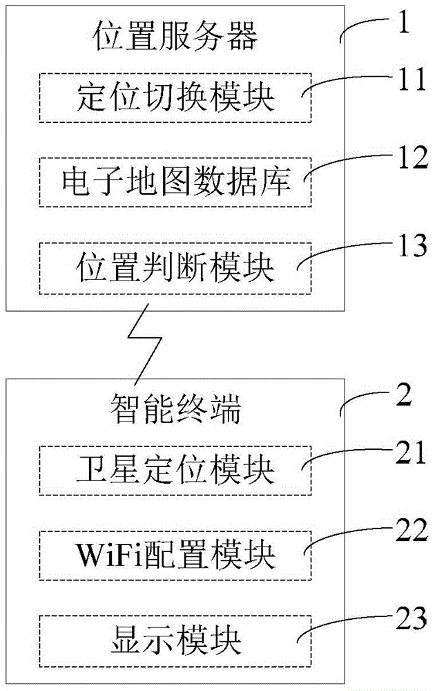
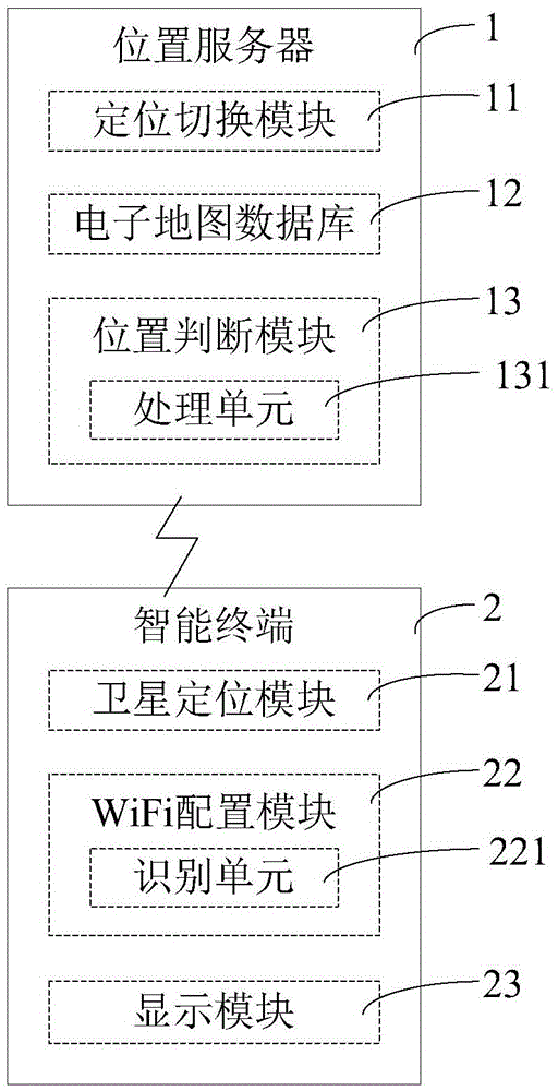
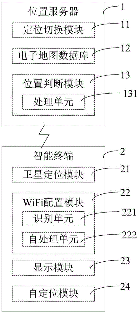
[0038] The present invention also provides an embodiment 2 of an intelligent navigation method based on satellite positioning and WiFi positioning, which embodiment includes steps:

[0039] a) Confirm the initial position of the smart terminal based on satellite positioning or WiFi positioning, and display the line between the initial position and the target position on the smart terminal according to the initial position and the target position, wherein, confirming the initial position of the smart terminal based on WiFi positioning includes The smart terminal detects at least one WiFi signal from the WiFi signal node, and confirms the initial position of the smart terminal according to the WiFi signal through a location server wirelessly connected to the smart terminal;

[0040] b) When the smart terminal is moving, the smart terminal detects whether there is a WiFi signal node. If there is at least one WiFi signal node, the smart terminal uses a WiFi-based positioning method...


PUM


Abstract

The invention discloses an intelligent navigation system based on satellite positioning and Wi-Fi positioning. The intelligent navigation system comprises a location server and an intelligent terminal connected with the location server via a wireless network. The location server judges the location information of the intelligent terminal according to the information of a Wi-Fi signal node detected by a Wi-Fi configuration module and output by the intelligent terminal, transmits the location information to the intelligent terminal, and displays the location of the intelligent terminal in an electronic map displayed by a display module of the intelligent terminal. The invention further provides an intelligent navigation method based on satellite positioning and Wi-Fi positioning. The intelligent navigation system realizes seamless switching between satellite positioning and Wi-Fi positioning, makes up for the problem that there is a lack of navigation positioning signals as there is only a single way of navigation, is of higher positioning accuracy, and provides better navigation experience for users.

Description

technical field [0001] The invention belongs to the field of positioning and navigation, and in particular relates to an intelligent navigation system and a navigation method based on satellite positioning and WiFi positioning. Background technique [0002] At present, cars have become a relatively common means of transportation. People often drive cars to destinations, some of which are unfamiliar places. Usually, people use satellite positioning system for navigation to reach their destination smoothly, but some places such as tunnels and underground spaces will cause great interference to satellite positioning, and the current position cannot be confirmed, thus losing the route to the destination, which is difficult for drivers. cause trouble. With the development of communication technology, more and more WiFi signal nodes are placed beside the road, especially in underground spaces and tunnels. Since WiFi signal nodes have unique MAC addresses, it is possible to locate...

Claims


Application Information

Patent Timeline
Patent Type & Authority Applications(China)
IPC IPC(8): G01S19/48G01C21/34
CPCG01S19/48G01C21/3415
Inventor 洪永川
Owner 享位科技有限公司
Why Eureka
Try Eureka