Raster-vector geographic data reversible decryption method based on trigonometric function

A technology of trigonometric functions and geographic data, applied in the field of geographic information security, which can solve the problems of low model security, slow processing speed, and difficulty in high-precision recovery.

Active Publication Date: 2017-05-31
NANJING NORMAL UNIVERSITY
View PDF4 Cites 9 Cited by
  • Summary
  • Abstract
  • Description
  • Claims
  • Application Information

AI Technical Summary

Problems solved by technology

[0003] At present, the existing geometric precision declassification methods include projection transformation method, frame transformation method, error random interference method based on shift circle, linear transformation method, nonlinear transformation method, etc. These methods still have some disadvantage

Method used


Image

  • Raster-vector geographic data reversible decryption method based on trigonometric function
  • Raster-vector geographic data reversible decryption method based on trigonometric function
  • Raster-vector geographic data reversible decryption method based on trigonometric function

Examples


Embodiment

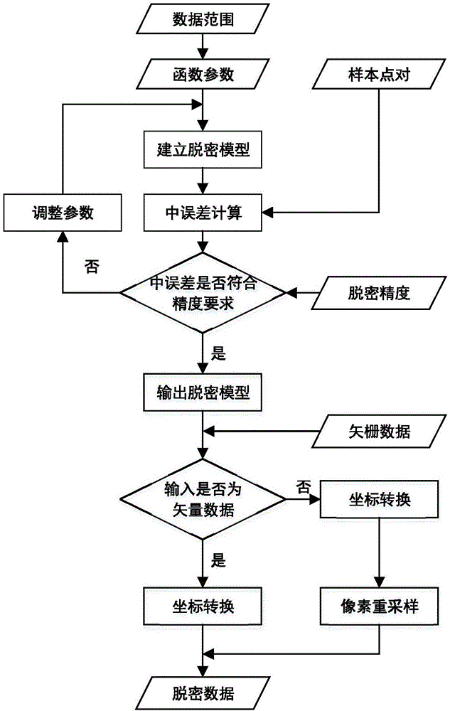
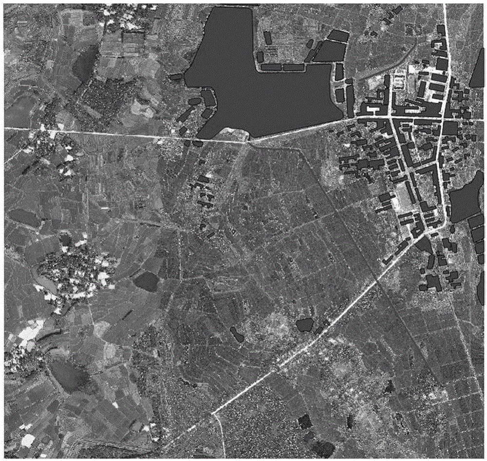
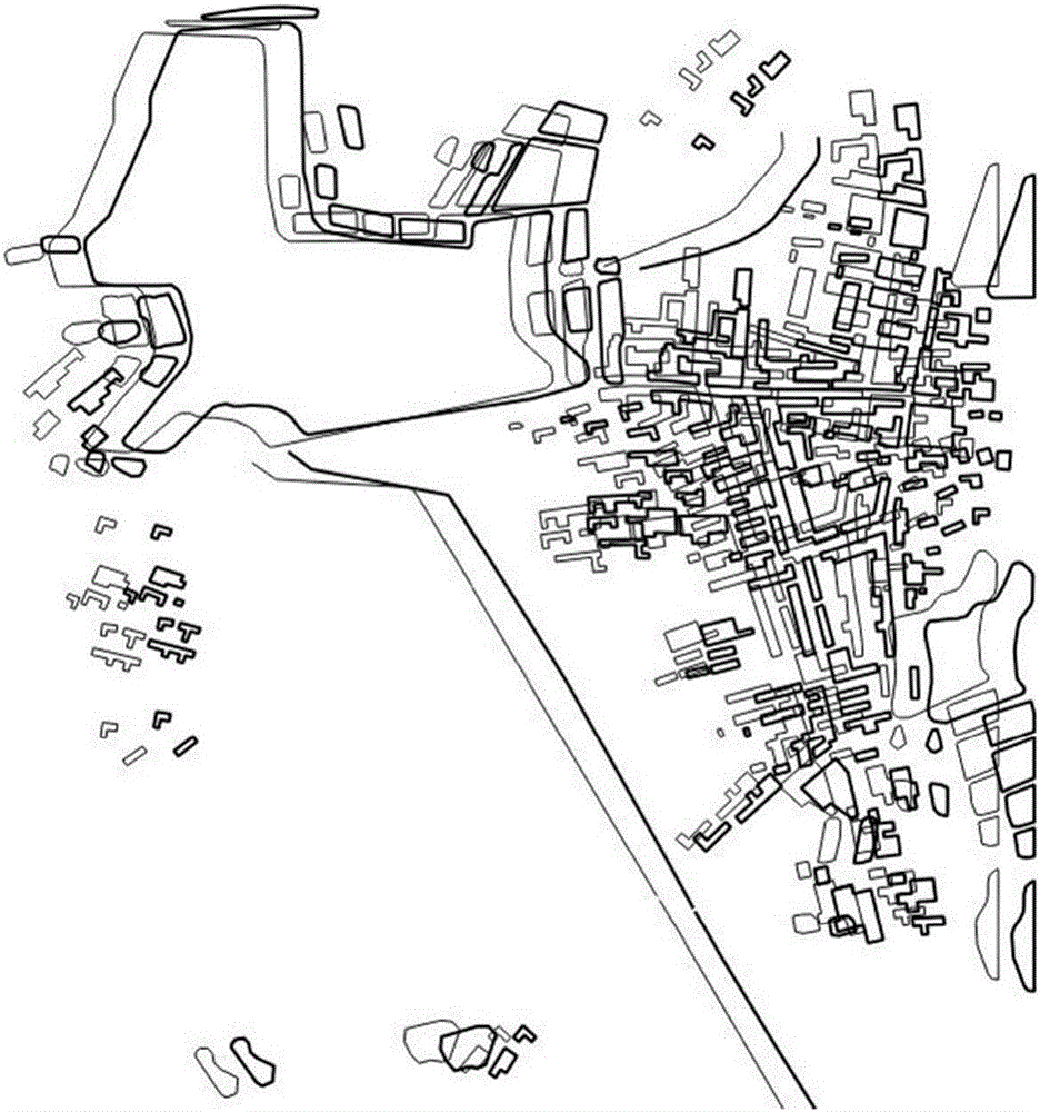
[0062] Embodiment: a kind of reversible deciphering method of vector raster geographic data based on trigonometric functions, such as figure 1 As shown, this embodiment selects the raster geographic data in tif format and the vector geographic data in shp format in the same area of ​​a certain place as the original vector raster geographic data, and its coordinate system is the WGS84 projected coordinate system, and the scale is 1:2000. The resolution of the raster data is 0.2m, the data size is 3667*3475, the original vector raster geographic data such as figure 2 As shown, the specific operation is as follows:

[0063] (1) Establishing a trigonometric function model

[0064] The trigonometric function model is established by adding a sine function and a cosine function, and its expression is as follows:

[0065] f(x)=b(a sin(ω 1 x)+(1-a)cos(ω 2 x)) (1)

[0066] where b is the amplitude value, a is used to control the shape of the function, ω 1 and ω 2 Determines the ...


PUM


Abstract

The invention provides a raster-vector geographic data reversible decryption method based on a trigonometric function. The method comprises the steps of building a trigonometric function model, calculating trigonometric function model parameters and building a decryption model according to original raster-vector geographic data, adopting the decryption model for performing decryption on the raster-vector geographic data, building a recovery model according to decryption model parameters, and adopting the recovery model for recovering the decrypted raster-vector geographic data. On the premise that the vector data topological relation is maintained unchanged, the excellent function characteristics of the trigonometric function are sufficiently utilized, and a decryption error is controlled by adjusting the amplitude; by keeping the model periodicity, and it is ensured that decryption data changes uniformly and the topology is kept good; by maintaining that an arbitrary order is derivable, the decryption effect is smooth and advanced gradually; the model attack resistance is improved, it is ensured that the decrypted data has the high safety, and has the advantages of being reversible and efficient in decryption, and technical supports can be provided for security, secrecy and sharing using of raster-vector geographic data.

Description

technical field [0001] The invention relates to the field of geographic information security, in particular to a method for reversible decryption of vector raster geographic data. Background technique [0002] my country's relevant laws, regulations and policies put forward clear confidentiality requirements for the sharing of basic geographic data, including the "Regulations on the Scope of State Secrets in Surveying and Mapping Management", "Supplementary Regulations on the Display of Public Map Contents" and "Regulations on the Public Expression of Basic Geographic Information", etc. The document stipulates the restrictions and confidentiality of public maps and geographic information, with particular emphasis on the confidentiality of basic geographic information and the spatial location accuracy of related elements. [0003] At present, the existing geometric precision declassification methods include projection transformation method, frame transformation method, error r...

Claims


Application Information

Patent Timeline
IPC IPC(8): G06F21/62G06F17/30
Inventor 于辉周卫
Owner NANJING NORMAL UNIVERSITY
Why Eureka
Try Eureka