High-standard farmland recognition method based on high-resolution remote sensing image

A remote sensing image, high-resolution technology, applied in character and pattern recognition, instruments, computer parts, etc., can solve the problem of lack of establishment, and achieve the effect of rapid recognition and accurate recognition results

Inactive Publication Date: 2017-08-29
XIAN UNIV OF SCI & TECH
View PDF2 Cites 15 Cited by
  • Summary
  • Abstract
  • Description
  • Claims
  • Application Information

AI Technical Summary

Problems solved by technology

[0004] At present, a high-standard farmland identification system based on remote sensing has basically not been established

Method used


Image

  • High-standard farmland recognition method based on high-resolution remote sensing image
  • High-standard farmland recognition method based on high-resolution remote sensing image
  • High-standard farmland recognition method based on high-resolution remote sensing image

Examples


Embodiment Construction

[0031] The specific implementation manners of the present invention will be further described in detail below in conjunction with the accompanying drawings and embodiments. The following examples are used to illustrate the present invention, but are not intended to limit the scope of the present invention. Based on the embodiments of the present invention, all other embodiments obtained by persons of ordinary skill in the art without creative efforts fall within the protection scope of the present invention.

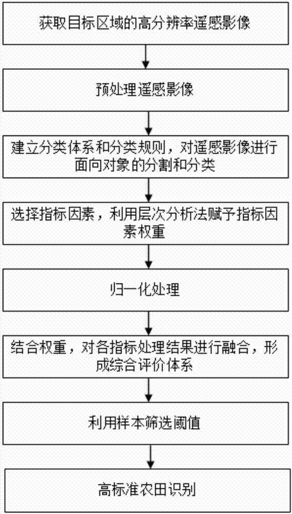
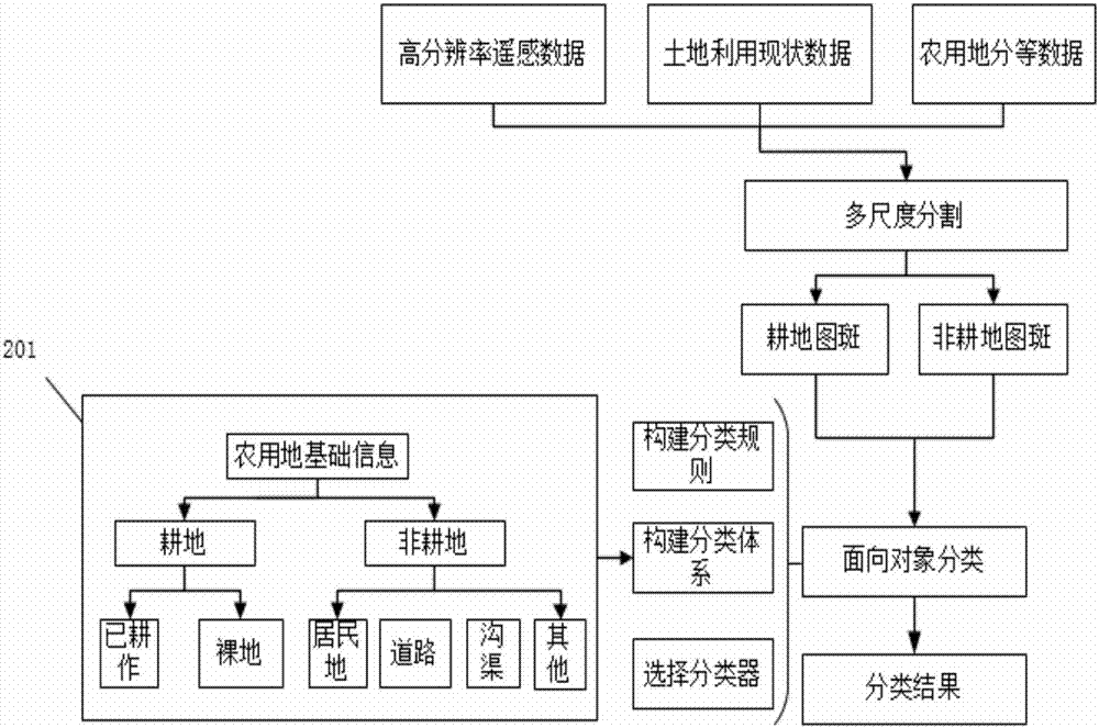
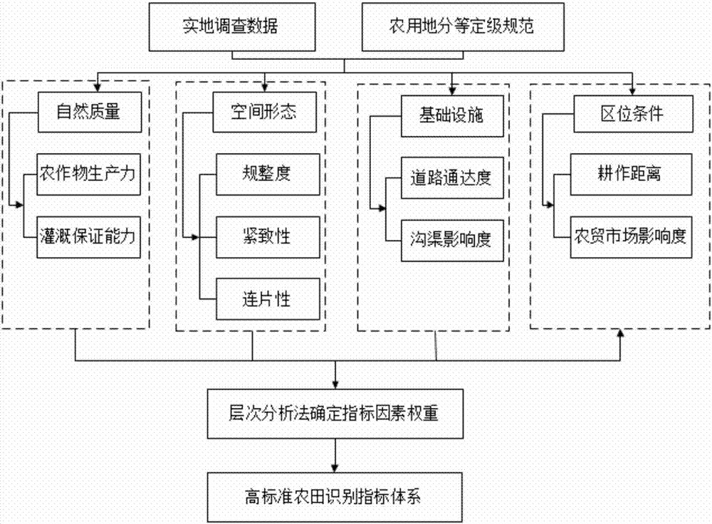
[0032] Such as figure 1 , Figure 5 As shown, the present invention provides a high-standard farmland recognition method based on high-resolution remote sensing images, and the specific steps are as follows:

[0033] Step 1. Determine the research area. According to the actual growth of the crops in the target area, select two phases of remote sensing images in the research area, namely the Gaofen-1 multispectral image for a period in the first half of the year, and th...


PUM


Abstract

The invention provides a high-standard farmland recognition method based on a high-resolution remote sensing image. The method comprises the steps: obtaining two high-resolution remote sensing images of a target region; carrying out the preprocessing of the remote sensing images; carrying out the object-oriented classification of the two high-resolution remote sensing images after preprocessing; carrying out the superposing of the two classification results, and forming plough map spot vector data; carrying out the normalization processing of a determination index value through employing an extreme difference normalization method; carrying out the processing of the plough map spot vector data through a selected index, carrying out the fusion processing of the normalization processing result through combining with the index weight, and forming a final comprehensive index processing result; selecting samples at a high-standard farmland construction base through a grid method, calculating a plurality of high-standard farmland sample point indexes, screening out a proper threshold value, judging whether the farmland belongs to a standard farmland or not, and completing the recognition of the high-standard farmland. The method achieves the recognition of the high-standard farmland based on the high-resolution remote sensing images, is accurate in recognition result, and is quick and reliable. The method achieves the effective monitoring of the high-standard farmland, and serves for a land planning department.

Description

technical field [0001] The invention relates to remote sensing image processing technology and farmland construction, in particular to a high-standard farmland identification method based on high-resolution remote sensing images Background technique [0002] Food security is related to my country's social stability, economic development, national self-reliance and other major issues. In recent years, with the rapid development of industrialization and urbanization, the lack of high-quality cultivated land resources in my country has decreased accordingly. In addition, the lack of water resources and frequent extreme weather have restricted food production. The huge population size and food demand determine that solving food problems based on the country’s cultivated land resources is always the foundation of development. In order to ensure national food security, the No. 4 document of Zhongfa pointed out that cultivated land should be protected like giant pandas, and high-st...

Claims


Application Information

Patent Timeline
Patent Type & Authority Applications(China)
IPC IPC(8): G06K9/00G06K9/62
CPCG06V20/188G06F18/24765G06F18/24
Inventor 姚顽强黄东锋马飞阮青山
Owner XIAN UNIV OF SCI & TECH
Why Eureka
Try Eureka