

Internet photo geospatial positioning method based on street views
A positioning method and geospatial technology, applied in geographic information databases, electronic digital data processing, special data processing applications, etc., can solve problems such as the absence of crowdsourced photos, limited accuracy of photo retrieval and positioning, and the inability to obtain the absolute geographic location of photos to be queried, etc. problem, to achieve the effect of increasing usability and applicability
- Summary
- Abstract
- Description
- Claims
- Application Information
AI Technical Summary
Problems solved by technology
Method used
Image

Examples
Embodiment Construction
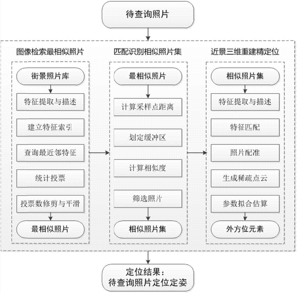
[0045] The present invention is described in detail below according to the accompanying drawings, so that the technical route and operation steps of the present invention are clearer.
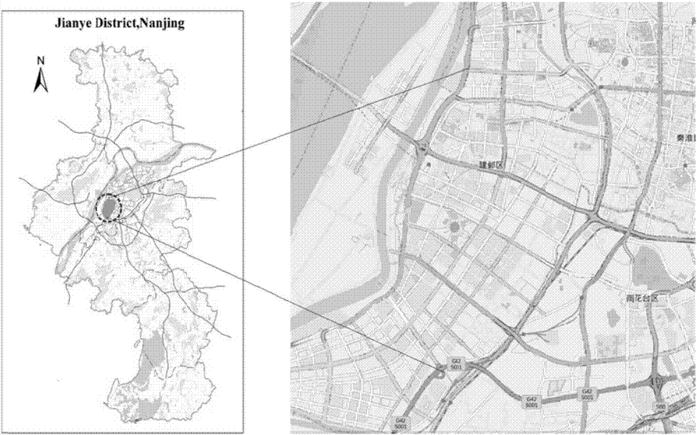
[0046] In this embodiment, Jianye District, one of the main urban areas of Nanjing, is selected as the experimental area, which is east of the Yangtze River and west of the Qinhuai River. figure 2 shown. In 2014, the Youth Olympic Games was grandly held here. In the "Post-Youth Olympic" period, Jianye District undertakes the great mission of building a modernized new Nanjing and will develop into a new center of a modernized international city. It is the most representative epitome of Nanjing's development, and its street information largely It can reflect the streetscape of Nanjing. The downloaded street view data covers nearly 180 kilometers of urban roads, with a total of about 15,000 sampling points, and the street view photo library has a data volume of 120,000 pieces.
[0047] This em...
PUM
 Abstract
Description
Claims
Application Information