Drivable Area Recognition Method Based on Image and Map Matching Based on Positioning

A driving area and map matching technology, which is applied in transportation and packaging, two-dimensional position/channel control, vehicle position/route/height control, etc., can solve problems such as difficult implementation, achieve simple structure, avoid non-real-time, Versatile effect

Active Publication Date: 2021-06-18
合肥九州龙腾科技成果转化有限公司
View PDF10 Cites 0 Cited by
  • Summary
  • Abstract
  • Description
  • Claims
  • Application Information

AI Technical Summary

Problems solved by technology

Since automatic driving in all working conditions cannot be realized immediately, automatic driving in local areas is not difficult to realize due to the simple environment structure

Method used


Image

  • Drivable Area Recognition Method Based on Image and Map Matching Based on Positioning
  • Drivable Area Recognition Method Based on Image and Map Matching Based on Positioning

Examples


Embodiment Construction

[0019] The present invention will be further described below in conjunction with the accompanying drawings and specific examples. It should be pointed out that the following is only an optimized technical solution and design principle for illustration, but the protection scope of the present invention is not limited thereto.

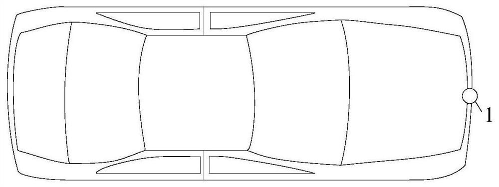
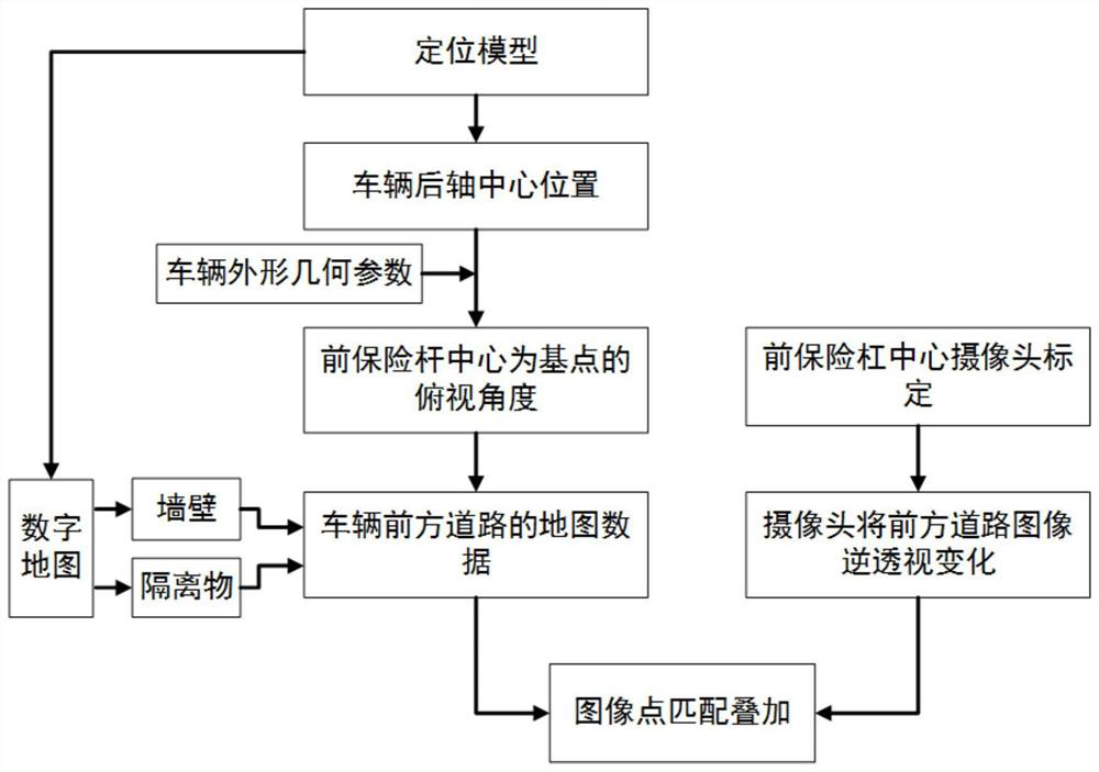
[0020] The present invention proposes a drivable area recognition method based on location-based image and map matching adapted to underground parking lot ramps. The positioning coordinates of the current vehicle in the ramp are obtained by the autonomous vehicle internal positioning system. Based on this positioning coordinates, the The map data ahead of the current position is extracted from the high-precision map of the ramp, and at this time the recognition system extracts the image from the camera in the middle of the front bumper of the autonomous vehicle, and points match the map data of the current position with the camera image to obtain the front...


PUM


Abstract

The invention discloses a drivable area identification method based on positioning-based image and map matching, which includes the following steps: 1) When an autonomous vehicle enters a ramp of an underground parking lot for unmanned driving, the positioning system in the autonomous vehicle can obtain The position of the vehicle on the ramp at the moment. 2) According to the position obtained by the positioning system, the drivable area identification system extracts the forward ramp information of the current position from the high-precision map; at the same time, the drivable area identification system extracts the image in the current vehicle camera. 3) Perform point matching between the image extracted from the high-precision map and the image obtained from the camera, and input the result of image matching and fusion into the drivable area recognition system, thereby identifying the walls, isolation facilities and other vehicles in the front area. The invention better solves the problem of driving area recognition in the slope of automatic driving in the area of ​​the underground parking lot in the future, has strong universality, and has high recognition accuracy and real-time performance.

Description

technical field [0001] The invention relates to the field of automatic driving, in particular to a drivable area recognition method based on positioning image and map matching. Background technique [0002] More and more car companies and Internet companies are vigorously deploying autonomous driving technology. At present, various companies also have some rudimentary autonomous driving vehicles that have been reported. [0003] However, due to the complexity and unpredictability of the working conditions and the limitations of current technology in order to realize the automatic driving under all working conditions, it is difficult to make a major breakthrough in the real automatic driving under all working conditions in the near future. . Like Google, even though self-driving vehicles have been tested on actual roads for a long distance, they dare not rush to launch fully automatic driving. [0004] At present, it is difficult to implement autonomous driving products, wh...

Claims


Application Information

Patent Timeline
Patent Type & Authority Patents(China)
IPC IPC(8): G05D1/02
CPCG05D1/0214G05D1/0251G05D1/0257G05D1/0276G05D2201/0212
Inventor 江浩斌张旭培马世典
Owner 合肥九州龙腾科技成果转化有限公司
Why Eureka
Try Eureka