An urban road network model for lane-level navigation and positioning
A navigation and positioning, lane-level technology, applied in the field of vehicle navigation and positioning, can solve the problems of restricting digital map attribute expansion and accuracy improvement, large signal error, lack of high-precision positioning data information, etc.
- Summary
- Abstract
- Description
- Claims
- Application Information
AI Technical Summary
Problems solved by technology
Method used
Image
Examples
Embodiment Construction
[0053] Below in conjunction with accompanying drawing and specific embodiment the present invention is described in further detail:
[0054] The present invention proposes an urban road network model oriented to lane-level navigation and positioning. The model framework is novel and reasonable, and the data structure is concise and perfect. With the advantages of complete quantity, high precision, and wide applicability, it can realize accurate, continuous, and real-time navigation and positioning of vehicles in complex urban traffic environments, and meet the needs of lane-level navigation and positioning.
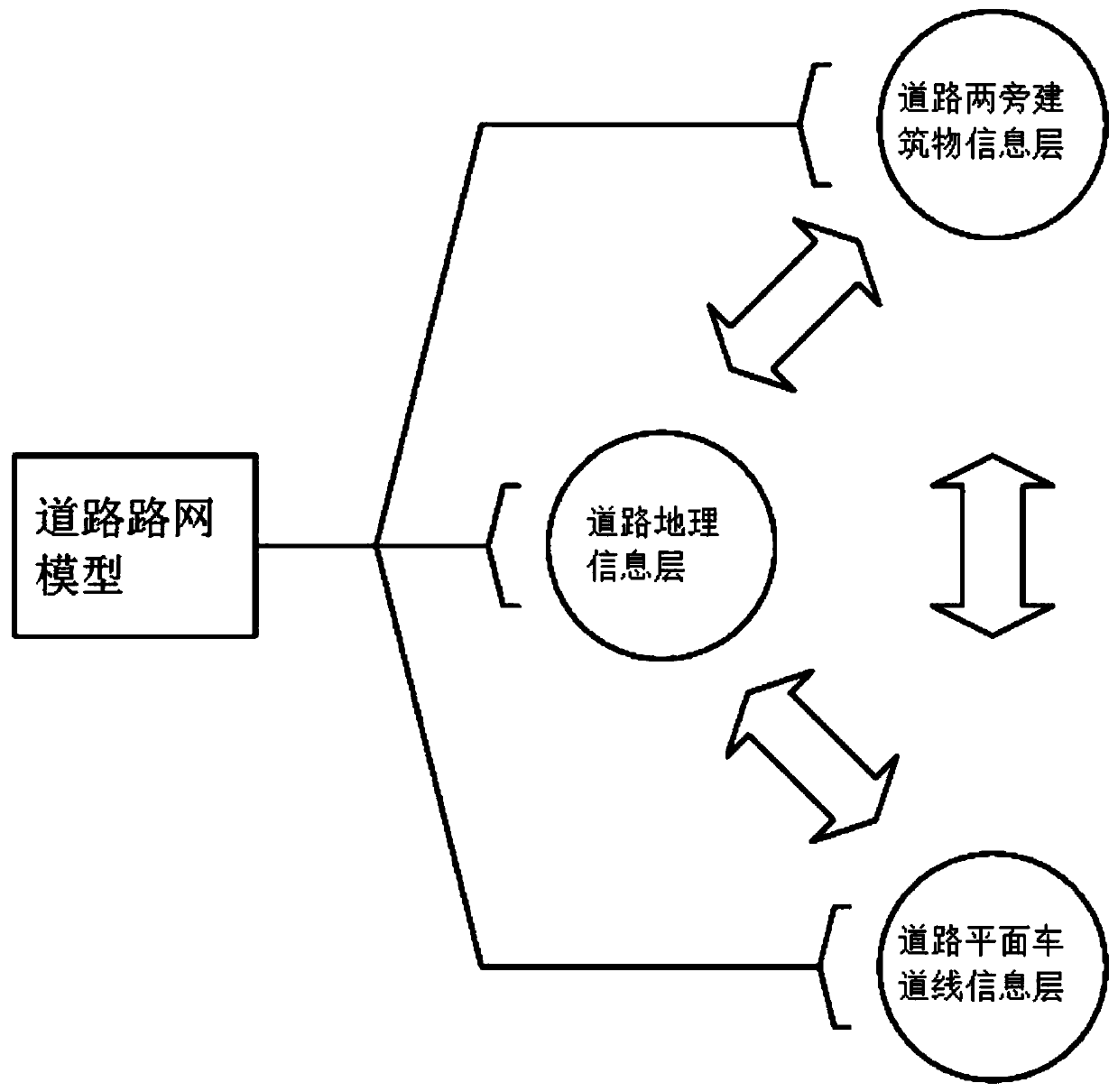
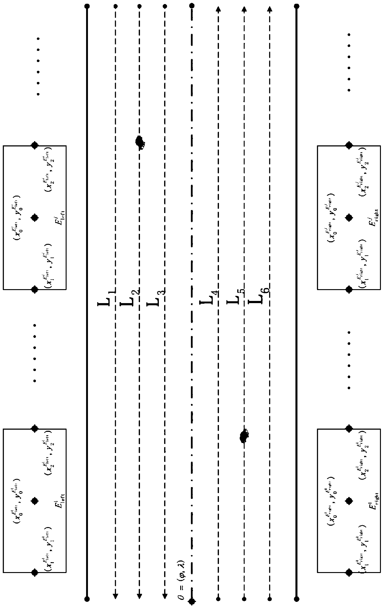
[0055] As an embodiment of the present invention, the present invention proposes as figure 1 and figure 2 Shown is an urban road network model for lane-level navigation and positioning. This model is based on the model framework and data structure of traditional road-level digital maps, and redefines the urban road network framework for the actual needs of lane-level na...
PUM
 Abstract
Description
Claims
Application Information
 - R&D
- Intellectual Property
- Life Sciences
- Materials
- Tech Scout
- Unparalleled Data Quality
- Higher Quality Content
- 60% Fewer Hallucinations
Browse by: Latest US Patents, China's latest patents, Technical Efficacy Thesaurus, Application Domain, Technology Topic, Popular Technical Reports.
© 2025 PatSnap. All rights reserved.Legal|Privacy policy|Modern Slavery Act Transparency Statement|Sitemap|About US| Contact US: help@patsnap.com


