A Block Adjustment Method for Satellite Imagery Based on Nonlinear Estimation of Constraint Function
A block network adjustment and non-linear estimation technology, applied in the field of satellite photogrammetry, can solve the problems of uncontrollable accuracy and loss of function, and achieve the effect of easy design and implementation, and reduce model error
- Summary
- Abstract
- Description
- Claims
- Application Information
AI Technical Summary
Problems solved by technology
Method used
Image
Examples
Embodiment 1
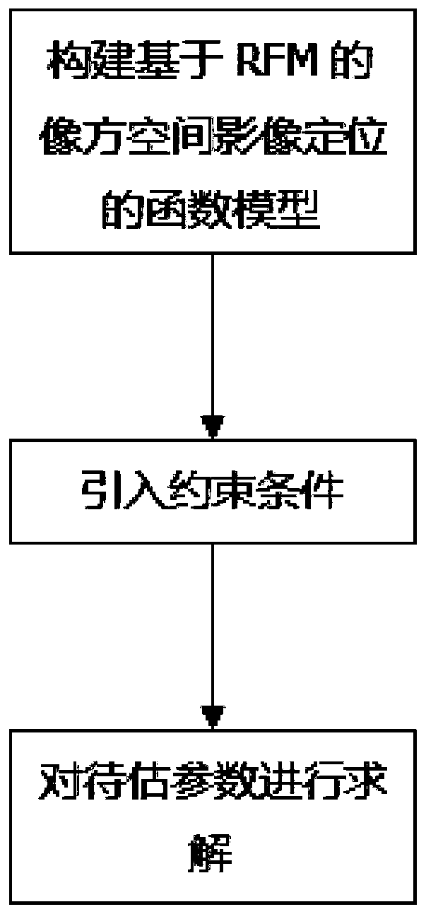
[0074] refer to figure 1 , figure 1 It is a general framework diagram of a satellite image block network adjustment method based on the non-linear estimation of the constraint function of the present invention.
[0075] A kind of satellite image area network adjustment method based on constraint function nonlinear estimation of the present invention comprises the following steps:
[0076] S01: Construct a function model of image space image positioning based on RFM;
[0077] The Rational Polynomial Coefficient file (Rational Polynomial Coefficient), that is, the RPC file, is provided in the image metadata acquisition, which is used to determine the quantitative relationship between the object space point and the corresponding image point; the image is geometrically corrected and compensated for system errors such as affine transformation, The system error is expressed as the affine transformation of the image point coordinates, and the block adjustment is added to the ration...
Embodiment 2
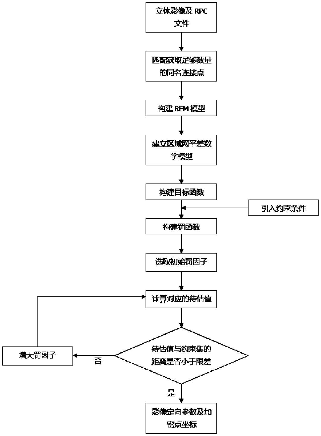
[0101] refer to figure 2 , figure 2 It is a detailed flow chart of a satellite imagery block adjustment method based on the nonlinear estimation of the constraint function. The specific process of the satellite imagery block adjustment method based on the non-linear estimation of the constraint function of the present invention is as follows.
[0102] S01: Construct a function model of image space image positioning based on RFM
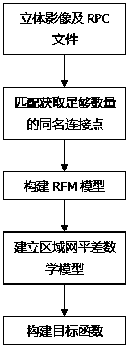
[0103] refer to image 3 , image 3 It is a flow chart of the present invention to construct a function model of RFM-based image space image positioning.
[0104] S011: Acquiring stereo images and RPC files
[0105] Obtain stereo images and RPC files in image metadata.
[0106] S012: Match to obtain a sufficient number of connection points with the same name
[0107] Use the least squares image matching algorithm to match the stereoscopic image sequence, obtain a sufficient number of connection points with the same name, and create a connecti...
Embodiment 3
[0159] The specific implementation of the satellite imagery block adjustment method based on the non-linear estimation of the constraint function of the present invention is as follows.
[0160] S01: Construct a function model of image space image positioning based on RFM
[0161] S011: Acquiring stereo images and RPC files
[0162] Obtain stereo images and RPC files in image metadata.
[0163] S012: Match to obtain a sufficient number of connection points with the same name
[0164] Use the least squares image matching algorithm to match the stereoscopic image sequence, obtain a sufficient number of connection points with the same name, and create a connection point file. The information recorded in the connection point file includes the number of the image where each connection point is located, and the coordinates of the image point.
[0165] S013: Build RFM model
[0166] Use the RPC file to construct the RFM model describing the quantitative relationship between the obje...
PUM
 Abstract
Description
Claims
Application Information
 - R&D
- Intellectual Property
- Life Sciences
- Materials
- Tech Scout
- Unparalleled Data Quality
- Higher Quality Content
- 60% Fewer Hallucinations
Browse by: Latest US Patents, China's latest patents, Technical Efficacy Thesaurus, Application Domain, Technology Topic, Popular Technical Reports.
© 2025 PatSnap. All rights reserved.Legal|Privacy policy|Modern Slavery Act Transparency Statement|Sitemap|About US| Contact US: help@patsnap.com


