
Method for monitoring reservoir patrolling in real time based on three-dimensional GIS

A real-time monitoring and reservoir technology, applied in the field of geographic information and water conservancy informatization, can solve the lack of timeliness in the management of reservoir inspection tasks, the inability to monitor the inspection routes of inspection personnel in real time, the informatization degree of reservoir inspection and low implementation efficiency And other issues

Active Publication Date: 2018-01-12
CHANGJIANG RIVER SCI RES INST CHANGJIANG WATER RESOURCES COMMISSION
View PDF7 Cites 23 Cited by
  • Summary
  • Abstract
  • Description
  • Claims
  • Application Information

AI Technical Summary

Problems solved by technology

At present, the inspection of reservoirs is mainly carried out through manual on-site inspections. The status of inspections cannot be known until the inspection is completed and the report is submitted. The degree of informatization and implementation efficiency of reservoir inspections are low.
It is difficult for the reservoir management department to grasp the inspection effect, the situation of the reservoir site cannot be understood in real time, and the actual inspection route of the inspectors cannot be supervised in real time. high standards

Method used


Image

  • Method for monitoring reservoir patrolling in real time based on three-dimensional GIS
  • Method for monitoring reservoir patrolling in real time based on three-dimensional GIS
  • Method for monitoring reservoir patrolling in real time based on three-dimensional GIS

Examples


Embodiment Construction

[0026] The technical solutions in the present invention will be clearly and completely described below in conjunction with the accompanying drawings in the present invention.

[0027] One of the embodiments of the real-time monitoring method for reservoir inspection based on three-dimensional GIS of the present invention comprises the following steps:

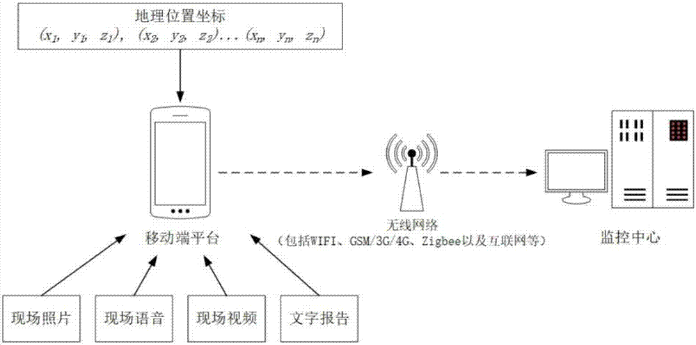
[0028] In the first step, inspectors use the mobile terminal platform (such as handheld information collection mobile terminal) to communicate with the monitoring center, and transmit geographic location coordinates and on-site environmental information (see figure 1 ).

[0029] Reservoir inspection personnel use the mobile terminal platform to transmit the geographic location coordinates to the monitoring center through the wireless network (such as WIFI, GSM / 3G / 4G, Zigbee, and the Internet, etc.) at the same time period, and upload the data with a time stamp to indicate the progress. The mobile terminal equipment also record...


PUM


Abstract

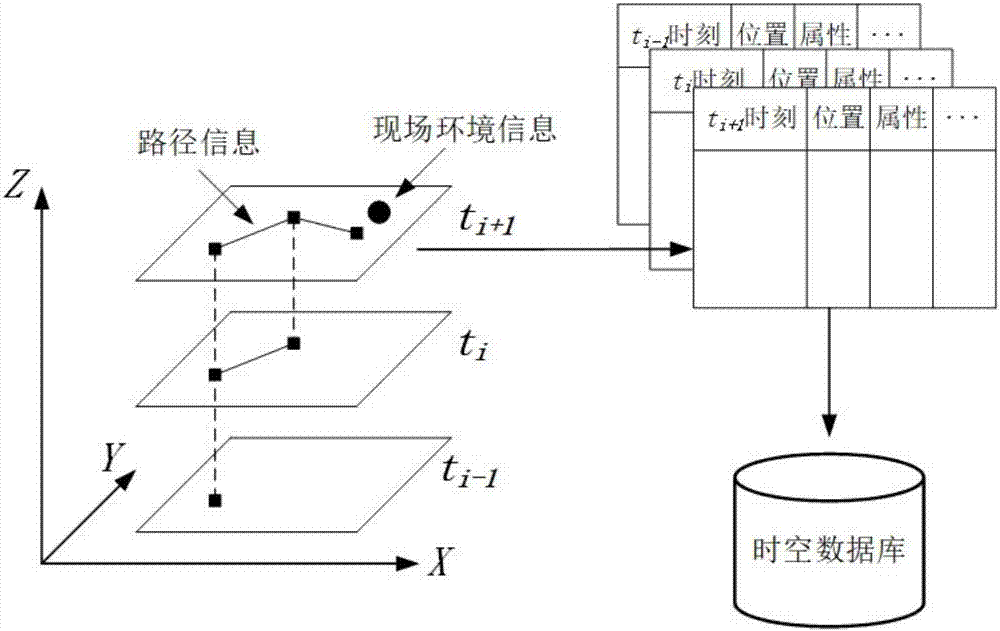
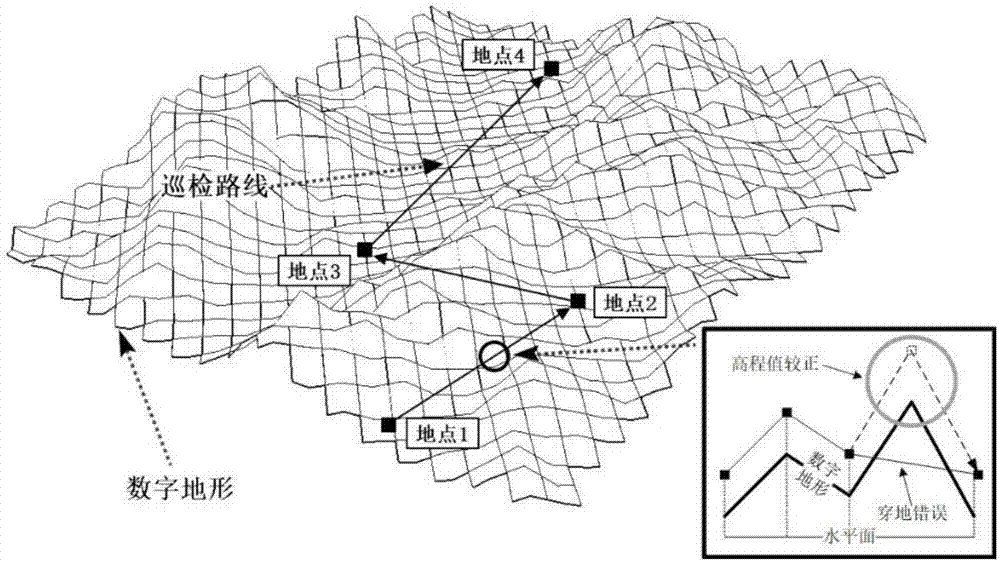
The invention discloses a method for monitoring reservoir patrolling in real time based on three-dimensional GIS. The method comprises the following steps: communicating a mobile terminal platform with a monitoring center to transmit geographic location coordinates and site environment information; constructing a reservoir patrolling spatio-temporal database for recording patrolling task information by the monitoring center; constructing a three-dimensional digital scene model of a reservoir region by utilizing a three-dimensional GIS and unmanned aerial vehicle oblique photography to displaypatrolling track information of the patrolling task and site environment attribute information; updating patrolling task progress in real time, displaying a complete patrolling route change in a three-dimensional digital geographic scene of the reservoir region, and providing real-time browsing of patrolling information; and after finishing the reservoir patrolling task, storing space data acquired in the patrolling task and historical data information, providing task backtracking at any angle of view in the three-dimensional digital geographic scene, and submitting a reservoir patrolling digital report. The method provided by the invention can simulate site conditions and progress of the patrolling task more accurately, and achieve purposes of informationization, contextualization and effectuation of the monitoring of the reservoir patrolling task.

Description

technical field [0001] The invention relates to the technical field of geographic information and water conservancy information, in particular to a three-dimensional GIS-based real-time monitoring method for reservoir inspection. Background technique [0002] With the rapid development of water conservancy, China has built a large number of water conservancy projects, and there are more than 80,000 reservoirs of various types. According to the relevant provisions of the national reservoir management, to ensure the safety of the reservoir project, it is necessary to send special personnel to conduct regular patrol inspections on the reservoir. At present, reservoir inspections are mainly carried out through manual on-site inspections, and the status of inspections cannot be known until personnel submit reports after inspections. The degree of informatization and implementation efficiency of reservoir inspections are low. It is difficult for the reservoir management departmen...

Claims


Application Information

Patent Timeline
Patent Type & Authority Applications(China)
IPC IPC(8): G01C11/00G01C13/00
CPCY02A90/30
Inventor 陈文龙杨云丽张煜叶松沈定涛曹波卢云峰魏思奇方喻弘黄晓贞
Owner CHANGJIANG RIVER SCI RES INST CHANGJIANG WATER RESOURCES COMMISSION
Learn More