A positioning and navigation system based on space-based random radio signals

A radio signal, positioning and navigation technology, applied in the field of positioning and navigation systems, achieves low cost, reduced construction costs, and obvious advantages

Active Publication Date: 2020-09-04
ACAD OF OPTO ELECTRONICS CHINESE ACAD OF SCI
View PDF3 Cites 0 Cited by
  • Summary
  • Abstract
  • Description
  • Claims
  • Application Information

AI Technical Summary

Problems solved by technology

[0008] In view of this, the present invention makes up for the shortcomings of the existing satellite navigation and positioning system constellation / signal transparency and vulnerability, and ensures local / hot spot emergency navigation and positioning in complex scenarios (physical occlusion, electromagnetic interference, deliberate strike / confrontation, etc.) To meet the needs of timing services, a positioning and navigation system based on space-based random radio signals is proposed. This system has the advantages of strong anti-interference ability, invulnerability, low cost and easy deployment.

Method used


Image

  • A positioning and navigation system based on space-based random radio signals
  • A positioning and navigation system based on space-based random radio signals
  • A positioning and navigation system based on space-based random radio signals

Examples


example 1

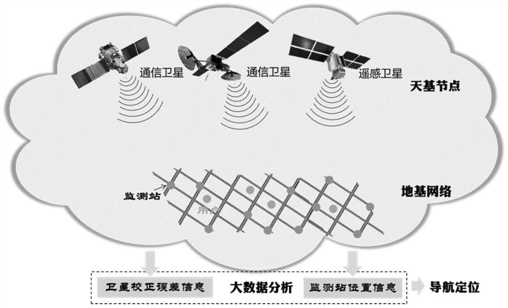
[0102] In the present invention, the framework schematic diagram of space-based random radio signal navigation system, such as figure 1 shown.

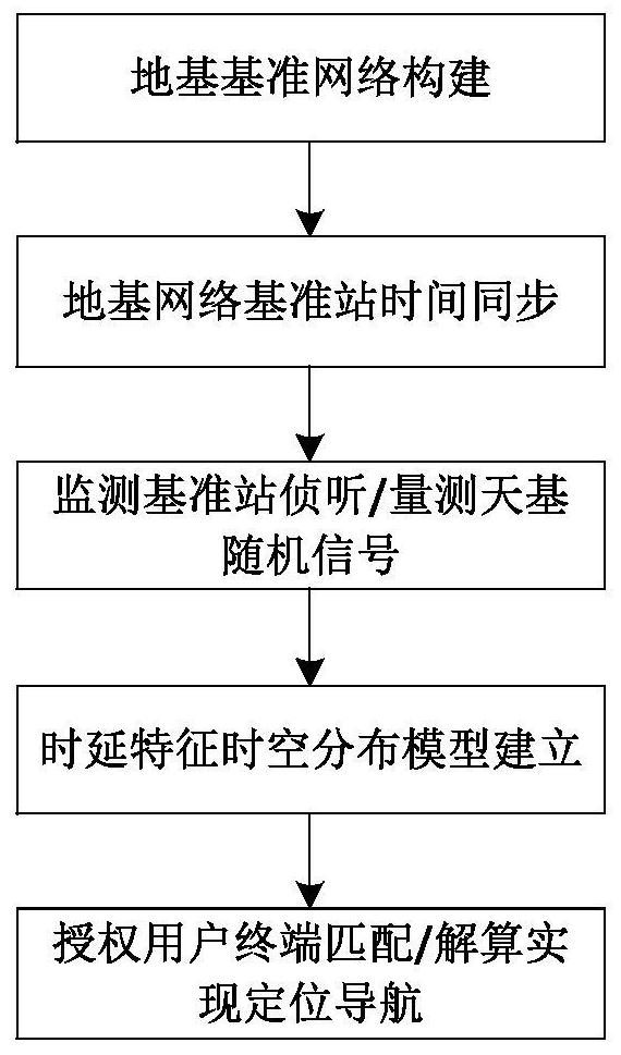
[0103] In conjunction with the flow chart of the embodiment, the basic implementation process is described as follows:

[0104] a) Construction of ground-based reference network;

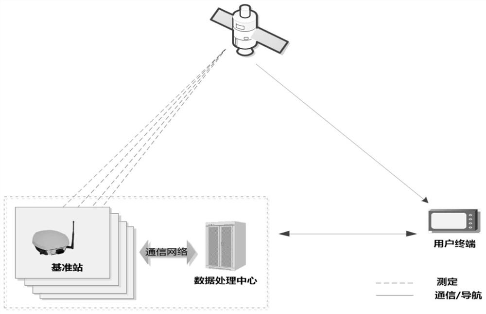
[0105] The schematic diagram of ground-based reference network construction is as follows: Figure 4 shown. According to the geographical environment, coverage and service accuracy requirements of the hotspot service area, the number and geometric layout of the ground reference network monitoring reference stations are determined. In principle, the larger the service area, the higher the service accuracy, and the more requirements for the number of monitoring reference stations. The geometric layout of the monitoring reference station can be selected according to the geometric precision factor DOP. Assume that N monitoring reference stations are set in...


PUM


Abstract

The invention provides a positioning navigation system based on space-based random radio signals. The positioning navigation system comprises a space-based non-navigation satellite / constellation, a ground reference station network, and a user terminal. The ground reference station network is formed by multiple monitoring reference stations with known coordinate positions, an inter-station communication network and a data processing center. The user terminal monitors downlink radio signals of the space-based non-navigation satellite and sends the signals to the data processing center through the inter-station communication network. The monitoring reference stations are used for monitoring the downlink radio signals of the space-based non-navigation satellite and sending the signals to the data processing center through the inter-station communication network. The data processing center establishes a time delay characteristic space-time distribution model on the basis of the signals sentfrom the monitoring reference stations, and can resolve the position of the space-based non-navigation satellite on the basis of the model. According to the signals sent from the user terminal, the data processing center matches / resolves the position of the user terminal on the basis of the time delay characteristic space-time distribution model to achieve positioning navigation. The system has the advantages and characteristics of exhibiting high an anti-interference capability, being destroy-resistant, surviving well, being low in cost, being easy to arrange, etc.

Description

technical field [0001] The invention belongs to the technical field of radio navigation and communication, and in particular relates to a positioning and navigation system based on space-based random radio signals. Background technique [0002] Global Navigation Satellite System (GNSS), as a satellite-based radio navigation system, is committed to providing military / civilian users with high-precision / reliable positioning, navigation and timing (Position, Navigation and Time, PNT) function. Extensive and effective innovative applications permeate into all fields of the national economy and play a pivotal role. [0003] The rapid development of information technology and the rise of location-based services have continuously expanded the application fields of GNSS systems, and at the same time, put forward higher performance and accuracy requirements for the system. Based on strategic and economic considerations, GNSS has successively launched system upgrades, such as the mod...

Claims


Application Information

Patent Timeline
Patent Type & Authority Patents(China)
IPC IPC(8): G01S5/10G01S5/14G01S5/00
Inventor 袁洪罗瑞丹徐颖欧阳光洲袁超唐阳阳袁杰汪建明
Owner ACAD OF OPTO ELECTRONICS CHINESE ACAD OF SCI
Why Eureka
Try Eureka