
High-resolution satellite data-based TRMM rainfall data downscaling method

A satellite data, high-resolution technology, applied in electrical digital data processing, special data processing applications, complex mathematical operations, etc., can solve the problems of not considering the lag of vegetation to precipitation, and the spatial inconsistency of vegetation index.

Inactive Publication Date: 2018-01-19
BEIJING NORMAL UNIVERSITY
View PDF1 Cites 20 Cited by
  • Summary
  • Abstract
  • Description
  • Claims
  • Application Information

AI Technical Summary

Problems solved by technology

This method also does not consider the hysteresis of vegetation to precipitation, and the spatial inconsistency of vegetation index due to groundwater, irrigation, etc., and there may be certain errors

Method used


Image

  • High-resolution satellite data-based TRMM rainfall data downscaling method
  • High-resolution satellite data-based TRMM rainfall data downscaling method
  • High-resolution satellite data-based TRMM rainfall data downscaling method

Examples


Embodiment Construction

[0061] Below in conjunction with accompanying drawing, technical scheme of the present invention is described in further detail:

[0062] The present invention provides a TRMM precipitation data downscaling method based on high-resolution satellite data. From the point of view of the prior art, there are some defects in the downscaling process.

[0063] 1. In the process of downscaling, the influence factors of precipitation are not comprehensively considered, or the possible influence factors are considered too much. This method selects meteorological factors and topographic elements related to precipitation as comprehensively as possible, and takes into account the possible multicollinearity of different variables. , select by step regression.

[0064] 2. At present, the final data resolution obtained by most downscaling methods is still relatively low. This method downscales by selecting meteorological element data with higher resolution, and finally obtains 1km×1km precipi...


PUM


Abstract

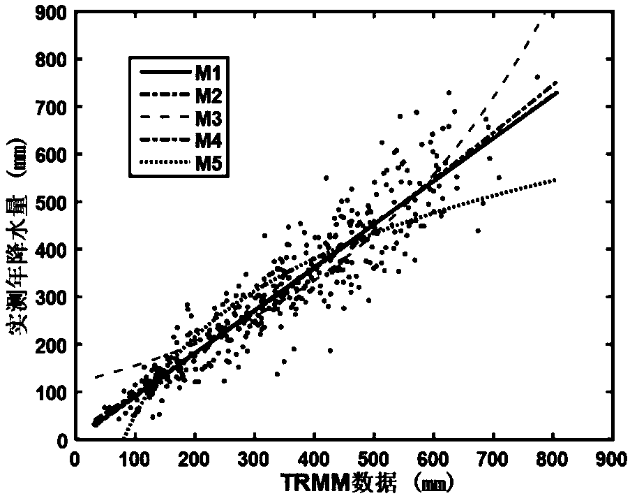
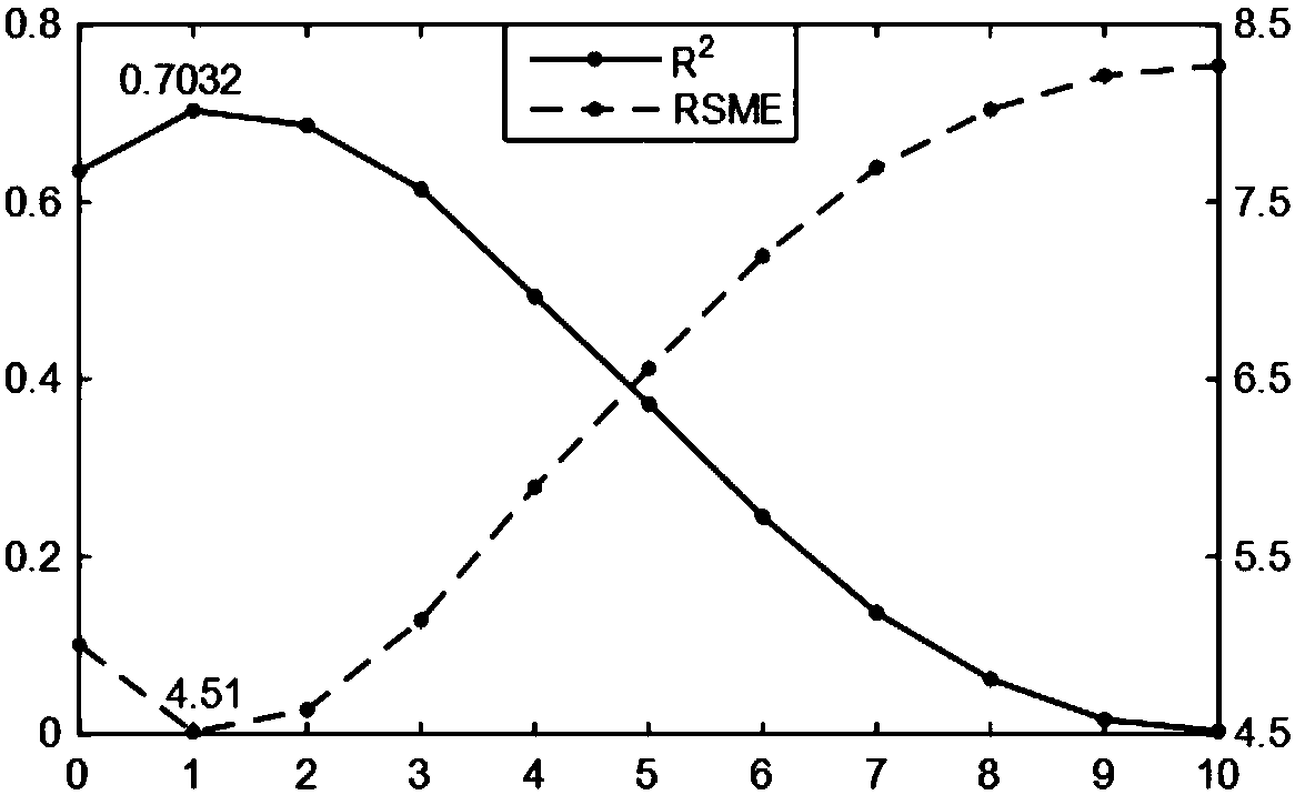
The invention relates to a high-resolution satellite data-based TRMM rainfall data downscaling method. The method comprises the following steps of: firstly obtaining multiple pieces of satellite meteorological data through an official way, and correcting TRMM remote sensing rainfall data through a Leave-one-out cross validation method; and selecting a variable through step regression according tofactors influencing the rainfall data, considering hysteresis quality, for vegetation, of rainfall and spatial correlation of the vegetation, establishing a multi-spatial scale model, and selecting anoptimum model to downscale the rainfall data. The method is simple in process and correct in rainfall prediction.

Description

technical field [0001] The invention relates to the technical field of meteorological prediction, in particular to a method for downscaling TRMM precipitation data based on high-resolution satellite data. Background technique [0002] Precipitation is an important part of the processes of material exchange and hydrological cycle in various circles on the global surface. Precipitation data is the most important data basis for the study of hydrology, meteorology, ecology and other fields, which can promote the understanding of water cycle process, water resource management, and alleviation of water resource shortage. At present, the main ways to obtain precipitation data are: actual measurement of rainfall stations and inversion by using remote sensing technology. Traditional regional precipitation data are usually obtained through spatial interpolation based on observation station data. In areas where there are few rainfall stations, the limited observation data can only ref...

Claims


Application Information

Patent Timeline
IPC IPC(8): G06F17/18G06F17/50
Inventor 张强范科科刘剑宇顾西辉史培军孙鹏
Owner BEIJING NORMAL UNIVERSITY
Learn More