

Navigation interest point retrieval method and device
A technology of point of interest and retrieval method, applied in the field of navigation point of interest retrieval method and device, to achieve the effect of avoiding crash and improving retrieval stability
- Summary
- Abstract
- Description
- Claims
- Application Information
AI Technical Summary
Problems solved by technology
Method used
Image


Examples
Embodiment 1
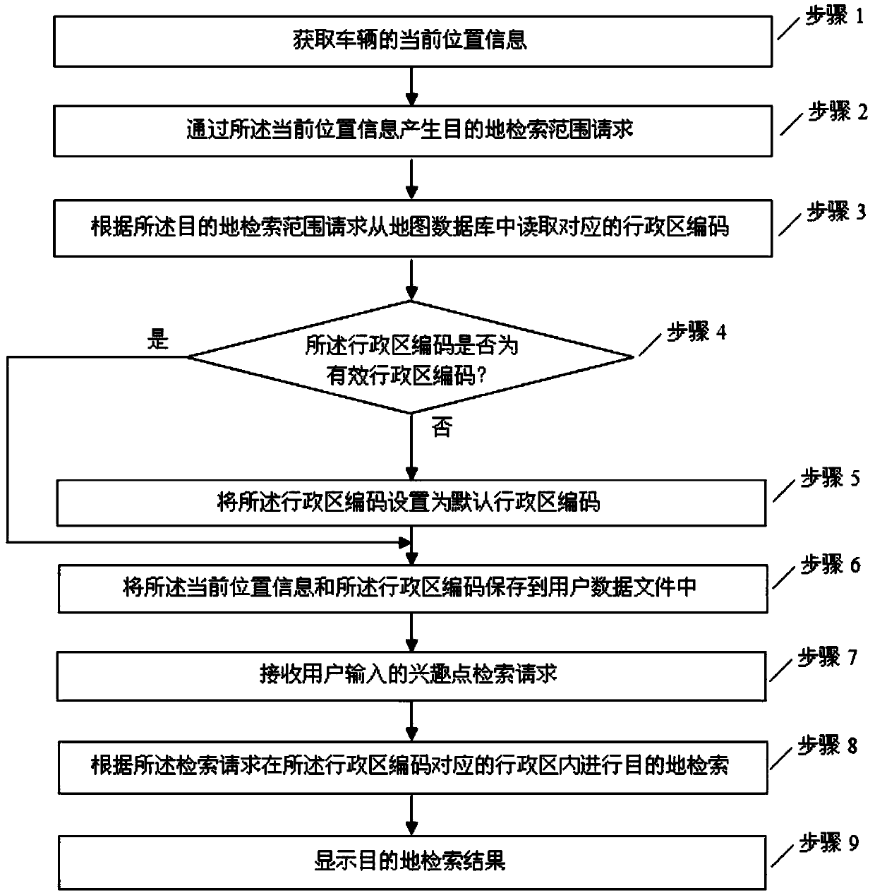
[0052] Such as figure 1 As shown, this embodiment provides a navigation point of interest retrieval method, including:
[0053] Step 1. Obtain the current location information of the vehicle.
[0054] In the car navigation system, the current location information is generally obtained through the navigation and positioning module, and the positioning can also be assisted by means of a data network.
[0055] The current location information mainly includes the latitude and longitude of the current location, and may also include altitude.
[0056] Step 2. Generate a destination retrieval range request based on the current location information.
[0057] In the car navigation system, a destination retrieval module is set, which is usually displayed as a retrieval interface, which includes icons of various retrieval types, such as "point of interest query" icon, "category query" icon, etc., which can be Set according to the actual application. Each search category is divided in...
Embodiment 2
[0072] Such as Figure 4 As shown, different from Embodiment 1, it also includes after step 4:
[0073] Step 41: Search within a search range centered on the current location information and with a preset distance as a radius.
[0074] Step 42, judging whether there is MESH within the search range, if yes, proceed to the next step, otherwise proceed to step 5;
[0075] MESH is the meaning of map segmentation area, which is a grid composed of a series of networks within the boundary.
[0076] Step 43, traversing the point sequence information of each administrative area of each MESH to obtain the shape of each administrative area.
[0077] Step 44, traversing the shape of each administrative area to obtain the administrative area code corresponding to the administrative area closest to the current location information.
[0078] In this embodiment, the step 41 includes:
[0079] Step 411. Calculate the lower left and upper right ranges of the current location.
[0080] St...
Embodiment 3
[0086] Such as Figure 5 As shown, another aspect of the present invention provides a navigation point of interest retrieval device, including a positioning module, a retrieval mode selection module, a retrieval range request module, a map database, an administrative area code reading module, an administrative area code judgment module, an administrative area code setting module, User database, point of interest input module, search engine module, search display module;
[0087] The positioning module is used to obtain current location information;
[0088] The retrieval method selection module is used to select a retrieval method;
[0089] The search range request module is configured to generate a destination search range request based on the current location information;
[0090] The map database is used to store navigation map data;
[0091] The administrative area code reading module is used to read the corresponding administrative area code from the map database for t...
PUM
 Abstract
Description
Claims
Application Information