

Forest land classification method based on remote sensing image
A technology of remote sensing image and classification method, applied in the field of remote sensing and geographic information system, can solve the problems of large minimum area of forest area and small mapping scale, so as to ensure the consistency of classification and the comparability of results, and improve the classification accuracy.
- Summary
- Abstract
- Description
- Claims
- Application Information
AI Technical Summary
Problems solved by technology
Method used
Image

Examples
Embodiment Construction
[0021] In order to better understand the present invention, the method of the present invention will be further described below with reference to the description of the embodiments in conjunction with the accompanying drawings.
[0022] In the following detailed description, numerous specific details are set forth in order to provide a thorough understanding of the present invention. However, it will be understood by those skilled in the art that the present invention may be practiced without these specific details. In the embodiments, well-known methods, procedures, components have not been described in detail so as not to unnecessarily obscure the embodiments.
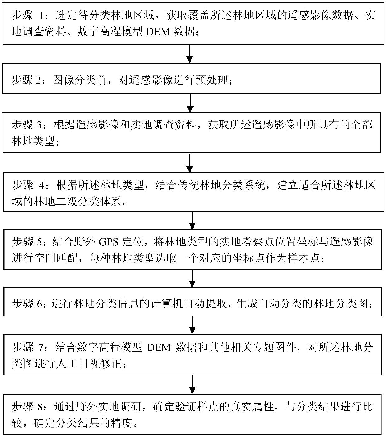
[0023] see figure 1 As shown, a kind of woodland classification method based on remote sensing image of the present invention is characterized in that, specifically comprises the following steps:
[0024] Step 1: Select the woodland area to be classified, and obtain remote sensing image data, field survey data, and...
PUM
 Abstract
Description
Claims
Application Information