

A Space Synchronization Method for Bistatic SAR Imaging System for Aircraft Landing
An imaging system and aircraft technology, applied in the field of electronics, can solve the problems of reduced use efficiency of the airborne runway scene image observation system, etc.
- Summary
- Abstract
- Description
- Claims
- Application Information
AI Technical Summary
Problems solved by technology
Method used
Image

Examples
Embodiment Construction
[0014] The specific embodiment of the present invention will be further described in detail below in conjunction with the accompanying drawings.
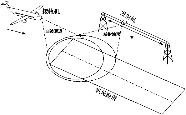
[0015] The specific application of the present invention is based on such as figure 1 In the scene shown, there is an elevated track parallel to the airport runway near the airport runway. The radar wave transmitter in the bistatic SAR imaging system is installed on the elevated track. For the aircraft that needs to be guided, the bistatic SAR imaging system is installed on the aircraft In the radar wave receiver, the basic principle of bistatic SAR imaging is that after the radar wave emitted by the transmitter is reflected on the runway, the reflected wave can be received by the receiver on the aircraft, and the SAR image of the runway can be calculated according to the reflected wave.
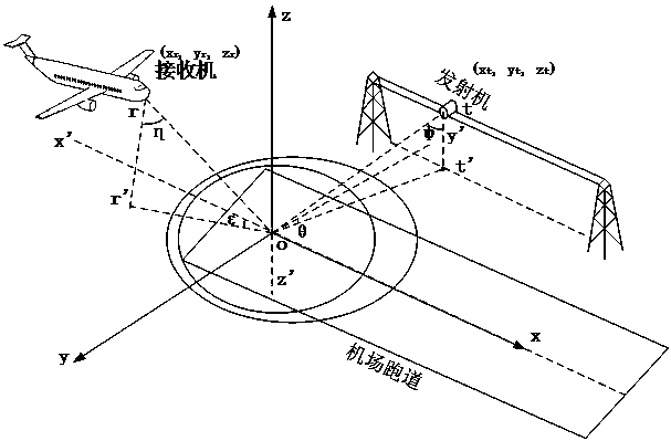
[0016] Bistatic SAR imaging system space synchronization method of the present invention, comprises the steps:
[0017] With GPS as the position...
PUM
 Abstract
Description
Claims
Application Information