

Position correction method based on CORS, positioning terminal and positioning system
A technology for positioning terminals and positioning systems, applied in satellite radio beacon positioning systems, radio wave measurement systems, measurement devices, etc., can solve the problem that hardware improves positioning accuracy, the positioning accuracy of ordinary mobile terminals cannot fully meet the needs, and users cannot modify it. and other problems to achieve the effect of improving the positioning accuracy
- Summary
- Abstract
- Description
- Claims
- Application Information
AI Technical Summary
Problems solved by technology
Method used
Image

Examples
Embodiment 1
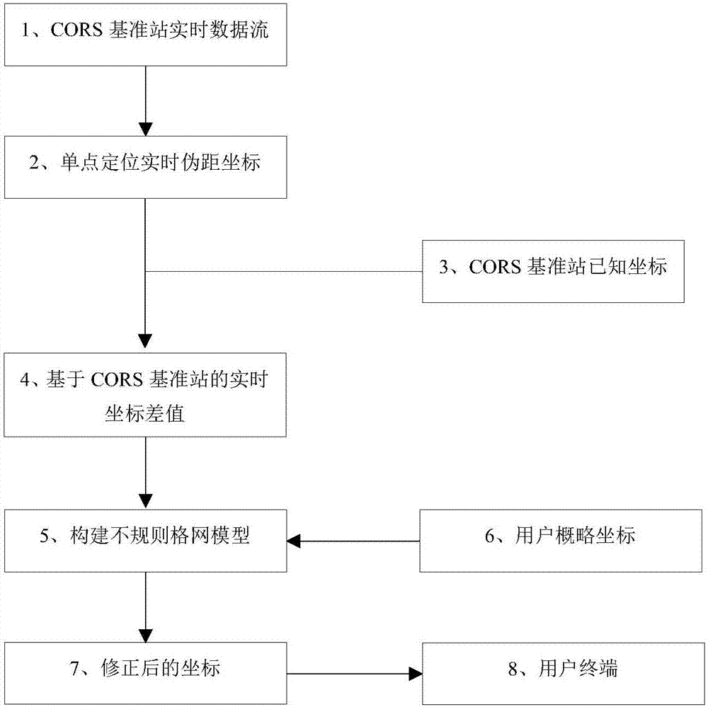
[0047] Embodiment 1: as Figure 1~2 , a CORS-based location correction method, comprising the following steps:
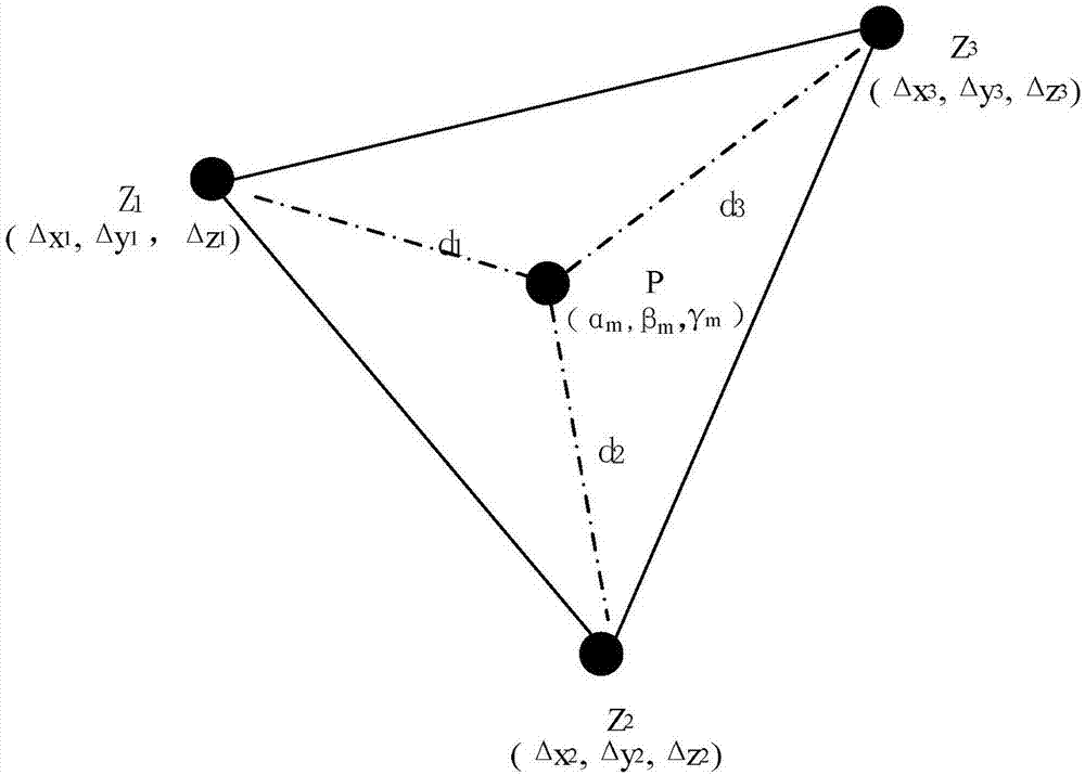
[0048] Step 1: Build an irregular grid model;
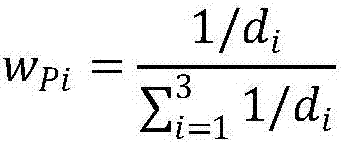
[0049] The nearest three CORS reference stations are connected to each other to form a triangle, and each CORS reference station is a node of the triangle, and the node data of node m adopts the coordinate difference of the corresponding CORS reference station (Δx m , Δy m , Δz m ); A plurality of described triangles forms an irregular grid model;
[0050] Coordinate difference of CORS reference station (Δx m , Δy m , Δz m ) refers to the known coordinate value of the CORS reference station (X m , Y m ,Z m ) (CORS reference station coordinates are obtained through joint measurement and adjustment with national A-level and B-level GPS control points.) and real-time pseudo-range coordinates (real-time pseudo-range coordinates are obtained by CORS reference station receivers The real-time positioning coordinate ...
specific example
[0087] Taking HNCORS as an example, three CORS reference stations YYSQ, YYHR and YYDT are selected to form a triangular station network. Five test points were selected within this triangle, and Huawei P9 mobile phone was used to collect data. The test results are shown in the table below, where △1 is the difference between the coordinate value measured by the Huawei P9 mobile phone and the RTK standard value, and △1 is the difference between the coordinate value calculated by this method and the RTK standard value.
[0088] Note: HuNan continuously operating reference stations, referred to as HNCORS. HNCORS is a network of national A-level and B-level point-to-point surveys and overall adjustment precision calculations. It is a 365-day*24-hour continuous uninterrupted observation station network, and precision adjustment calculations are carried out regularly. Currently HNCORS has a total of 122 reference stations (85 reference stations are compatible with the Beidou system),...
PUM
 Abstract
Description
Claims
Application Information